Related Research Articles

Sarina is a rural town and coastal locality in the Mackay Region, Queensland, Australia. In the 2021 census, the locality of Sarina had a population of 5,619 people.

Capella is a rural town and locality in the Central Highlands Region, Queensland, Australia. In the 2021 census, the locality of Capella had a population of 974 people.

Wallumbilla is a rural town and locality in the Maranoa Region, Queensland, Australia. In the 2021 census, the locality of Wallumbilla had a population of 331 people. with 191 people living in the town itself.
Gilnockie Provincial Park is a provincial park in British Columbia, Canada. This 2842-hectare park is situated southeast of Cranbrook and just north of the U.S. border. It includes the upper portion of Gilnockie Creek. Gilnockie Provincial Park protects some of the oldest fir and larch stands in the region where bears, moose, elk, white-tail and mule deer are found.
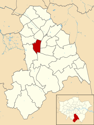
Fairfield is a ward in the London Borough of Croydon, covering most of the Croydon area of London in the United Kingdom. The ward currently forms part of the Croydon Central parliamentary constituency, except for a small area near West Croydon station which is part of the Croydon North constituency. The population of the ward at the 2011 Census was 16,569.

Carmila is a rural town and coastal locality in the Isaac Region, Queensland, Australia. In the 2021 census, the locality of Carmila had a population of 340 people.

Lake Bathurst is a shallow lake located 27 kilometres (17 mi) south-east of Goulburn, New South Wales in Australia. It is also the name of a nearby locality in the Goulburn Mulwaree Council.

Moto Hoshizaki Station is a railway station on the Meitetsu Nagoya Main Line located in Minami-ku, Nagoya, Japan. It is located 56.7 kilometers from the junction of the Nagoya Main Line at Toyohashi.
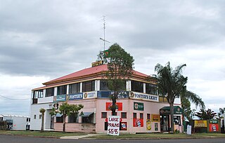
Dulacca is a rural town and locality in the Western Downs Region, Queensland, Australia. In the 2021 census, the locality of Dulacca had a population of 131 people.

Meandarra is a rural town and locality in the Western Downs Region, Queensland, Australia. In the 2021 census, the locality of Meandarra had a population of 244 people.
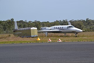
Caloundra West is a mixed-use suburb of Caloundra in the Sunshine Coast Region, Queensland, Australia. In the 2021 census, Caloundra West had a population of 7,270 people.

Dingo is a rural town and locality in the Central Highlands Region, Queensland, Australia. In the 2021 census, the locality of Dingo had a population of 221 people.
Koumala is a rural town and coastal locality in the Mackay Region, Queensland, Australia. In the 2021 census, the locality of Koumala had a population of 772 people.
The Leap is a coastal rural locality in the Mackay Region, Queensland, Australia. In the 2021 census, The Leap had a population of 664 people.
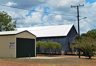
Gogango is a rural town and locality in the Rockhampton Region, Queensland, Australia. In the 2021 census, the locality of Gogango had a population of 184 people.
West Mackay is a suburb of Mackay in the Mackay Region, Queensland, Australia. In the 2021 census, West Mackay had a population of 6,536 people.

Tirrannaville is a locality in the Goulburn Mulwaree Council, New South Wales, Australia. It is located about 11 km south of Goulburn on the road to Braidwood. It was formerly called Terranna, which is the name of the parish covering most of the locality. The northern part of the defined locality, including the small settlement of Tirrannaville and cemetery, is in the parish of Goulburn. At the 2016 census, it had a population of 237. The locality mostly consists of grazing land.
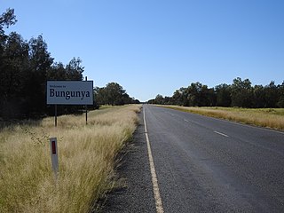
Bungunya is a rural town and locality in the Goondiwindi Region, Queensland, Australia. The locality is on the border of Queensland and New South Wales. In the 2021 census, the locality of Bungunya had a population of 62 people.

Boolburra is a rural town and locality in the Central Highlands Region, Queensland, Australia. In the 2021 census, the locality of Boolburra had a population of 34 people.

Grasstree Beach is a coastal locality in the Mackay Region, Queensland, Australia. It contains two towns, Grasstree in the centre of the locality and Zelma on the coast. In the 2021 census, Grasstree Beach had a population of 717 people.
References
- ↑ Wittenbra station NSWrail.net, accessed 9 April 2010.