The Darlington's Bridge at Delaware Station was a highway bridge that spanned the Delaware River in the community of Delaware, New Jersey.

The Carquinez Strait is a narrow tidal strait located in the Bay Area of Northern California, United States. It is part of the tidal estuary of the Sacramento and the San Joaquin rivers as they drain into the San Francisco Bay. The strait is eight miles (13 km) long and connects Suisun Bay, which receives the waters of the combined rivers, with San Pablo Bay, a northern extension of the San Francisco Bay.
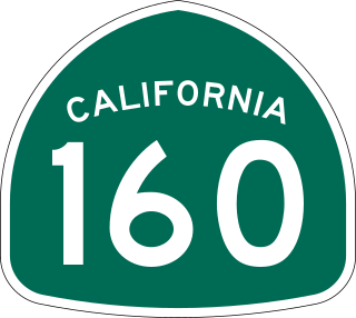
State Route 160 is a state highway in the U.S. state of California consisting of two sections. The longer, southern, section is a scenic highway through the alluvial plain of the Sacramento River, linking SR 4 in Antioch with Sacramento via the Antioch Bridge. The northern section, separated from the southern by Sacramento city streets, is the North Sacramento Freeway, running from the 16th Street Bridge over the American River to Interstate 80 Business towards Roseville.

Benjamin Leroy Holt was an American businessman and inventor who patented and manufactured the first practical crawler-type tread tractor. The continuous-type track is used for heavy agricultural and engineering vehicles to spread the weight over a large area to prevent the vehicle from sinking into soft ground. He founded with his brothers the Holt Manufacturing Company.
Kingston is a former town that was originally in Fresno County, until 1909 when that territory south of Kings River was transferred to Kings County, California. It was located on the south bank of the Kings River 8.5 miles (13.7 km) northwest of Hanford at Whitmore's Ferry.

Alexandra Bridge Park lies within the lower Fraser Canyon of British Columbia, Canada. This provincial park is adjacent to the historic suspension bridge from 1926, which spans the Fraser River and was built using the eastern abutment of the bridge from 1863. The locality, on BC Highway 1, is by road about 44 kilometres (27 mi) north of Hope and 65 kilometres (40 mi) south of Lytton.

Woodbridge is a census-designated place in San Joaquin County, California. Woodbridge sits at an elevation of 43 feet (13 m). The 2010 United States census reported Woodbridge's population was 3,984. Founded in the 1850s, the town is listed as a California Historical Landmark.

The Bridgeport Covered Bridge is located in Bridgeport, Nevada County, California, southwest of French Corral and north of Lake Wildwood. It is used as a pedestrian crossing over the South Yuba River. The bridge was built in 1862 by David John Wood. Its lumber came from Plum Valley in Sierra County, California. The bridge was closed to vehicular traffic in 1972 and pedestrian traffic in 2011 due to deferred maintenance and "structural problems".

The Emigrant Trail in Wyoming, which is the path followed by Western pioneers using the Oregon, California, and Mormon Trails, spans 400 miles (640 km) through the U.S. state of Wyoming. The trail entered from Nebraska on the eastern border of the state near the present day town of Torrington and exited on the western border near the towns of Cokeville and Afton. An estimated 350,000 to 400,000 settlers traveled on the trail through Wyoming between 1841 and 1868. All three trails follow the same path through most of the state. The Mormon Trail splits at Fort Bridger and enters Utah, while the Oregon and California Trails continue to Idaho.
The Western Pacific Railroad (1862–1870) was formed in 1862 to build a railroad from Sacramento, California, to the San Francisco Bay, the westernmost portion of the First transcontinental railroad. After the completion of the railroad from Sacramento to Alameda Terminal on September 6, 1869, and then the Oakland Pier on November 8, 1869, which was the Pacific coast terminus of the transcontinental railroad, the Western Pacific Railroad was absorbed in 1870 into the Central Pacific Railroad.

King Island is an island in the north Sacramento-San Joaquin River Delta, twenty kilometres east of Antioch, and twenty kilometres west of Stockton. The 1,300 ha (3,200-acre) island is bounded on the north by White Slough, on the east by Bishop Cut, on the south by Disappointment Slough, and on the west, Honker Cut. It is in San Joaquin County, and managed by Reclamation District 2044. It appears on a 1952 United States Geological Survey map of the area.
There are 45 routes assigned to the "J" zone of the California Route Marker Program, which designates county routes in California. The "J" zone includes county highways in Alameda, Calaveras, Contra Costa, Fresno, Kern, Inyo, Mariposa, Merced, Sacramento, San Benito, San Joaquin, Stanislaus, and Tulare counties.
Gordon's Ferry is both a geographical location and a historic site in Bakersfield, California. It is located where China Grade Loop crosses the Kern River and meets with Alfred Harrell Highway in Northeast Bakersfield. It is named after a ferry that used to cross the river near the existing bridge. It was one of the only eastern crossings, until 1877, when the Jewett Avenue bridge was constructed farther west. It is California Historical Landmark #137.
The Stockton–Los Angeles Road, also known as the Millerton Road, Stockton–Mariposa Road, Stockton–Fort Miller Road or the Stockton–Visalia Road, was established about 1853 following the discovery of gold on the Kern River in Old Tulare County. This route between Stockton and Los Angeles followed by the Stockton–Los Angeles Road is described in "Itinerary XXI. From Fort Yuma to Benicia, California", in The Prairie Traveler: A Hand-book for Overland Expeditions by Randolph Barnes Marcy. The Itinerary was derived from the report of Lieutenant R. S. Williamson on his topographical survey party in 1853, that was in search of a railroad route through the interior of California.
Tejon Creek, originally in Spanish Arroyo de Tejon, is a stream in Kern County, California. Its headwaters are located on the western slopes of the Tehachapi Mountains, and it flows northwest into the southern San Joaquin Valley.

San Joaquin City is a former settlement in San Joaquin County, California. It was established in 1849, during the California Gold Rush. It was located on the west bank of the San Joaquin River just below the point where Airport Way crosses the river today. It was an important settlement along the old River Road between Banta and Grayson's Ferry (now the community of Grayson in Stanislaus County.
The Byrne's Ferry bridge was a historic cantilevered covered bridge across the Stanislaus River between Calaveras County and Tuolumne County, California. Originally built during the California Gold Rush, the bridge was located on the O'Byrne's Ferry road between Chinese Camp and Copperopolis. Until the mid-20th century, it was one of the last remaining covered bridges in the state; the bridge was destroyed in 1957 to make way for the construction of Tulloch Dam.

The Empire Tract is an island in the Sacramento–San Joaquin River Delta in San Joaquin County, California, United States. It has been used for agriculture since the 1800s; in the early 20th century it was used to plant potatoes, and United States president Herbert Hoover operated a beet farm there. In the 1960s, natural gas deposits were discovered beneath the island. In 1936, it was connected to the mainland by the Eight Mile Road Bridge, across King Island. As with many islands in the Delta, the Empire Tract has experienced considerable subsidence, and is well below sea level.

Benson's Ferry site is a historical site in Manteca, California in San Joaquin County. The Benson's Ferry site is a California Historical Landmark No. 149, listed on January 11, 1935. The Benson River Ferry started operation n 1849 and was sold to John A. Benson in 1850. In 1852, John A. Benson planed and built a covered wagon trail from Sacramento to Stockton. John A. Benson was killed in 1859 and is son-in-law Ed Gayetty took over the opertions of the River Ferry. Benson was born in 1821 in Missouri. The Benson River Ferry operated across the Mokelumne River near what is now San Joaquin County J8, 3 miles North of Thornton, California. There is a Benson River Ferry historical sign in Galt, California at Benson Ferry Road and Thorton Road.

Weber Point Home is a historical site in Stockton, California in San Joaquin County. The site of the former Weber Point Home is a California Historical Landmark No. 165, listed on January 11, 1935. The Weber Point Home was a built by Captain Charles M. Weber founder of Stockton. Weber was pioneer of California and built a two-story adobe-and-redwood house in 1850. At the time it was the largest house in Stockton. The house was built on the east end of the Stockton Channel. The house was surrounded by landscaped gardens built for his new wife Helen Murphy. Weber lived in the house till his death in 1881. The house was located on Center Street between Channel and Miner Street in Stockton. The Weber Point House was destroyed in a fire in 1917. The Weber Point House was the center of the 8,747 acre Mexican land grant Rancho Campo de los Franceses. The Rancho owned present day Stockton and lands south and east, most of the current San Joaquin County.


