Worcestershire is a non-metropolitan administrative, ceremonial and historic county, situated in the West Midlands region of England.

Worcester is a cathedral city in Worcestershire, England, 30 miles (48 km) south-west of Birmingham, 101 miles (163 km) west-north-west of London, 27 miles (43 km) north of Gloucester and 23 miles (37 km) north-east of Hereford. The population is about 100,000. The River Severn flanks the western side of the city centre, which is overlooked by Worcester Cathedral. The Battle of Worcester in 1651 was the final one in the English Civil War, where Oliver Cromwell's New Model Army defeated King Charles I's Royalists. Worcester is the home of Royal Worcester Porcelain, composer Edward Elgar, Lea & Perrins, makers of traditional Worcestershire sauce, University of Worcester, and Berrow's Worcester Journal, claimed as the world's oldest newspaper.

Sandhurst is a small town and civil parish in England of 7,966 homes and 20,803 inhabitants, primarily domiciliary in nature with a few light industries. It is in the south eastern corner of the ceremonial Royal County of Berkshire, within the Borough of Bracknell Forest, and is situated 32 miles (51 km) west-southwest of central London, 2.5 miles (4.0 km) north west of Camberley and 5 miles (8.0 km) south of Bracknell.
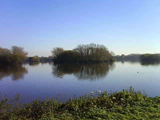
Kingsbury Water Park is a country park in north Warwickshire, England, not far from Birmingham and lying on the River Tame. It is owned and managed by Warwickshire County Council. It has fifteen lakes situated in over 600 acres (2.4 km2) of country park. It is renowned for its birdlife, and is popular with birdwatchers. It is bordered on the western edge by the Birmingham and Fazeley Canal.
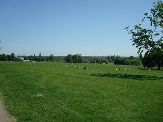
Danson Park is a public park in the London Borough of Bexley, South East London, located between Welling and Bexleyheath. At 75 hectares, it is the second largest public park in the borough, and the most used by the community. Opened in 1925, it is often considered the finest green open space in the borough, and is Grade II listed on the Register of Historic Parks and Gardens. The park also gives its name to the electoral ward that covers the park and the surrounding area. The park is located at grid reference TQ472752. The southern boundary of both the park and the ward is delineated by Rochester Way, the A2 road.
The University of Worcester is a public research university, based in Worcester, England. Worcester is the only university based in the counties of Worcestershire and Herefordshire. With a history dating back to 1946, the university began awarding degrees in 1997 and was granted full university status in 2005.

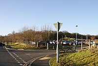
Wychbold is a village in the Wychavon district of Worcestershire. The village is situated on the A38 between Droitwich Spa and Bromsgrove, and by Junction 5 of the M5 motorway.

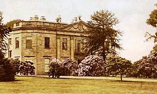
White Ladies Aston is a village in Worcestershire, England, United Kingdom, and also lends its name to the Civil Parish in which the village is located.

Wepre Park is a 160 acres (65 ha) country park near Connah's Quay in Flintshire, Wales. The park is home to Ewloe Castle and contains a children's playground, outdoor gym, football playing pitches and a visitor centre.

Wavertree Playground, also known locally as The Mystery, was one of the first purpose-built public playgrounds in the United Kingdom. It is based in the Wavertree area of Liverpool, England.

Castlemorton is a village and civil parish close to Malvern in the Malvern Hills District in the county of Worcestershire, England. It consists of a village centre, a large common and many farms and houses within the area. To the south of the village are the earthwork remains of a medieval motte-and-bailey castle.

Northwich Woodlands is an area of 373 hectares of publicly accessible countryside near Northwich in Cheshire, England. It comprises nine separate woods, country parks, lakes and parks, many of which are connected to each other via footpaths and other rights of way. Much of the land was formerly industrial and used for mining salt and manufacturing chemicals. The extraction of salt caused subsidence leading to the formation of pools known as flashes. The land became derelict during the 20th century as the salt industry contracted. Much of the area has now been reclaimed for the purposes of conservation and recreation and forms part of the Mersey Forest initiative.
Shipley Hall was a country estate in Shipley, Derbyshire near Heanor and Ilkeston which now forms a Country Park.

Shorne Wood Country Park is located between Strood and Gravesend, in the English county of Kent. It was once part of a large estate and then later passed to the county council to be used as a country park.

The administrative boundaries of Worcestershire, England have been fluid for over 150 years since the first major changes in 1844. There were many detached parts of Worcestershire in the surrounding counties, and conversely there were islands of other counties within Worcestershire. The 1844 Counties Act began the process of eliminating these, but the process was not completed until 1966, when Dudley was absorbed into Staffordshire.

Worcestershire Parkway is a split-level railway station where the Cotswold and Cross Country lines cross near Norton, Worcester, England. It opened on 23 February 2020.

Gedling Country Park is a country park in Gedling, Nottingham, England.

Sherwood Pines Forest Park is a forest park located in Mansfield, Nottinghamshire, England. Originally called Clipstone Heath it was acquired by The Forestry Commission in 1925 and planted with trees in response to a wood shortage after World War I. The park offers activities such as walking, bushcraft, mountain biking and there is a visitor centre. It is the largest park in the East Midlands of England.

Rising Sun Country Park is a country park in Benton, North Tyneside, England.