Wybranowo, Żnin County

Last updated
Wybranowo
Village
Country Flag of Poland.svg  Poland
Voivodeship Kuyavian-Pomeranian
County Żnin
Gmina Janowiec Wielkopolski

Wybranowo [vɨbraˈnɔvɔ] (German : Wibrach) is a village in the administrative district of Gmina Janowiec Wielkopolski, within Żnin County, Kuyavian-Pomeranian Voivodeship, in north-central Poland. [1]

German language West Germanic language

German is a West Germanic language that is mainly spoken in Central Europe. It is the most widely spoken and official or co-official language in Germany, Austria, Switzerland, South Tyrol (Italy), the German-speaking Community of Belgium, and Liechtenstein. It is also one of the three official languages of Luxembourg and a co-official language in the Opole Voivodeship in Poland. The languages which are most similar to German are the other members of the West Germanic language branch: Afrikaans, Dutch, English, the Frisian languages, Low German/Low Saxon, Luxembourgish, and Yiddish. There are also strong similarities in vocabulary with Danish, Norwegian and Swedish, although those belong to the North Germanic group. German is the second most widely spoken Germanic language, after English.

Gmina Janowiec Wielkopolski is an urban-rural gmina in Żnin County, Kuyavian-Pomeranian Voivodeship, in north-central Poland. Its seat is the town of Janowiec Wielkopolski, which lies approximately 18 kilometres (11 mi) south-west of Żnin and 53 km (33 mi) south-west of Bydgoszcz.

Żnin County County in Kuyavian-Pomeranian, Poland

Żnin County is a unit of territorial administration and local government (powiat) in Kuyavian-Pomeranian Voivodeship, north-central Poland. It came into being on January 1, 1999, as a result of the Polish local government reforms passed in 1998. Its administrative seat and largest town is Żnin, which lies 36 km (22 mi) south-west of Bydgoszcz and 65 km (40 mi) west of Toruń. The county contains three other towns: Barcin, lying 17 km (11 mi) east of Żnin, Łabiszyn, lying 19 km (12 mi) north-east of Żnin, and Janowiec Wielkopolski, 18 km (11 mi) south-west of Żnin.
Related Research Articles

Lowlands (festival) music festival in Netherlands

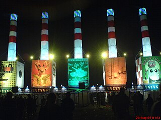
A Campingflight to Lowlands Paradise (Lowlands), is an annual three-day music and performing arts festival, held in the Netherlands. The festival is held 68 kilometres (42 mi) east of Amsterdam in Biddinghuizen, at Spijk en Bremerberg, which is adjacent to Walibi Holland.

Bambari Place in Ouaka, Central African Republic

Bambari is a town in the Central African Republic, lying on the Ouaka River. It has a population of 41,356 and is the capital of Ouaka prefecture. Bambari is an important market town and is home to Bambari Airport, and the Roman Catholic Diocese of Bambari.

Barh Sara is one of 3 departments which make up the region of Mandoul in southern Chad. Its capital is Moïssala.

Gomel District, Homieĺski Rajon is a district of Gomel Region, in Belarus.

Autovía A-35 road in Spain

The Autovía A-35 is a highway in the province of Valencia, Spain.

Châu Thành is a rural district of Tien Giang province in the Mekong Delta region of Vietnam. As of 2003 the district had a population of 252,068. The district covers an area of 256 km². The district capital lies at Tân Hiệp.

Podole, Rypin County Village in Kuyavian-Pomeranian, Poland

Podole is a village in the administrative district of Gmina Rypin, within Rypin County, Kuyavian-Pomeranian Voivodeship, in north-central Poland. It lies approximately 5 kilometres (3 mi) north of Rypin and 55 km (34 mi) east of Toruń.

Gawin is a village in the administrative district of Gmina Chodecz, within Włocławek County, Kuyavian-Pomeranian Voivodeship, in north-central Poland.

Skiwy Duże is a village in the administrative district of Gmina Siemiatycze, within Siemiatycze County, Podlaskie Voivodeship, in north-eastern Poland.

Wielgomłyny-Kolonia Village in Łódź, Poland

Wielgomłyny-Kolonia is a village in the administrative district of Gmina Wielgomłyny, within Radomsko County, Łódź Voivodeship, in central Poland. It lies approximately 23 km (14 mi) east of Radomsko and 88 km (55 mi) south of the regional capital Łódź.

Pardasówka is part of Sabaudia village in the administrative district of Gmina Tomaszów Lubelski, within Tomaszów Lubelski County, Lublin Voivodeship, in eastern Poland.

Szczekarzów is a village in the administrative district of Gmina Skalbmierz, within Kazimierza County, Świętokrzyskie Voivodeship, in south-central Poland.

Siepietnica Village in Subcarpathian, Poland

Siepietnica is a village in the administrative district of Gmina Skołyszyn, within Jasło County, Subcarpathian Voivodeship, in south-eastern Poland. It lies approximately 4 kilometres (2 mi) north-west of Skołyszyn, 14 km (9 mi) west of Jasło, and 60 km (37 mi) south-west of the regional capital Rzeszów.

Bielawy is a village in the administrative district of Gmina Glinojeck, within Ciechanów County, Masovian Voivodeship, in east-central Poland.

Lisice-Folwark is a village in the administrative district of Gmina Gozdowo, within Sierpc County, Masovian Voivodeship, in east-central Poland.

Kalwaria, Pomeranian Voivodeship Village in Pomeranian, Poland

Kalwaria is a village in the administrative district of Gmina Dziemiany, within Kościerzyna County, Pomeranian Voivodeship, in northern Poland. It lies approximately 4 kilometres (2 mi) south of Dziemiany, 22 km (14 mi) south-west of Kościerzyna, and 72 km (45 mi) south-west of the regional capital Gdańsk.

Struhařov is a municipality and village in Benešov District in the Central Bohemian Region of the Czech Republic.

Újezdec (Mělník District) Municipality and village in Central Bohemian Region, Czech Republic

Újezdec is a village and municipality in Mělník District in the Central Bohemian Region of the Czech Republic. The municipality covers an area of 2.36 square kilometres (0.91 sq mi) and as of 2006 it had a population of 94. First written notice about the village is from year 1380.

Gangara, Niger is a village and rural commune in Niger.

Rivand Rural District is a rural district (dehestan) in the Central District of Nishapur County, Razavi Khorasan Province, Iran. At the 2006 census, its population was 12,619, in 3,301 families. The rural district has 59 villages.

References


Coordinates: 52°45′55″N17°25′27″E / 52.76528°N 17.42417°E / 52.76528; 17.42417

Geographic coordinate system Coordinate system

A geographic coordinate system is a coordinate system that enables every location on Earth to be specified by a set of numbers, letters or symbols. The coordinates are often chosen such that one of the numbers represents a vertical position and two or three of the numbers represent a horizontal position; alternatively, a geographic position may be expressed in a combined three-dimensional Cartesian vector. A common choice of coordinates is latitude, longitude and elevation. To specify a location on a plane requires a map projection.