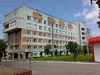
Heusden also known as Asten-Heusden is a small village in North Brabant in the Netherlands. It is in the region often known as Heuze. Heusden has a small village square with a few bars, a church, a grocery store, and a youth center. The village is only a couple kilometers from Asten which is much larger and the center of activity for most residents of Heusden. Heusden also has the romantic remains of an old castle that dates from the fifteenth century. Attached to the ruins, a seventeenth-century v-shape farmstead is still in place.

Krasyliv is a city in Khmelnytskyi Oblast (province) of western Ukraine. Krasyliv is also the administrative center of the Krasyliv Raion (district), housing the district's local administration buildings. It is located at around 49°39′7″N26°58′14″E.
Harichand is a town and union council in Charsadda District of Khyber-Pakhtunkhwa. It is located at 34°23'2N 71°48'18E and has an altitude of 381 metres.

Hako ; is a village in the Aragatsotn Province of Armenia. It is mostly populated by Yazidis. The population of Hako was 95 as per the 2011 census, down from 229 reported in the 2001 census.
Stara Moczalnia is a village in the administrative district of Gmina Sokółka, within Sokółka County, Podlaskie Voivodeship, in north-eastern Poland, close to the border with Belarus.

Ciechanowczyk is a village in the administrative district of Gmina Ciechanowiec, within Wysokie Mazowieckie County, Podlaskie Voivodeship, in north-eastern Poland. It lies approximately 4 kilometres (2 mi) south-east of Ciechanowiec, 30 km (19 mi) south of Wysokie Mazowieckie, and 68 km (42 mi) south-west of the regional capital Białystok.

Topalhəsənli is a village and municipality in the Kurdamir Rayon of Azerbaijan.

Qarıkaha is a village in the Lachin Rayon of Azerbaijan.

Bashmalakh is a village in the Qakh Rayon of Azerbaijan.

Kamienna-Wieś is a village in the administrative district of Gmina Błaszki, within Sieradz County, Łódź Voivodeship, in central Poland. It lies approximately 4 kilometres (2 mi) north-west of Błaszki, 27 km (17 mi) west of Sieradz, and 76 km (47 mi) west of the regional capital Łódź.

Filipole is a village in the administrative district of Gmina Złoczew, within Sieradz County, Łódź Voivodeship, in central Poland. It lies approximately 8 kilometres (5 mi) south-east of Złoczew, 25 km (16 mi) south of Sieradz, and 70 km (43 mi) south-west of the regional capital Łódź.

Proćwin is a village in the administrative district of Gmina Końskie, within Końskie County, Świętokrzyskie Voivodeship, in south-central Poland. It lies approximately 3 kilometres (2 mi) north-west of Końskie and 41 km (25 mi) north-west of the regional capital Kielce.

Dąbrówka Drygalska is a village in the administrative district of Gmina Biała Piska, within Pisz County, Warmian-Masurian Voivodeship, in northern Poland. It lies approximately 5 kilometres (3 mi) north-east of Biała Piska, 21 km (13 mi) east of Pisz, and 107 km (66 mi) east of the regional capital Olsztyn.

The Danu Self-Administered Zone, as stipulated by the 2008 Constitution of Myanmar, is a self-administered zone consisting of two townships in Shan State:

Doibani I is a commune in the Dubăsari sub-district of Transnistria, Moldova. It is composed of three villages: Coicova, Doibani I and Doibani II. It is currently under the administration of the breakaway government of the Transnistrian Moldovan Republic.
Tõlli is a village in Saaremaa Parish, Saare County in western Estonia.

Mechraa Safa is a town and commune in Tiaret Province in northwestern Algeria.

Krong Suong District is a district (srok) of Tboung Khmum Province, Cambodia.

The Baisha Port is a port in Liuqiu Township, Pingtung County, Taiwan. It is the main port for people to get in and out from Lamay Island.

Dafu Port is a port on Lamay Island in Pingtung County, Taiwan. It is a home port for fishing vessels that operate from the island. It is the second largest port on the island after Baisha Port.


