| Developer(s) | Gerd Knorr |
|---|---|
| Stable release | 3.107 / May 16, 2020 [1] |
| Repository | git |
| Operating system | Unix-like |
| Type | TV recording |
| License | GPL |
| Website | www |
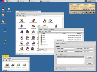
xawtv is software for watching and recording television and webcams [2] [3] with either a TV tuner or a Satellite receiver card (DVB-S). xawtv works on Unix-like operating systems, and is licensed under the GPL.
xawtv does not favour any particular desktop environment. It comes with applications which use Motif-based widgets, as well as other X11 and command line applications. It works with Video4linux and XVideo. The interface to xawtv is minimalistic, so it has been used to add video support to other programs. [4] [5] [6] [7] [8]
BeOS is an operating system for personal computers first developed by Be Inc. in 1990. It was first written to run on BeBox hardware.

Audacity is a free and open-source digital audio editor and recording application software, available for Windows, macOS, Linux, and other Unix-like operating systems. Audacity was started in the fall of 1999 by Dominic Mazzoni and Roger Dannenberg at Carnegie Mellon University and was released on May 28, 2000 as version 0.8.
Qt Extended is an application platform for embedded Linux-based mobile computing devices such as personal digital assistants, video projectors and mobile phones. It was initially developed by Qt Software, a subsidiary of Nokia. When they cancelled the project the free software portion of it was forked by the community and given the name Qt Extended Improved. The QtMoko Debian-based distribution is the natural successor to these projects as continued by the efforts of the Openmoko community.

Geographic Resources Analysis Support System is a geographic information system (GIS) software suite used for geospatial data management and analysis, image processing, producing graphics and maps, spatial and temporal modeling, and visualizing. It can handle raster, topological vector, image processing, and graphic data.

Computer-mediated reality refers to the ability to add to, subtract information from, or otherwise manipulate one's perception of reality through the use of a wearable computer or hand-held device such as a smartphone.
Access Grid is a collection of resources and technologies that enables large format audio and video based collaboration between groups of people in different locations. The Access Grid is an ensemble of resources, including multimedia large-format displays, presentation and interactive environments, and interfaces with grid computing middleware and visualization environments. In simple terms, it is advanced videoconferencing using big displays and with multiple simultaneous camera feeds at each node (site). The technology was invented at Argonne National Laboratory, Chicago.
The World Wide Web has become a major delivery platform for a variety of complex and sophisticated enterprise applications in several domains. In addition to their inherent multifaceted functionality, these Web applications exhibit complex behaviour and place some unique demands on their usability, performance, security, and ability to grow and evolve. However, a vast majority of these applications continue to be developed in an ad hoc way, contributing to problems of usability, maintainability, quality and reliability. While Web development can benefit from established practices from other related disciplines, it has certain distinguishing characteristics that demand special considerations. In recent years, there have been developments towards addressing these considerations.
Indeo Video is a family of audio and video formats and codecs first released in 1992, and designed for real-time video playback on desktop CPUs. While its original version was related to Intel's DVI video stream format, a hardware-only codec for the compression of television-quality video onto compact discs, Indeo was distinguished by being one of the first codecs allowing full-speed video playback without using hardware acceleration. Also unlike Cinepak and TrueMotion S, the compression used the same Y'CbCr 4:2:0 colorspace as the ITU's H.261 and ISO's MPEG-1. Indeo use was free of charge to allow for broadest usage.

In computing, ambient intelligence (AmI) refers to electronic environments that are sensitive and responsive to the presence of people. Ambient intelligence was a projection on the future of consumer electronics, telecommunications and computing that was originally developed in the late 1990s by Eli Zelkha and his team at Palo Alto Ventures for the time frame 2010–2020. Ambient intelligence would allow devices to work in concert to support people in carrying out their everyday life activities, tasks and rituals in an intuitive way using information and intelligence that is hidden in the network connecting these devices. As these devices grew smaller, more connected and more integrated into our environment, the technological framework behind them would disappear into our surroundings until only the user interface remains perceivable by users.
ArcGIS is a geographic information system (GIS) for working with maps and geographic information maintained by the Environmental Systems Research Institute (Esri). It is used for creating and using maps, compiling geographic data, analyzing mapped information, sharing and discovering geographic information, using maps and geographic information in a range of applications, and managing geographic information in a database.

QGIS is a free and open-source cross-platform desktop geographic information system (GIS) application that supports viewing, editing, and analysis of geospatial data.

Ubuntu Studio is a recognized flavor of the Ubuntu Linux distribution, which is geared to general multimedia production. The original version, based on Ubuntu 7.04, was released on 10 May 2007.

MapWindow GIS is a lightweight open-source GIS (mapping) desktop application and set of programmable mapping components.
The Video Disk Recorder (VDR) is an open-source application for Linux designed to allow any computer to function as a digital video recorder, in order to record and replay TV programming using the computer's hard drive. The computer needs to be equipped with a digital TV tuner card. VDR can also operate as an mp3 player and DVD player using available plugins. VDR uses drivers from the LinuxTV project. VDR was originally written by Klaus-Peter Schmidinger, one of the founders of CadSoft Computer GmbH and original developer of the EAGLE electronic design application. The software was originally hosted on CadSoft's server.
Integrated Land and Water Information System (ILWIS) is a geographic information system (GIS) and remote sensing software for both vector and raster processing. Its features include digitizing, editing, analysis and display of data, and production of quality maps. ILWIS was initially developed and distributed by ITC Enschede in the Netherlands for use by its researchers and students. Since 1 July 2007, it has been released as free software under the terms of the GNU General Public License. Having been used by many students, teachers and researchers for more than two decades, ILWIS is one of the most user-friendly integrated vector and raster software programmes currently available. ILWIS has some very powerful raster analysis modules, a high-precision and flexible vector and point digitizing module, a variety of very practical tools, as well as a great variety of user guides and training modules all available for downloading. The current version is ILWIS 3.8.6. Similar to the GRASS GIS in many respects, ILWIS is currently available natively only on Microsoft Windows. However, a Linux Wine manual has been released.
Spatial contextual awareness consociates contextual information such as an individual's or sensor's location, activity, the time of day, and proximity to other people or objects and devices. It is also defined as the relationship between and synthesis of information garnered from the spatial environment, a cognitive agent, and a cartographic map. The spatial environment is the physical space in which the orientation or wayfinding task is to be conducted; the cognitive agent is the person or entity charged with completing a task; and the map is the representation of the environment which is used as a tool to complete the task.

Hollywood is a commercially distributed programming language developed by Andreas Falkenhahn which mainly focuses on the creation of multimedia-oriented applications. Hollywood is available for AmigaOS, MorphOS, WarpOS, AROS, Windows, macOS, Linux, Android, and iOS. Hollywood has an inbuilt cross compiler that can automatically save executables for all platforms supported by the software. The generated executables are completely stand-alone and do not have any external dependencies, so they can also be started from a USB flash drive. An optional add-on also allows users to compile projects into APK files.
TrueConf is a Russian company that produces software-based video conferencing and unified communications products. The company's applications are designed for usage in conference or meeting rooms, at workplaces, and on mobile devices. TrueConf is headquartered in Moscow, Russia.

DIPS is a set of plug-in objects that handle real-time digital image processing in Max/MSP programming environment. Combining with the built-in objects of the environment, DIPS enables to program the interaction between audio and visual events with ease, and supports the realization of interactive multimedia art as well as interactive computer music.
|journal= (help)| | This free and open-source software article is a stub. You can help Wikipedia by expanding it. |
| | This multimedia software-related article is a stub. You can help Wikipedia by expanding it. |