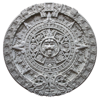
Mesoamerican chronology divides the history of prehispanic Mesoamerica into several periods: the Paleo-Indian, the Archaic, the Preclassic or Formative, the Classic (250–900CE), and the Postclassic, Colonial (1521–1821), and Postcolonial (1821–present). The periodization of Mesoamerica is based on archaeological, ethnohistorical, and modern cultural anthropology research. The endeavor to create cultural histories of Mesoamerica dates to the early twentieth century, with ongoing work by archeologists, ethnohistorians, historians, and cultural anthropologists.

Lamanai is a Mesoamerican archaeological site, and was once a major city of the Maya civilization, located in the north of Belize, in Orange Walk District. The site's name is pre-Columbian, recorded by early Spanish missionaries, and documented over a millennium earlier in Maya inscriptions as Lam'an'ain. Lamanai is renowned for its exceptionally long occupation spanning three millennia, beginning in the Early Preclassic Maya period and continuing through the Spanish and British Colonial periods, into the 20th century. Unlike most Classic-period sites in the southern Maya lowlands, Lamanai was not abandoned at the end of the 10th century AD.
Ndaxagua, locally known in Spanish as El Puente Colosal is a natural cave with double entrance and archaeological site, located in the extreme northern end of the Coixtlahuaca Basin, central-southern Mexico. The cave was most likely used by Mesoamerican cultures such as the Zapotec and Mixtec as well.

Mesomerica is a historical region and cultural area in North America. It extends from approximately central Mexico through Belize, Guatemala, El Salvador, Honduras, Nicaragua, and northern Costa Rica, and within this region pre-Columbian societies flourished before the Spanish colonization of the Americas in the 15th and 16th centuries where they caused mass genocide of the people there. It is one of five areas in the world where ancient civilization arose independently, and the second in the Americas along with Norte Chico (Caral-Supe) in present-day Peru, in the northern coastal region.
The Petén Basin is a geographical subregion of Mesoamerica, primarily located in northern Guatemala within the Department of El Petén, and into Campeche state in southeastern Mexico.
Cholula was an important city of pre-Columbian Mesoamerica, dating back to at least the 2nd century BCE, with settlement as a village going back at least some thousand years earlier. The site of Cholula is just west of the modern city of Puebla and served as a trading outpost. Its immense pyramid is the largest such structure in the Americas, and the largest pyramid structure by volume in the world.

Uxbenka is a pre-Columbian Mesoamerican archaeological site located in Belize's southernmost district of Toledo. An urban settlement of the pre-Columbian Maya, it is the earliest-known Maya polity in the southern Belizean lowlands, with evidence of occupation dating to the Early Classic period of Mesoamerican chronology. It is one of five major Maya sites in this region, whose archaeological sites also include Nim Li Punit and Lubaantun. Settlement of Uxbenka has been suggested to have occurred originally by Peten peoples. The site is approximately 40 square kilometers in size, and Uxbenka is referred to as a medium sized polity ). Uxbenka rose shortly after the expansion of another Mayan site: Tikal. The site is thought to have been first inhabited during the late Preclassic period.

Xnaheb is an archaeological site of the pre-Columbian Maya civilization, one of five primary sites identified in the southern Belize region. The center is built on a ridge of foothills that extends from the Maya Mountains, in what is now the Toledo District of Belize. Based on certain architectural similarities between the two sites, it is possible that Xnaheb was founded as an offshoot of Nim Li Punit.

Chichen Itza was a large pre-Columbian city built by the Maya people of the Terminal Classic period. The archaeological site is located in Tinúm Municipality, Yucatán State, Mexico.

Although the Maya were once thought to have been peaceful, current theories emphasize the role of inter-polity warfare as a factor in the development and perpetuation of Maya society. The goals and motives of warfare in Maya culture are not thoroughly understood, but scholars have developed models for Maya warfare based on several lines of evidence, including fortified defenses around structure complexes, artistic and epigraphic depictions of war, and the presence of weapons such as obsidian blades and projectile points in the archaeological record. Warfare can also be identified from archaeological remains that suggest a rapid and drastic break in a fundamental pattern due to violence.
The San Estevan archaeological site is located in northern Belize 1 km from the modern community of San Estevan, Belize. The site is a Maya civilization site occupied during the Formative and Classic eras of Mesoamerican chronology. San Estevan is located on the New River half way between the sites of Cerros and Lamanai. Beginning in the Late Formative period, San Estevan was a regional political center.
Pusilhá is an archaeological site in Belize. The location of this Late Classic Maya urban complex along the east and west flow of trade afford archaeologist a historical view of a secondary Maya site. Continuing excavation has changed the overall picture of Maya social and political relationships between larger and smaller cities. The research conducted at Pusilhá began at the beginning of the 20th century and continues to this day.
Baking Pot is a Maya archaeological site located in the Belize River Valley on the southern bank of the river, northeast of modern-day town of San Ignacio in the Cayo District of Belize; it is 6 kilometres (3.7 mi) downstream from the Barton Ramie and Lower Dover archaeological sites. Baking Pot is associated with an extensive amount of research into Maya settlements, community-based archaeology, and of agricultural production; the site possesses lithic workshops, and possible evidence of cash-cropping cacao as well as a long occupation from the Preclassic through to the Postclassic period.
K’axob is an archaeological site of the Maya civilization located in Belize. It was occupied from about 800 B.C. to A.D. 900. The site is located in northern Belize in the wetlands of Pulltrouser Swamp in proximity to the Sibun River Valley in central Belize. Research has shown that K’axob was occupied from the Late Preclassic Period to the Early Postclassic Period. This period in time and the site is characterized by specific ceramic types as well as agriculture and an increase in social stratification. K’axob is a village site centered on two pyramid plazas and later grew in size during the Early Classic Period to the Late Classic Period. The site includes a number of household, mounds and plazas. K’axob is mostly based on residential and household living but also has some ritualistic aspects. Many of the structures at the site show evidence of household dwellings as well as ritual purposes. There are many burials at the site that illustrate the ritualistic aspects and social stratification at K’axob. Many of the individuals, some more than others, were interned with beads made of shell as well as ceramic vessels, demonstrating this potential social stratification. The pottery vessels recovered from the site demonstrates regularity in the production of pottery. The most prominent type of ceramic vessels recovered from the site were ‘serving bowls,’ with a tripodal base, and were present during the Early Classic Period. There is also evidence of specialized areas for pottery production. There are middens at the site that yielded a great deal of pottery sherds and are associated with structures that are believed to be kilns as well as with tools similar to modern pottery making tools. There is also some evidence of stone tool production at the site. The most common stone tool recovered from the site is a chert oval biface and is associated with agriculture and thought to have been used for weeding and hoeing.
Anabel Ford is an American archaeologist specializing in the study of Mesoamerica, with a focus on the lowland Maya of Belize and Guatemala. She is recognized for her discovery of the ancient Maya city El Pilar. Ford is currently affiliated with the Institute of Social Behavioral and Economic Research (ISBER) and is the director of the MesoAmerican Research Center (MARC) at the University of California, Santa Barbara.
The Classic Maya used dedication rituals to sanctify their living spaces and family members by associating their physical world with supernatural concepts through religious practice. The existence of such rituals is inferred from the frequent occurrence of so-called 'dedication' or 'votive' cache deposits in an archaeological context.


