Yōrō Falls

Last updated

Yōrō Falls(養老の滝,Yōrō no Taki) is a waterfall in Yōrō Park located in the town of Yōrō, Yōrō District, Gifu, Japan.

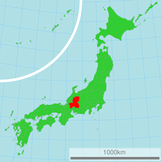
Yōrō, Gifu Town in Chūbu, Japan

Yōrō is a town located in Yōrō District, Gifu Prefecture, Japan. As of 1 April 2018, the town had an estimated population of 29,309 in 10,356 households and a population density of 405 persons per km2. The total area of the town was 72.29 square kilometres (27.91 sq mi).

Yōrō District, Gifu district of Japan

Yōrō is a district located in Gifu Prefecture, Japan.

Gifu Prefecture Prefecture of Japan

Gifu Prefecture is a prefecture in the Chūbu region of central Japan. Its capital is the city of Gifu.

Contents

Yoro Falls in autumn Yoro Falls 2008-11-26.jpg
Yōrō Falls in autumn

Summary

The waterfall is 32 meters high and 4 meters wide. It was chosen as one of Japan’s Top 100 Waterfalls. The water from the falls is praised for its high quality, and is mentioned in a legend that tells the story of a dedicated son who offered the water, which tasted like sake to his ailing father who, upon drinking it, was revived. [1] The Empress Genshō, who visited this area, renamed the period of her reign "Yōrō" saying, "Rei Springs art beautiful springs. And so doth nourish the old. Perhaps it be the spirit of the waters. I do [hereby] give amnesty under heaven, and fix the third year of the Reiki (era) anew to year 1 of the Yōrō (era)."

<i>Sake</i> alcoholic beverage of Japanese origin

Sake, also spelled saké, also referred to as a Japanese rice wine, is an alcoholic beverage made by fermenting rice that has been polished to remove the bran. Unlike wine, in which alcohol is produced by fermenting sugar that is naturally present in fruit, typically grapes, sake is produced by a brewing process more akin to that of beer, where starch is converted into sugars which ferment into alcohol.

Empress Genshō Empress of Japan

Empress Genshō was the 44th monarch of Japan, according to the traditional order of succession. She was the only empress regnant in Japan's history to have inherited her title from another empress regnant rather than from a male predecessor.

Reiki (era) Japanese era 715-717

Reiki (霊亀) was a Japanese era name after Wadō and before Yōrō. This period spanned the years from September 715 through November 717. The reigning empress was Genshō-tennō (元正天皇).

Yōrō Park extends from Yōrō Falls to the Nanno Sekigahara Line, a prefectural road that runs along the foot of the mountain. From the park's parking lot, one must climb a steep hillside road for 700 to 800 meters, but from about midway between the parking lot and the falls, there is a lift running. By taking this lift, one may reach the falls with comparative ease. Also, there is another parking lot nearer the falls. The carbonated beverages like Ramune and cider, which are made using the water, are also popular.

Ramune carbonated soft drink

Ramune (ラムネ) is a type of [carbonated] soft drink originally created and sold in Japan which was introduced in Kobe by Alexander Cameron Sim. The name is derived from the English word lemonade transliterated into Japanese. These and similar drinks are sometimes referred to as サイダー "cider".

The cider that is made with the local water was once called "Yōrō Cider" and was produced in the town. In recent years, the production of this beverage has been taken over by a different company, and the product renamed "Yōrō Sanroku Cider."

Geography

The waterfall is in the upstream part of the Taki Valley, which joins in Tsuta River (Tributary of Ibi River) then flows Ise Bay. [2] Taki Valley is the source river on Mount Yōrō. Yōrō Station of YORO Railway CO.,LTD is the nearest station for the waterfall. It is in the Ibi-Sekigahara-Yōrō Quasi-National Park [3] (List of national parks of Japan). It is near the starting point for climbing Mount Yōrō and Mount Shō. [4] The hiker often visits the waterfall. Also there is the Tōkai Nature Trail in the south soon.

Tributary stream or river that flows into a main stem river or lake

A tributary or affluent is a stream or river that flows into a larger stream or main stem river or a lake. A tributary does not flow directly into a sea or ocean. Tributaries and the main stem river drain the surrounding drainage basin of its surface water and groundwater, leading the water out into an ocean.

Ibi River river flows thorough Chubu region of Japan

The Ibi River is a tributary of the Kiso River located in Gifu and Mie Prefectures in Japan. Along with the Nagara and Kiso rivers, the Ibi is the third of the Kiso Three Rivers of the Nōbi Plain. It is one of Japan's first-class rivers. The former Tōkaidō post station of Kuwana-juku was located on the western banks of this river during the Edo period.

Ise Bay bay in Japan

Ise Bay is a bay located at the mouth of the Kiso Three Rivers between Mie and Aichi Prefectures in Japan. Ise Bay has an average depth of 19.5 metres and a maximum depth of 30 metres toward the centre. The mouth of the bay is 9 kilometres wide and is connected to the smaller Mikawa Bay by two channels: the Nakayama Channel and the Morosaki Channel. Mikawa Bay is subsequently joined to the Pacific Ocean by the Irako Channel, which ranges from 50 to 100 metres in depth.

Mount Yōrō mountain in Gifu Prefecture, Japan

Mount Yōrō is a mountain located in the cities of Yōrō and Ōgaki, Gifu Prefecture, Japan. Its peak rises 859 m (2,818 ft) and is the main peak in the Yōrō Mountains that stretch through the region. It was previously called Mount Tagi.

See also

Yōrō Station railway station in Yoro, Yoro district, Gifu prefecture, Japan

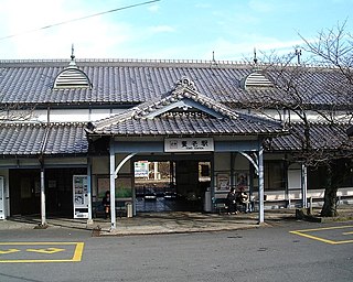
Yōrō Station is a railway station in the town of Yōrō, Yōrō District, Gifu Prefecture, Japan, operated by the private railway operator Yōrō Railway.

Ibi-Sekigahara-Yōrō Quasi-National Park

Ibi-Sekigahara-Yōrō Quasi-National Park is a Quasi-National Park in southwest Gifu Prefecture, Japan. The park was established in 1970.

Tōkai Nature Trail Japanese hiking trail

The Tōkai Nature Trail is a long distance walkway that traverses 11 prefectures and covers 1,697 kilometres (1,054 mi), running from Meiji no Mori Takao Quasi-National Park in Tokyo to Meiji no Mori Minō Quasi-National Park in Osaka Prefecture. Hiking the entire trail usually takes 40 to 50 days.

Related Research Articles

Mino Province one of the old provinces of Japan, encompassed part of modern-day Gifu Prefecture


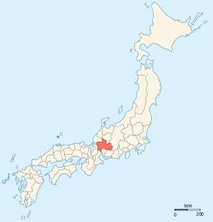
Mino Province, one of the old provinces of Japan, encompassed the southern part of modern-day Gifu Prefecture. It was sometimes called Nōshū (濃州). Mino Province bordered Echizen, Hida, Ise, Mikawa, Ōmi, Owari, and Shinano Provinces.

Ibigawa Town in Chūbu, Japan

Ibigawa is a town located in Ibi District, Gifu Prefecture, Japan. As of 1 December 2018, the town had an estimated population of 21,319 in 8,015 households and a population density of 27 persons per km2, in 8,032 households. The total area of the town was 803.44 square kilometres (310.21 sq mi).

Ikeda, Gifu Town in Chūbu, Japan

Ikeda is a town located in Ibi District, Gifu Prefecture, Japan. As of 1 December 2018, the town had an estimated population of 24,034 in 8291 households and a population density of 620 persons per km2. The total area of the town was 38.80 square kilometres (14.98 sq mi).

Mount Ibuki mountain in Gifu Prefecture, Japan

Mount Ibuki is a 1,377-metre-high (4,518 ft) mountain, on the border of Maibara, Shiga Prefecture, and Ibigawa, Gifu Prefecture, Japan. It is one of the 100 Famous Japanese Mountains, and is also included on the lists of the 100 Kinki Mountains and the 50 Shiga Mountains. Mount Ibuki is the highest mountain in Shiga Prefecture.

Hakusan National Park national park of Japan

Hakusan National Park is a national park in the Chūbu region of Honshū, Japan. Established in 1962, it spans the borders of Fukui, Gifu, Ishikawa, and Toyama prefectures. Its main geographical feature is Mount Haku. In 1980 an area of 480 km² corresponding to the national park was designated a UNESCO Man and the Biosphere Reserve.

Mount Hotakadake mountain in Nagano Prefecture, Japan

Mount Hotaka, also known as Mount Hotakadake, is one of the 100 Famous Japanese Mountains as coined by the media, reaching a height of 3,190 m (10,466 ft). Mount Hotaka is situated in Japan's Hida Mountains and all its major peaks except Mount Maehotaka, lie on the border between the cities of Matsumoto, Nagano Prefecture, and Takayama, Gifu Prefecture. This mountain is located in Chūbu-Sangaku National Park.

Nōbi Plain geographical object

The Nōbi Plain is a large plain in Japan that stretches from the Mino area of southwest Gifu Prefecture to the Owari area of northwest Aichi Prefecture, covering an area of approximately 1,800 square kilometres (695 sq mi). It is an alluvial plain created by the Kiso Three Rivers and has very fertile soil. It is bordered on the west by the Ibuki and Yōrō mountain ranges, and to the east by the Owari Hills. Its northern border is marked by the Ryōhaku Mountains and the south by Ise Bay.

Matsuo Pond

Matsuo Pond is a pond in Gifu, Gifu Prefecture, Japan. It is located at the southern base of Mount Dodo, the city's tallest mountain. The area around the lake is known as the Hagi Falls Nature Park. The park is very popular in the fall when the leaves are changing color.

Yōrō Mountains mountain in Japan

The Yōrō Mountains are a mountain range straddling the border between Gifu and Mie prefectures in Japan. They form part of the western border of the Nōbi Plain.

Hagi Falls waterfall

The Hagi Falls is a waterfall located in Mount Dodo's small valley in the city of Gifu, Gifu Prefecture, Japan. In 1986, it was named one of Gifu Prefecture's "50 Famous Waters."

Mount Kanmuri (Gifu, Fukui) mountain in Fukui Prefecture, Japan

Mount Kanmuri is a mountain located on the border between Gifu and Fukui prefectures in the Chūbu region of Japan. It is 1,256.6 m (4,123 ft) tall and part of the Ryōhaku Mountains. It is also the source of the Ibi River.

Mount Ikeda mountain in Gifu Prefecture, Japan

Mount Ikeda is a mountain located in the towns of Ikeda and Ibigawa, in Ibi District, Gifu Prefecture, Japan.

Hayato Great Falls waterfall

Hayato Great Falls is a waterfall on the Hayato River within the boundaries of the Tanzawa-Ōyama Quasi-National Park, in Sagamihara, Kanagawa Prefecture, Japan.
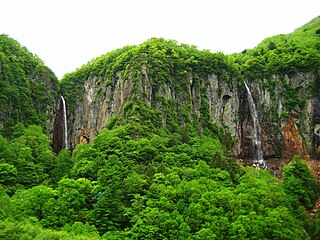
Yonako Falls waterfall in Yonako, Suzaka City, Nagano Prefecture, Japan

Yonako Falls, literally "Yonako Large Waterfalls" ) is a waterfall located in Yonako, Suzaka City, Nagano Prefecture, in the central part of Japan.

Kuji River river in Japan

Kuji River is a river in Fukushima Prefecture, Tochigi Prefecture and Ibaraki Prefecture, Japan. It rises at the northern slope of Mount Yamizo, where the border of these three prefectures is located, and flows into Pacific Ocean at Hitachi and Tokai in Ibaraki Prefecture. It has a length of 124 kilometers (77 mi) and a drainage area of 1,490 square kilometers (580 sq mi), and is designated as a Class A river.
References

  1. The Mountains around Nagoya. YAMA-KEI Publishers. 2010. ISBN   978-4-635-18017-7.
  2. Mountain and plateau map, Gozaisyo Ryōzen and Ibuki (山と高原地図). Shobunsha Publications. 2010. ISBN   978-4-398-75724-1.
  3. "Quasi-National Park". Ministry of the Environment (Japan) . Retrieved December 4, 2010.
  4. The Mountains of Gifu prefecture. YAMA-KEI Publishers. 2009. ISBN   978-4-635-02370-2.

Coordinates: 35°16′48″N136°32′03″E / 35.28000°N 136.53417°E / 35.28000; 136.53417