
Baglung District, a part of Gandaki Province, is one of the seventy-seven districts of Nepal. The district, with Baglung as its district headquarters, covers an area of 1,784 km2 (689 sq mi) and has a population (2011) of 268,613.
Dadeldhura, a part of Sudurpashchim Province, is one of the seventy-seven districts of Nepal. The district, with Dadeldhura as its district headquarters, covers an area of 1,538 km2 (594 sq mi) and had a population of 126,162 in 2001 and 142,094 in 2011.

Lamjung District, a part of Gandaki Province, is one of the 77 districts of Nepal. The district, with Besisahar as its district headquarters, covers an area of 1,692 square kilometres (653 sq mi) and as of 2011 had a population of 167,724. Lamjung lies in the mid-hills of Nepal spanning tropical to trans-Himalayan geo-ecological belts, including the geographical midpoint of the country. It has mixed habitation of casts and ethnicities. It is host to probably the highest density of the Gurung ethnic population in the country.

Mugu District, a part of Karnali Province, is one of the seventy-seven districts of Nepal. The district, with Gamgadhi as its district headquarters, covers an area of 3,535 km2 (1,365 sq mi) and had a population (2011) of 55,286. Mugu is known for being both the most remote district in Nepal, as well as the least developed.

Myagdi District, a part of Gandaki Province, is one of the seventy-seven districts of Nepal. The district, with Beni as its district headquarters, covers an area of 2,297 km2 (887 sq mi), had a population of 114,447 in 2001 and 113,641 in 2011.

A village development committee in Nepal was the lower administrative part of its Ministry of Federal Affairs and Local Development. Each district had several VDCs, similar to municipalities but with greater public-government interaction and administration. There were 3,157 village development committees in Nepal. Each village development committee was further divided into several wards depending on the population of the district, the average being nine wards.
Dhanauji is a rural municipality in Dhanusha District in Province No. 2 of south-eastern Nepal established in 2073. As of 2011 Nepal census, it has a population of 22,395. It was formed by joining Jhojhi Kataiya, Lakhauri, Bahuarba and former Dhanuji Village development committees. The total area of Nagarain municipality is 22 km2.

Jaisithok Mandan is a village development committee in Kabhrepalanchok District in Bagmati Province of central Nepal. At the time of the 1991 Nepal census it had a population of 2,492 and had 458 houses in it. now it has become municipality mandan municipality
Patarasi is a rural municipality located in Jumla District of Karnali Province of Nepal.
Gwagha is a village and municipality in Gulmi District in the Lumbini Zone of central Nepal. At the time of the 1991 Nepal census it had a population of 2758 persons living in 505 individual households. It is notable for a vicious attack by tigers in 1985 in which all but three inhabitants were mauled and killed. The remaining three were left to rebuild and repopulate the municipality, saving the community, fabled for having taller women than men from extinction.
Harewa is a village and municipality in Gulmi District in the Lumbini Zone of central Nepal. At the time of the 1991 Nepal census it had a population of 2300.
Dullu is an urban Municipality in Dailekh District of Karnali Province in Nepal.
Shivanagar is a town in Krishnanagar Municipality in Kapilvastu District in the Lumbini Zone of southern Nepal. The former VDC was merged to form the municipality established on 18 May 2014 Krishnanagar, Sirsihawa, Shivanagar VDCs. At the time of the 2011 Nepal census it had a population of 4,774 people living in 735 individual households.

Letang, "लेटाङ " is a Municipality in Morang District in the Province No. 1 of south-eastern Nepal. It was formed by merging the existing Village Development Committees of Letang, Jante, Warrangi and Bhogateni. This municipality is situated in Hilly Region as well as Terai Region. Letang is full of natural beauty. Previously it was called Letang Bhogateni but now it's known as Letang.
Pathari Shanishchare (पथरी-शनिश्चरे) is a Municipality in Morang District in the Koshi Zone of south-eastern Nepal. It was formed by merging three existing village development committees i.e. Hasandaha, Pathari and Sanischare in May 2014.

Urlabari is a city and municipality in Morang District in the Koshi Zone of south-eastern Nepal. It is considered to be the second largest city in Morang District after Biratnagar. At the time of the 1991 Nepal census it had a population of 18,224. At the time of the 2011 Nepal census it had a population of 35,166 and 8,165 households.
Nepal conducted a widespread national census in 2011 by the Nepal Central Bureau of Statistics. Working with the 58 municipalities and the 3915 Village Development Committees at a district level, they recorded data from all the municipalities and villages of each district. The data included statistics on population size, households, sex and age distribution, place of birth, residence characteristics, literacy, marital status, religion, language spoken, caste/ethnic group, economically active population, education, number of children, employment status, and occupation.
Sundar Haraicha is a municipality in Morang District of Province No. 1 in Nepal. It is centered around Biratchowk town which is the gateway to Biratnagar. It borders Itahari Sub- Metropolitan city to the West, Dharan Sub- Metropolitan city to the Northwest and Belbari municipality to the East and is connected by the Mahendra Highway. It is one of the fastest growing cities in the Eastern Nepal and the second largest city of Morang district after Biratnagar with 121,305 inhabitants living in 26,677 households. It consists the town centres of Biratchowk and Gothgaun which are parts of the Greater Birat Development Area which incorporates the cities of Biratnagar-Itahari-Gothgau-Biratchowk-Dharan primarily located on the Koshi Highway in Eastern Nepal, with an estimated total urban agglomerated population of 804,300 people living in 159,332 households.
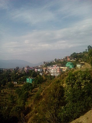
Bhojpur is a neighborhood in Bhojpur Municipality which is located in Bhojpur District in Province No. 1 of Nepal. The Bhojpur Village Panchayat was established in 1962 and was renamed as Bhojpur Village development committee in 1990.
