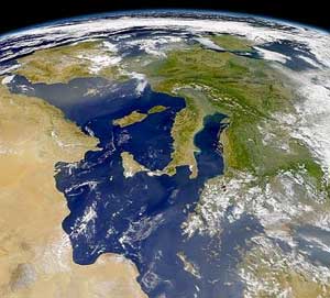
Italy is located in southern Europe and comprises the long, boot-shaped Italian Peninsula, the southern side of Alps, the large plain of the Po Valley and some islands including Sicily and Sardinia. Corsica, although belonging to the Italian geographical region, has been a part of France since 1769. Italy is part of the Northern Hemisphere.
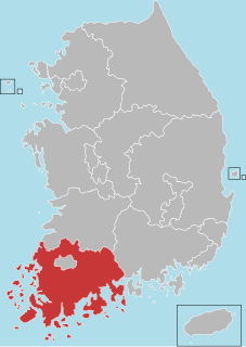
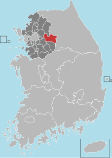
South Jeolla Province or Jeollanam-do is a province in the southwest of South Korea. The province was formed in 1896 from the southern half of the former Jeolla province, remained a province of Korea until the country's division in 1945, then became part of South Korea. Gwangju was the capital of the province, until the provincial office moved to the southern village of Namak, Muan County in 2005.
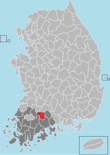
Gokseong County (Gokseong-gun) is a county in South Jeolla Province, South Korea.

Gapyeong County is a county in Gyeonggi Province, South Korea. It was the scene of the Battle of Kapyong, a major battle of the Korean War.
Jangsu County (Jangsu-gun) is a county in North Jeolla Province, South Korea. It is well known for Jangsu-Galbi.
Yangpyeong County (Yangpyeong-gun) is a county in Gyeonggi Province, South Korea.

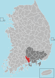
Geochang Country is a county in South Gyeongsang Province, South Korea.
Hadong County (Hadong-gun) is a county in South Gyeongsang Province, South Korea.

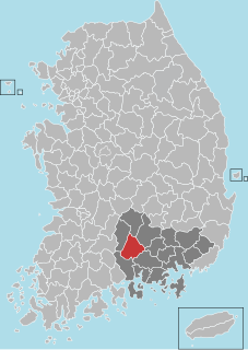
Hamyang County (Hamyang-gun) is a county in South Gyeongsang Province, South Korea.
Sancheong County (Sancheong-gun) is a county in South Gyeongsang Province, South Korea.

Jeonju World Cup Stadium, nicknamed "Fort Jeonju", is a football stadium in the South Korean city of Jeonju. It is the home of Jeonbuk Hyundai Motors. The stadium's capacity is 42,477. The final of 2011 AFC Champions League was held at this stadium.
The Hwang River is a tributary of the Nakdong River, flowing through Gyeongsangnam-do in southeastern South Korea. It originates in Geochang, from the union of various streams flowing from the slopes of Deogyusan, and meets the Nakdong in Hapcheon County. It covers about 117 kilometers. The name literally means "yellow," and refers to the yellow sand found along much of the river's course.
The sites of fossilized dinosaurs across the southern South Korean coast is a tentative UNESCO World Heritage site registered by the South Korean government since 2002. Although the evidence is rare, fossils reveal that there were dinosaurs in South Korea. The ancient remains of dinosaurs are located within a beautiful display of nature that includes petrified wood, the tracks of extinct dinosaurs and other animals, the exposure of geographic rock layers, and particular river drifts. This dinosaur park is well protected by the local governments and by the Marine National Park and is an invaluable resource for understanding the ecosystem and nesting behaviors of dinosaurs of the Mesozoic.

Kimhwa County is a kun, or county, in Kangwŏn province, North Korea.
Hyoja-dong is a dong, neighbourhood of Jongno-gu in Seoul, South Korea.
Jongjasan is a mountain near the city of Pocheon, Gyeonggi-do in South Korea. It has an elevation of 877.2 m (2,878 ft).

Wansa Station is a railway station on the Gyeongjeon Line in South Korea.
Bukcheon Station is a railway station in South Korea. It is on the Gyeongjeon Line.
The Misa Bridge crosses the Han River in South Korea and connects the cities of Hanam and Namyangju. It is part of the Seoul-Chuncheon Expressway.

Daejeoncheon is a river of South Korea. It is a river of the Geum River system. The stream divides several of the boroughs of Daejeon.


