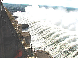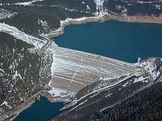
The Tucuruí Dam is a concrete gravity dam on the Tocantins River located on the Tucuruí County in the State of Pará, Brazil. The main purpose of the dam is hydroelectric power production and navigation. It is the first large-scale hydroelectric project in the Brazilian Amazon rainforest. The installed capacity of the 25-unit plant is 8,370 megawatts (11,220,000 hp). Phase I construction began in 1975 and ended in 1984 while Phase II began in 1998 and ended in 2012. The dam was featured in the 1985 film The Emerald Forest.

The Xiaowan Dam is an arch dam on the Lancang (Mekong) River in Nanjian County, Yunnan Province, southwest China. The primary purpose of the dam is hydroelectric power generation and it supports a 4,200 MW power station. Constructed between 2002 and 2010 by Huaneng Power International at a cost of ¥32 billion, it is the world's second highest arch dam at 292 m (958 ft). It is also third highest among dams of all types behind Jinping-I and Nurek and the third largest hydroelectric power station in China.

Taki Dam (滝ダム) is a gravity dam on the Tadami River, 7.3 km (5 mi) east of Tadami in Fukushima Prefecture, Japan. Surveys for the dam were carried out in 1958, construction began in 1959 and the dam was complete in 1961. The primary purpose of the dam is hydroelectric power generation and it supports a 92 MW power station consisting of 2 x 46 MW Kaplan turbines. The dam is 46 m (151 ft) tall and 264 m (866 ft) long. It creates a reservoir with a 27,000,000 m3 (21,889 acre⋅ft) capacity, of which 10,300,000 m3 (8,350 acre⋅ft) is active for power generation. The dam's spillway is controlled by four sluice gates and has a 200 m3/s (7,063 cu ft/s) discharge capacity.

The Upper Kotmale Dam is located in Talawakele, within the Nuwara Eliya District, in the Central Province of Sri Lanka. The dam feeds the third largest hydroelectric power station in the country.

The Ust-Ilimsk Hydroelectric Power Station is a concrete gravity dam on the Angara River and adjacent hydroelectric power station. It is located near Ust-Ilimsk, Irkutsk Oblast in Russia and is the third dam on the Angara cascades. Construction on the dam began in 1963, its reservoir began filling in 1974 and its power plant was commissioned in 1980.

The Longyangxia Dam is a concrete arch-gravity dam at the entrance of the Longyangxia canyon on the Yellow River in Gonghe County, Qinghai Province, China. The dam is 178 metres (584 ft) tall and was built for the purposes of hydroelectric power generation, irrigation, ice control and flood control. The dam supports a 1,280 MW power station with 4 x 320 MW generators that can operate at a maximum capacity of 1400 MW. Controlling ice, the dam controls downstream releases to reservoirs lower in the river, allowing them to generate more power instead of mitigating ice. Water in the dam's 24.7 billion m3 reservoir provides irrigation water for up to 1,000,000 hectares of land.

The Baishan Dam is an arch-gravity dam on the Second Songhua River near the town of Baishanzhen, Huadian, Jilin Province, China. The purpose of the dam is hydroelectric power generation and flood control. The dam supplies water to five turbine-generators in two different powerhouses for an installed capacity of 1,500 megawatts (2,000,000 hp) while it can also control a design 19,100 cubic metres per second (670,000 cu ft/s) flood. Additionally, it has a 300 megawatts (400,000 hp) pumped-storage hydroelectric generation capacity. It is named after Baekdu Mountain, near the city of Baishan.

The Yantan Dam is a gravity dam on the Hongshui River near Dahua County, Guangxi China. The main purpose of the dam is hydroelectric power production and it has an associated 1,210 MW power station consisting of 4 x 302.5 MW Francis turbine-generators.

The Wujiangdu Dam is an arch-gravity dam on the Wu River south of Zunyi, Guizhou Province, China. The purpose of the dam is hydroelectric power generation, flood control and navigation. The dam's power stations contain five generators for a total installed capacity of 1,130 MW.

The Zimapán Dam, also known as Fernando Hiriart Balderrama Dam, is an arch dam on the Moctezuma River about 15 km (9 mi) southwest of Zimapán in Hidalgo state, Mexico. The primary purpose of the dam is hydroelectric power production and it services a 292 MW power station with water.

The Ichari Dam is a concrete gravity dam on the Tons River 13 km (8 mi) north of Dakpathar in Uttarakhand, India. The primary purpose of the dam is hydroelectric power production and it is a run-of-the-river-type. It was completed in 1972. The dam diverts water to the Chibro Power Station which is then returned to the Tons River before being fed to the Khodri Power Station.

The Okutadami Dam (奥只見ダム) is a concrete gravity dam on the Tadami River, 26 km (16 mi) east of Uonuma on the border of Niigata and Fukushima Prefectures, Japan. The primary purpose of the dam is hydroelectric power generation and it supports a 560 MW power station which is the largest conventional hydroelectric power station in Japan. The dam also forms the second largest reservoir in Japan, next to that of the Tokuyama Dam.

The Otori Dam is a concrete arch-gravity dam on the Tadami River, 17 km (11 mi) southwest of Tadami in Fukushima Prefecture, Japan. The primary purpose of the dam is hydroelectric power generation and it supports a 182 MW power station. The power station contains two Kaplan turbine-generators. Unit 1 was commissioned on 20 November 1963 while Unit 2 was commissioned on 7 June 2003 as part of a power plant expansion project that included an additional 200 MW generator at Okutadami Dam upstream. The dam is 83 m (272 ft) tall and 188 m (617 ft) long. Its reservoir has a 15,800,000 m3 (12,809 acre⋅ft) capacity of which 5,000,000 m3 (4,054 acre⋅ft) is active for power generation. The reservoir has a catchment area of 656.9 km2 (254 sq mi) and surface area of 89 ha. Of the two generators, Unit 1 has a maximum effective hydraulic head of 50.8 m (167 ft) and Unit 2 is afforded 48.1 m (158 ft). The design flood discharge of the dam is 2,200 m3/s (77,692 cu ft/s) and its service spillway is controlled by three tainter gates.

The Huanglongtan Dam is a concrete gravity dam located on the Du River, a tributary of the Han River. It is located 25 km (16 mi) west of Shiyan in Hubei Province, China. The main purpose of the dam is hydroelectric power generation but it also provides for flood control. It was constructed between 1969 and 1976 and support a 510 MW power station.

The Longshou II Dam, also referred to as Longshou No. 2, is a concrete-face rock-fill dam on the Heihe River, located 35 km (22 mi) southwest of Zhangye in Gansu Province, China. It is part of the Gansu Heihe Rural Hydropower Development and supports a 157 MW power station. The dam's first feasibility study was carried out in 2000 and river diversion construction began in December 2001. In June 2002, the river was diverted and in September that year, filling of the dam's body began. On 17 August 2004, the first generator was operational with the rest by the end of the year. The 146.5 m (481 ft) high dam withholds a reservoir with a capacity of 86,200,000 m3 (69,883 acre⋅ft). It's spillway is located on the right bank and is a controlled chute type with a discharge capacity of 2,696 m3/s (95,208 cu ft/s). Water is delivered to the dam's power station downstream via a 1.7 km (1 mi) long tunnel. The dam is located upstream of the Longshou I Dam, an 80 m (262 ft) tall double-curvature arch dam with an installed capacity of 52 MW. Upstream is the Xiaogushan Dam, a gravity dam which diverts water to a 102 MW power station.

The Daguangba Dam is a multi-purpose dam on the Changhua River in Hainan Province, China. It is located 35 km (22 mi) east of Dongfang. As the primary component of the Daguangba Multipurpose Project, the dam was constructed between 1990 and 1995. It serves to provide water for both hydroelectric power generation and agriculture. It supports a 240 MW power station and supplies water for the irrigation of 12,700 ha. It is also the largest dam and hydroelectric power station in Hainan.

The Güllübağ Dam is a gravity dam near the town of Güllübağ on the Çoruh River in Erzurum Province, Turkey. The primary purpose of the dam is hydroelectric power production. Construction on the river diversion tunnel began in 2009 and the dam was complete in 2012. That same year the first generator became operational and the final generator was operational in March 2013. Water from the dam is sent down downstream through a 3,200 m (10,500 ft) long penstock where it reaches an 84 MW power station. The dam is part of the Çoruh Development Plan and it is owned by Turkey's State Hydraulic Works.

The Kukule Ganga Dam is a 110 m (360 ft) gravity dam built across the Kukule River in the Sabaragamuwa Province of Sri Lanka. The run-of-river-type dam feeds an underground hydroelectric power station located approximately 5 kilometres (3.1 mi) away, via tunnel.

Ghatghar Dam refers to two associated gravity dams built using roller-compacted concrete, the first use in India. They are situated in Ghatghar village in Ahmednagar district Maharashtra, India. Both dams create a lower and upper reservoir for the 250 MW pumped-storage hydroelectric power station. The upper Ghatghar dam is 15 m (49 ft) tall and on the Pravara River, a tributary of Godavari river. The lower Ghatghar dam is 86 m (282 ft) tall and located on the Shahi Nalla which is a tributary of Ulhas River to the south west of the upper reservoir in a steep valley. The hydro power project diverts Godavari river basin water outside the basin area to a west flowing river of Western ghats.

The Kayrakkum Dam, also spelt variously as Kayrakum, Kairakum, Qayraqqum or Qayroqqum, is an embankment dam on the Syr Darya River near the town of Kayrakkum in Sughd Province, Tajikistan. It is situated on the western edge of the Fergana Valley and creates Kayrakkum Reservoir. The reservoir supplies water for irrigation, primarily in Uzbekistan downstream, and hydroelectric power production. The reservoir is also a Ramsar site. The dam's power station has an installed capacity of 126 MW and is operated by Barki Tojik. Construction on the dam began in 1952. It began to impound its reservoir in 1956 and the first two generators were commissioned that year. The other four were operational in 1957 and the project was complete in 1959. The power station is currently undergoing a rehabilitation which should be completed in 2020. Two new and larger turbines will increase the installed capacity to 142 MW.


