
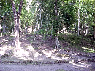
Piedras Negras is the modern name for a ruined city of the pre-Columbian Maya civilization located on the north bank of the Usumacinta River in the Petén department of northwestern Guatemala. Piedras Negras was one of the most powerful of the Usumacinta ancient Maya urban centers. Occupation at Piedras Negras is known from the Late Preclassic period onward, based on dates retrieved from epigraphic information found on multiple stelae and altars at the site. Piedras Negras is an archaeological site known for its large sculptural output when compared to other ancient Maya sites. The wealth of sculpture, in conjunction with the precise chronological information associated with the lives of elites of Piedras Negras, has allowed archaeologists to reconstruct the political history of the Piedras Negras polity and its geopolitical footprint.

Yaxchilan is an ancient Maya city located on the bank of the Usumacinta River in the state of Chiapas, Mexico. In the Late Classic Period Yaxchilan was one of the most powerful Maya states along the course of the Usumacinta River, with Piedras Negras as its major rival. Architectural styles in subordinate sites in the Usumacinta region demonstrate clear differences that mark a clear boundary between the two kingdoms.

Seibal, known as El Ceibal in Spanish, is a Classic Period archaeological site of the Maya civilization located in the northern Petén Department of Guatemala, about 100 km SW of Tikal. It was the largest city in the Pasión River region.

The Usumacinta River is a river in southeastern Mexico and northwestern Guatemala. It is formed by the junction of the Pasión River, which arises in the Sierra de Santa Cruz and the Salinas River, also known as the Rio Chixoy, or the Rio Negro, which descends from the Sierra Madre de Guatemala. It defines part of the border between Guatemala and the Mexican state of Chiapas, then continues its northwesterly course, meandering through the Mexican state of Tabasco to the Gulf of Mexico.
The Mayan architecture of the Maya civilization spans across several thousands of years, several eras of political change, and architectural innovation before the Spanish colonization of the Americas. Often, the buildings most dramatic and easily recognizable as creations of the Maya peoples are the step pyramids of the Terminal Preclassic Maya period and beyond. Based in general Mesoamerican architectural traditions, the Maya utilized geometric proportions and intricate carving to build everything from simple houses to ornate temples. This article focuses on the more well-known pre-classic and classic examples of Maya architecture. The temples like the ones at Palenque, Tikal, and Uxmal represent a zenith of Maya art and architecture. Through the observation of numerous elements and stylistic distinctions, remnants of Maya architecture have become an important key to understanding their religious beliefs and culture as a whole.

Motul de San José is an ancient Maya site located just north of Lake Petén Itzá in the Petén Basin region of the southern Maya lowlands. It is a few kilometres from the modern village of San José, in Guatemala's northern department of Petén. A medium-sized civic-ceremonial centre, it was an important political and economic centre during the Late Classic period (AD 650–950).
Ixlu is a small Maya archaeological site that dates to the Classic and Postclassic Periods. It is located on the isthmus between the Petén Itzá and Salpetén lakes, in the northern Petén Department of Guatemala. The site was an important port with access to Lake Petén Itzá via the Ixlu River. The site has been identified as Saklamakhal, also spelt Saclemacal, a capital of the Kowoj Maya.

El Zotz is a Mesoamerican archaeological site of the pre-Columbian Maya civilization, located in the Petén Basin region around 20 kilometres (12 mi) west of the major center of Tikal and approximately 26 kilometres (16 mi) west of Uaxactun. It is so called because of the large number of bats living in caves in the nearby cliffs. The site is located within the San Miguel la Palotada National Park bordering the Tikal National Park in the present-day department of Petén, Guatemala. It is a large Classic Period site and contains many unexcavated mounds and ruins.
La Amelia is a Pre-Columbian Maya archaeological site near Itzan, in the lower Pasión River region of the Petén Department of Guatemala. It formed a polity in the Late Classic, and was involved in the war between Tikal and Calakmul followed, in 650, by La Amelia's takeover by Dos Pilas. Two centuries of intermittent warfare followed until the area's population was so diminished by about 830, that this is considered the beginning of abandonment of Classic sites in the region.

The Pasión River is a river located in the northern lowlands region of Guatemala. The 353.9-kilometre-long (219.9 mi) river is fed by a number of upstream tributaries whose sources lie in the hills of Alta Verapaz. These flow in a general northerly direction to form the Pasión, which then tends westwards to meet up with the Salinas River at 16°28′52″N90°32′39″W. At this confluence, the greater Usumacinta River is formed, which runs northward to its eventual outlet in the Gulf of Mexico. The Pasión River's principal tributaries are the San Juan River, the Machaquila River, and the Cancuén River.
Altar de Sacrificios is a ceremonial center and archaeological site of the pre-Columbian Maya civilization, situated near the confluence of the Pasión and Salinas Rivers, in the present-day department of Petén, Guatemala. Along with Seibal and Dos Pilas, Altar de Sacrificios is one of the better-known and most intensively-excavated sites in the region, although the site itself does not seem to have been a major political force in the Late Classic period.

El Tintal is a Maya archaeological site in the northern Petén region of Guatemala, about 25 kilometres (16 mi) northeast of the modern-day settlement of Carmelita, with settlement dating to the Preclassic and Classic periods. It is close to the better known sites of El Mirador, to which it was linked by causeway, and Nakbé. El Tintal is a sizeable site that includes some very large structures and it is one of the four largest sites in the northern Petén; it is the second largest site in the Mirador Basin, after El Mirador itself. El Tintal features monumental architecture dating to the Middle Preclassic similar to that found at El Mirador, Nakbé and Wakna. Potsherds recovered from the site date to the Late Preclassic and Early Classic periods, and construction continued at the site in the Late Classic period.

Sacul is an archaeological site of the Maya civilization located in the upper drainage of the Mopan River, in the Petén department of Guatemala. The city occupied an important trade route through the Maya Mountains. The main period of occupation dates to the Late Classic Period. In the late 8th century AD through to the early 9th century, Sacul was one of the few kingdoms in the southeastern Petén region to use its own Emblem Glyph, together with Ixtutz and Ucanal.
Baking Pot is a Maya archaeological site located in the Belize River Valley on the southern bank of the river, northeast of modern-day town of San Ignacio in the Cayo District of Belize; it is 6 kilometres (3.7 mi) downstream from the Barton Ramie and Lower Dover archaeological sites. Baking Pot is associated with an extensive amount of research into Maya settlements, community-based archaeology, and of agricultural production; the site possesses lithic workshops, and possible evidence of cash-cropping cacao as well as a long occupation from the Preclassic through to the Postclassic period.
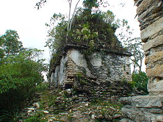
Sak tzʼi is an archaeological site of the pre-Columbian Maya civilization. It is located in the municipality of Ocosingo of the Mexican state of Chiapas. The ruins are notable for having the earliest urban remains in the Upper Usumacinta region, as well as a unique ancient theater for elite use. The ancient identity of the site is subject to debate.
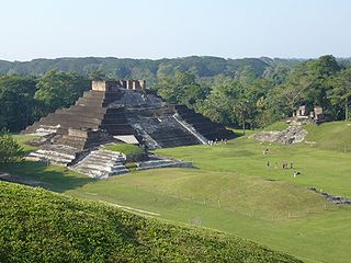
Comalcalco is an ancient Maya archaeological site in the State of Tabasco, Mexico, adjacent to the modern city of Comalcalco and near the southern coast of the Gulf of Mexico. It is the only major Maya city built with bricks rather than limestone masonry and was the westernmost city of the Maya civilisation. Covering an area of 7 km2 (2.7 sq mi), Comalcalco was founded in the Late Classic period and may have been a satellite or colony of Palenque based on architectural similarities between the two. The city was a center of the Chontal Maya people.

Aguada Fénix is a large Preclassic Mayan ruin located in the state of Tabasco, Mexico, near the border with Guatemala. It was discovered by aerial survey using laser mapping and announced in 2020. The flattened mound is 1,400 m long and is described as the oldest and the largest Mayan ceremonial site known. The monumental structure is constructed of earth and clay, and is believed to have been built from around 1000 BC to 800 BC. It is also believed to have been abandoned in around 750 BC, shortly after its completion in roughly 800 BC.

Chinikiha is a large Maya archaeological site from the Classic period located in the Usumacinta basin region in the Mexican state of Chiapas. Chinikiha is located between the Maya sites of Palenque and Pomoná and was during the Classic period a major Maya city and the capital of an important dynasty with great power over the Palenque and Usumacinta region.
El Palma, known anciently as Lakamtuun, is an archaeological Maya site located in the Lacantún river of Chiapas in Mexico. El Palma or Lakamtuun was an ancient Mayan state of the Classic period that ruled a part of the western territory of the Usumacinta Basin along the Lacantún River. According to the inscriptions found in the region, the site faced constant wars against other Maya states of the Usumacinta region, mainly with Yaxchilan.

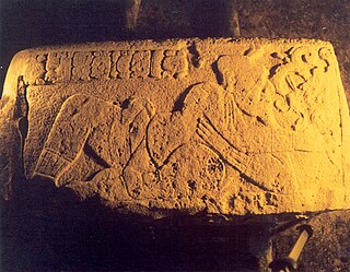
El Cayo, anciently known as Yax Niil or more extended Yax Akul Ha’ Yax Nil, is an archaeological Maya site located in the bank of the Usumacinta River in the state of Chiapas, Mexico. El Cayo was a major Maya city from the Usumacinta region subordinated for a period to Piedras Negras. Numerous stelae and monuments with glyphic inscriptions have been found in the site, the monuments narrate the complex context and political organization that the site lived during the Classic period in the region of the Usumacinta River Basin, most of the site remains unexplored and hidden in the jungle.

