The Puebloans or Pueblo peoples, are Native Americans in the Southwestern United States who share common agricultural, material and religious practices. When Spaniards entered the area beginning in the 16th century, they came across complex, multi-story villages built of adobe, stone and other local materials, which they called pueblos, or towns, a term that later came to refer also to the peoples who live in these villages.

Mesa Verde National Park is an American national park and UNESCO World Heritage Site located in Montezuma County, Colorado. The park protects some of the best-preserved Ancestral Puebloan archaeological sites in the United States.

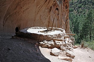
A kiva is a room used by Puebloans for religious rituals and political meetings, many of them associated with the kachina belief system. Among the modern Hopi and most other Pueblo people, kivas are square-walled and underground, and are used for spiritual ceremonies.

Chaco Culture National Historical Park is a United States National Historical Park hosting the densest and most exceptional concentration of pueblos in the American Southwest. The park is located in northwestern New Mexico, between Albuquerque and Farmington, in a remote canyon cut by the Chaco Wash. Containing the most sweeping collection of ancient ruins north of Mexico, the park preserves one of the most important pre-Columbian cultural and historical areas in the United States.

Mogollon culture is an archaeological culture of Native American peoples from Southern New Mexico and Arizona, Northern Sonora and Chihuahua, and Western Texas, a region known as Oasisamerica.

Hovenweep National Monument is located on land in southwestern Colorado and southeastern Utah, between Cortez, Colorado and Blanding, Utah on the Cajon Mesa of the Great Sage Plain. Shallow tributaries run through the wide and deep canyons into the San Juan River.

Casas Grandes is a prehistoric archaeological site in the northern Mexican state of Chihuahua. Construction of the site is attributed to the Mogollon culture. Casas Grandes has been designated a UNESCO World Heritage Site and is under the purview of INAH.

Canyons of the Ancients National Monument is a national monument protecting an archaeologically-significant landscape located in the southwestern region of the U.S. state of Colorado. The monument's 176,056 acres (71,247 ha) are managed by the Bureau of Land Management, as directed in the Presidential proclamation which created the site on June 9, 2000. Canyons of the Ancients National Monument is part of the National Landscape Conservation System, better known as the National Conservation Lands. This system comprises 32 million acres managed by the Bureau of Land Management to conserve, protect, and restore these nationally significant landscapes recognized for their outstanding cultural, ecological, and scientific values. Canyons of the Ancients encompasses and surrounds three of the four separate sections of Hovenweep National Monument, which is administered by the National Park Service. The monument was proclaimed in order to preserve the largest concentration of archaeological sites in the United States, primarily Ancestral Puebloan ruins. As of 2005, over 6,000 individual archeological sites had been identified within the monument.

This is a timeline of in North American prehistory, from 1000 BC until European contact.

Kin Kletso is a Chacoan Ancestral Pueblo great house and notable archaeological site located in Chaco Culture National Historical Park, 25 miles southwest of Nageezi, New Mexico, US. It was a medium-sized great house located 0.5 miles (0.8 m) west of Pueblo Bonito; it shows strong evidence of construction and occupation by Pueblo peoples who migrated to Chaco from the northern San Juan Basin in the time period of 1125 to 1200. From its masonry work, rectangular shape and design Kletso is identified as Pueblo III architecture by prominent Chaco archaeologists Stephen H. Lekson and Tom Windes. They also argue that this great house was only occupied by one or two households. Fagen writes that Kletso contained around 55 rooms, four ground-floor kivas, and a two-story cylindrical tower that may have functioned as a kiva or religious center. Evidence of an obsidian production industry were discovered here. The house was erected between 1125 and 1130.

Chetro Ketl is an Ancestral Puebloan great house and archeological site located in Chaco Culture National Historical Park, New Mexico, United States. Construction on Chetro Ketl began c. 990 and was largely complete by 1075, with significant remodeling occurring in the early and mid-1110s. Following the onset of a severe drought, most Chacoans emigrated from the canyon by 1140; by 1250 Chetro Ketl's last inhabitants had vacated the structure.
Kin Nahasbas is a Chacoan Anasazi great house and archaeological site located in Chaco Canyon, 25 miles southwest of Nageezi, New Mexico, United States. Built in either the 9th or 10th centuries, it was major pueblo located slightly north of the Una Vida complex, which is positioned at the foot of the north mesa. Limited excavation has been conducted in this area. The ruins are now protected within the borders of Chaco Culture National Historical Park.

Hundreds of Ancestral Puebloan dwellings are found across the American Southwest. With almost all constructed well before 1492 CE, these Puebloan towns and villages are located throughout the geography of the Southwest.

The Pueblo III Period was the third period, also called the "Great Pueblo period" when Ancestral Puebloans lived in large cliff-dwelling, multi-storied pueblo, or cliff-side talus house communities. By the end of the period the ancient people of the Four Corners region migrated south into larger, centralized pueblos in central and southern Arizona and New Mexico.
Joe Ben Wheat Site Complex is a set of archaeological sites dated from AD 600 to 1300 that are located near Yellow Jacket in Montezuma County, Colorado. The complex is also known by its collective site ID of 5MT16722. In 2004, the Joe Ben Wheat Site Complex was added to the National Register of Historic Places.
Huérfano Mountain, also known as Huerfano Mesa and El Huerfano, is one of four sacred mountains in the mythology of the Navajo people. Located in San Juan County, New Mexico, the 7,470-foot (2,280 m) mountain is believed in Navajo culture to be the home of Yódí Atʼééd and Yódí Ashkii. It is also thought to be the original home of Áłtsé Hastiin and Áłtsé Asdzą́ą́.
The Chaco Meridian is a theoretical north-south axis on which lie the Ancestral Puebloan sites, Aztec Ruins and Chaco Canyon, as well as Paquime at Casas Grandes in northern Mexico. Archeologist Stephen H. Lekson developed the theory, which suggests the location of these sites on the same approximate line of longitude (107°57'25") was intentional, and represents a ceremonial connection between them.

Anna Sofaer is a researcher and educator on the archaeoastronomy of the Ancestral Puebloans of the American Southwest and other ancient cultures. In 1977, she "rediscovered" the astronomical marker site known as the Sun Dagger on Fajada Butte in Chaco Culture National Historical Park. Research has indicated this site records the solar and lunar cycles. In 1978, she founded the non-profit Solstice Project, through which she has produced a book of peer-reviewed research papers and two documentary, PBS broadcast films on Chaco Canyon. She continues to produce research and films from Santa Fe, New Mexico, where the Solstice Project is based.
The Fort Pueblo massacre was a retaliatory attack that occurred on December 25, 1854 against Fort Pueblo as known as El Pueblo, a settlement on the north side of the Arkansas River, 1⁄2 mile west of the mouth of Fountain Creek, above the mouth of the Huerfano. It followed the deaths of Chico Velasquez and others who died after having been given blankets saturated with smallpox by US authorities during the American Indian Wars. Coalition forces of over 100 Muache Utes and Jicarilla Dindes under the leadership of Chief Tierra Blanco led the attack against Fort Pueblo, killing 15 men, and capturing one woman, and two boys. Later on, the Muache killed the woman south of Pueblo at the Salt Creek. 2 women and 1 man survived the joint military operation, and the two boys who were captured, eventually returned.


