Related Research Articles

Delaware County is a county in the east central portion of the U.S. state of Indiana. As of 2020, the population was 111,903. The county seat is Muncie.

The White River is an American two-forked river that flows through central and southern Indiana and is the main tributary to the Wabash River. Via the west fork, considered to be the main stem of the river by the U.S. Board on Geographic Names, the White River is 362 miles (583 km) long. Indiana's capital, Indianapolis, is located on the river. The two forks meet just north of Petersburg and empty into the Wabash River at Mount Carmel, Illinois.

Tulpehocken Creek is a 39.5-mile-long (63.6 km) tributary of the Schuylkill River in southeastern Pennsylvania in the United States, and during the American Canal Age, once provided nearly half the length of the Union Canal linking the port of Philadelphia, the largest American city and the other communities of Delaware Valley with the Susquehanna basin and the Pennsylvania Canal System connecting the Eastern seaboard to Lake Erie and the new settlements of the Northwest Territory via the Allegheny, Monongahela, and Ohio Rivers at Pittsburgh.
Red Clay Creek is a 12.7-mile-long (20.4 km) tributary of White Clay Creek, running through southeastern Pennsylvania and northern Delaware in the United States. As of 2000, portions of the creek are under wildlife habitat protection.

The Feather River is the principal tributary of the Sacramento River, in the Sacramento Valley of Northern California. The river's main stem is about 73 miles (117 km) long. Its length to its most distant headwater tributary is just over 210 miles (340 km). The main stem Feather River begins in Lake Oroville, where its four long tributary forks join—the South Fork, Middle Fork, North Fork, and West Branch Feather Rivers. These and other tributaries drain part of the northern Sierra Nevada, and the extreme southern Cascades, as well as a small portion of the Sacramento Valley. The total drainage basin is about 6,200 square miles (16,000 km2), with approximately 3,604 square miles (9,330 km2) above Lake Oroville.

Cedar Creek is the largest tributary of the St. Joseph River, draining 174,780 acres (707.3 km2) in the Eastern Corn Belt Plains of northeastern Indiana. It is 31.9 miles (51.3 km) long, rising in northwestern DeKalb County and joining the St. Joseph just below the Cedarville Dam in Allen County.

The Cardinal Greenway (TGC) is a multi-use recreational network combining a rail trail and an on-street route that together cross 62 miles (100 km) and five counties — in east central Indiana. The greenway, which was designated a National Recreation Trail in June 2003 and in 2018 was named to the Rails-to-Trails Conservancy's "Rail Trail Hall of Fame." uses the former CSX railroad track between Richmond and Marion. It is named after the Cardinal, the last regular passenger train service on the (Chicago-Cincinnati-Washington) route. Currently it is Indiana's longest rail trail project.

Poquessing Creek is a 10.3-mile-long (16.6 km) creek, a right tributary of the Delaware River, that forms the boundary between Philadelphia and Bensalem Township, which borders it to the northeast along the Delaware. It has defined this boundary between Bucks and Philadelphia counties since 1682.

The Saline River is a tributary of the Ohio River, approximately 27 miles (43 km) long, in the Southern Illinois region of the U.S. state of Illinois. The river drains a large section of southeast Illinois, with a drainage basin of 1,762 square miles (4,564 km2). The major tributaries include the South Fork, Middle Fork and North Fork, all lying within the Saline Valley. The once meandering swampy river was important among Native Americans and early settlers as a source of salt from numerous salt springs where it was commercially extracted in the early 19th century.

Wills Creek is a tributary of the Muskingum River, 92.2 mi (148.4 km) long, in eastern Ohio in the United States. Via the Muskingum and Ohio Rivers, it is part of the watershed of the Mississippi River. It drains an area of 853 mi2 (2,209 km2).

Martins Creek is a 10.4-mile-long (16.7 km) tributary of the Delaware River in eastern Pennsylvania in the United States. In all, the main creek and its two branches drain an area of 46.7 square miles. Martins Creek joins the Delaware just south of the town of Martins Creek.

Big Pine Creek is a creek in northwestern Indiana, USA. It begins in Round Grove Township in southwestern White County and flows generally southward 51.3 miles (82.6 km) through Benton and Warren counties before meeting the Wabash River near the town of Attica. The lower section of the creek from Rainsville to the Wabash is used by canoeists, particularly during the spring when the water is at its highest, and local flora, fauna and geology can be observed.
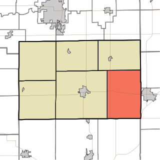
Madison Township is one of six townships in Tipton County, Indiana, United States. As of the 2020 census, its population was 1,286 and it contained 571 housing units.

Black Creek is a tributary of the St. Johns River in Clay County, Florida. It is formed by the confluence of North Fork Black Creek and South Fork Black Creek. North Fork Black Creek originates as an outflow from Kingsley Lake and flows north and then southeast, meeting South Fork Black Creek on the east side of MIddleburg. North Fork Black Creek has Yellow Water Creek as its main tributary. South Fork Black Creek originates in a chain of lakes about four miles south of Kingsley Lake, with Ates Creek, Bull Creek, and Greens Creek as its main tributaries. Both forks are fed by areas of wetlands and numerous small streams.
Fall Creek is a navigable in law waterway in the U.S. state of Indiana, and a tributary of the White River. It is 57.5 miles (92.5 km) long and has a watershed drainage area of 318 square miles (820 km2) in central Indiana before flowing into the White River in Indianapolis. As it flows southwest, Fall Creek is the namesake of three townships in Indiana, in Henry County, Madison County, and then Hamilton County.
The Eel River is a 52.8-mile-long (85.0 km) tributary of the White River in southwestern Indiana. Via the White, Wabash, and Ohio rivers, its waters flow to the Mississippi River and the Gulf of Mexico. The Eel River flows through Greene, Owen, Clay, and Putnam counties. It is the southern of the two rivers named Eel River within Indiana.
The Union Moraine begins in Ohio, east of Bellefontaine and the highest point in that state, towards Greenville in Darke County. Traveling southwestward and arcing a little northward, the moraine reaches Union City, Ohio for which it is named. From here, it travels almost directly westward to Muncie, Indiana. From Muncie, the moraine runs northwest ending in the bluffs overlooking Pipe Creek at Bunker Hill, Indiana, just south of Peru on the Wabash River.

Clear Creek is an American creek in Monroe County, Indiana. Flowing in the general south-western and southern direction, it is a tributary of Salt Creek, which in its turn flows into the East Fork of Indiana's White River.
Pipe Creek is a stream in the U.S. state of Indiana. It is a tributary of the White River, and is named for Captain Pipe, a Delaware chief.
References
- ↑ "Lake and Fishing Information for York Prairie Creek - Delaware County, Indiana". Lake-Link.com. Retrieved 2016-03-30.
- ↑ "Indiana Gazetteer: Maps, Data, Photos for 2,560 locations". indiana.hometownlocator.com. Retrieved 2016-03-30.