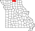
York Township is a township in northwestern Putnam County, Missouri. [1]
The organization date and origin of the name of York Township is unknown. [2]
Putnam County is a county in north central Missouri. At the 2020 census, the population was 4,681. Its county seat is Unionville. The county was organized February 28, 1845, and named for Israel Putnam, a hero in the French and Indian War and a general in the American Revolutionary War.
Sullivan County is a county located in the northern portion of the U.S. state of Missouri. As of the 2020 census, the population was 5,999. Its county seat is Milan. The county was organized February 14, 1845, and named for Major General John Sullivan of the American Revolutionary War.
Polk County is a county located in the southwestern portion of the U.S. state of Missouri. As of the 2020 census, the population was 31,519. Its county seat is Bolivar. The county was organized January 5, 1835, and named for Ezekiel Polk. Polk County is part of the Springfield, MO Metropolitan Statistical Area.
Mercer County is a county located in the northwestern portion of the U.S. state of Missouri. As of the 2020 census, the population was 3,538, making it the second-least populous county in Missouri. Its county seat is Princeton. The county was organized February 14, 1845, and named for General John F. Mercer of the Revolutionary War.
Carroll County is a county located in the U.S. state of Missouri. As of the 2020 census, the county had a population of 8,495. Its county seat is Carrollton. The county was organized on January 2, 1833, from part of Ray County and named for Charles Carroll of Carrollton, a signer of the Declaration of Independence.
Appanoose County is a county in the U.S. state of Iowa. As of the 2020 census, the population was 12,317. Its county seat is Centerville.
Lemons is a census-designated place in southwestern Wilson Township, Putnam County, Missouri, United States. It is located approximately four miles south of Unionville on Route 5.
Polk Township is a rural township in Dade County, in the U.S. state of Missouri. It is laid out as a north-south rectangle just east of Pleasant Hill, Dade County, Missouri. There is much open farmland. Several streams, including Cave Spring Branch, Lumley Branch, Turnback Creek, and the Sac River flow through this township.
Galesburg is an unincorporated community in Putnam County, in the U.S. state of Missouri.
Quinn is an unincorporated community in Putnam County, in the U.S. state of Missouri.
St. John is an unincorporated community in Putnam County, in the U.S. state of Missouri.
West Liberty is an extinct town in section 27 of southern Sherman Township in Putnam County, in the U.S. state of Missouri.
Wyreka is an unincorporated community in Putnam County, in the U.S. state of Missouri.
Grant Township is a township in northeastern Putnam County, Missouri.
Jackson Township is a township in southern Putnam County, Missouri.
Liberty Township is a township in northeastern Putnam County, Missouri.
Medicine Township is a township in southwestern Putnam County, Missouri.
Sherman Township is a township in northern Putnam County, Missouri.
Union Township is a township in northern Putnam County, Missouri. The county seat of Unionville is primarily located in the southeastern portion of this township.
Wilson Township is a township in southern Putnam County, Missouri. The county seat of Unionville is partly located in the northeastern portion of this township.