Chariton, Missouri

Last updated

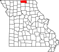
Chariton is an unincorporated community in northeast Putnam County, in the U.S. state of Missouri. [1]

The community is on Missouri Route DD two miles east of Missouri Route 149. The Missouri-Iowa border is one mile north of the community. Unionville is approximately 15 miles to the southwest. [2]

History

A post office called Chariton was established in 1883, and remained in operation until 1907. [3] The community takes its name from the nearby Chariton River. [4]

Related Research Articles

Chariton County, Missouri County in Missouri, United States

Chariton County is a county located in the north-central portion of the U.S. state of Missouri. As of the 2020 census, the population was 7,408. Its county seat is Keytesville. The county was organized November 16, 1820, from part of Howard County and is named for the Chariton River.

Bynumville is an unincorporated community in eastern Chariton County, Missouri, United States. It is located approximately twelve miles north of Salisbury on Route 129.

Forest Green is an unincorporated community in southeastern Chariton County, Missouri, United States. It is located approximately eight miles south of Salisbury on Route 5.

Prairie Hill, Missouri

Prairie Hill is an unincorporated community in eastern Chariton County, Missouri, United States. The community is located at the intersection of Missouri routes W and HH approximately seven miles north-northeast of Salisbury. The Thomas Hill Reservoir dam is seven miles to the northeast in adjacent Randolph County.

Connelsville is an unincorporated community in Nineveh Township, Adair County, Missouri, United States. The community is on Missouri Route 149 about three miles north of Novinger and eight miles northwest of Kirksville. Shuteye Creek flows past the north side of the town and its confluence with the Chariton River is about one mile to the east.

Stahl is an unincorporated community in northwest Adair County, Missouri, United States. The community is on Missouri Route O about six miles northwest of Novinger and 12 miles northwest of Kirksville. The Union Ridge Conservation Area lies to the west about two miles and Spring Creek flows past the community to its confluence with the Chariton River south of Novinger.

Locust Creek is a stream in Wayne County, Iowa and Chariton, Linn, Livingston, Putnam and Sullivan counties in Missouri. It is a tributary of the Grand River.

Mike is an unincorporated community in Chariton County, in the U.S. state of Missouri.

Mussel Fork is a stream in Adair, Chariton, Linn, Macon and Sullivan counties in the U.S. state of Missouri. It is a tributary to the Chariton River.

Musselfork is an unincorporated community in Chariton County, in the U.S. state of Missouri.

Chapel is an unincorporated community in Putnam County, in the U.S. state of Missouri.

Glendale is an unincorporated community in eastern Putnam County, in the U.S. state of Missouri.

Graysville is an unincorporated community in eastern Putnam County, in the U.S. state of Missouri.

Hartford is an unincorporated community in Putnam County, in the U.S. state of Missouri.

Martinstown is an unincorporated community in southeast Putnam County, in the U.S. state of Missouri.

Shoal Creek is a stream in Appanoose and Wayne counties of Iowa and Putnam County, Missouri. It is a tributary of the Chariton River.

Sidney is an unincorporated community in Putnam County, in the U.S. state of Missouri.

Hubbard is an unincorporated community in northwest Randolph County, Missouri.

Pennville is an unincorporated community in northeast Sullivan County, in the U.S. state of Missouri.

Spring Creek is a stream in Putnam, Sullivan and Adair counties of northern Missouri. It is a tributary of the Chariton River.

References

  1. U.S. Geological Survey Geographic Names Information System: Chariton, Missouri
  2. Missouri Atlas & Gazetteer, DeLorme, 1st ed. 1998, p. 17 ISBN   0899332242
  3. "Post Offices". Jim Forte Postal History. Retrieved 11 December 2016.
  4. "Putnam County Place Names, 1928–1945". The State Historical Society of Missouri. Archived from the original on June 24, 2016. Retrieved December 11, 2016.

Coordinates: 40°34′13″N92°46′53″W / 40.5702984°N 92.7813081°W / 40.5702984; -92.7813081