Related Research Articles

The Metropolitan Borough of Solihull is a metropolitan borough in West Midlands county, England. It is named after its largest town, Solihull, from which Solihull Metropolitan Borough Council is based. For Eurostat purposes it is a NUTS 3 region and is one of seven boroughs or unitary districts that comprise the "West Midlands" NUTS 2 region. Much of the large residential population in the north of the borough centres on the communities of Castle Bromwich, Kingshurst, Marston Green and Smith's Wood as well as the towns of Chelmsley Wood and Fordbridge. In the south are the towns of Shirley and Solihull, as well as the large villages of Knowle, Dorridge, Meriden and Balsall Common.
Kingshurst is a post-war village and civil parish in the Metropolitan Borough of Solihull, in the West Midlands, England. Historically part of the county of Warwickshire in the Meriden Rural District, It lies about 7 miles (11 km) north of Solihull town centre, 10 miles (16 km) east of Birmingham and 12 miles (16km) west of Coventry, it borders North Warwickshire to the east. The village is encompassed within the electoral ward Kingshurst & Fordbridge which had a population of 7,868 in the 2011 census.
Smith's Wood is a suburban civil parish in the Metropolitan Borough of Solihull in the West Midlands of England. It is known best for its schools and ancient woodland. The civil parish has a population of 10,476, according to the 2011 census. North Warwickshire forms its north and east boundary, Kingshurst its south, and Castle Bromwich its west. Smith's Wood also has several parks including Lanchester Park, Woodlands Green Park, and the Smith's Wood Playing Fields.

Kingfisher Country Park is a country park situated in the Metropolitan Borough of Solihull in England, straddling the historic border of Warwickshire and Worcestershire, mostly within the former. Initially designated as Project Kingfisher by Birmingham City Council, the park was formally declared a country park in July 2004. The country park is located along an 11 km (6.8 mi) stretch of the River Cole from Small Heath in Birmingham to Chelmsley Wood at the M6 motorway. It is a Local Nature Reserve.
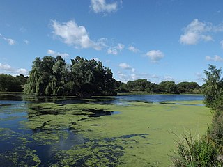
Babbs Mill Lake, sometimes called Kingshurst Lake, is a man-made lake in the Kingfisher Country Park in Kingshurst, Solihull in England. The lake was created as a balancing feature in times of flooding from the nearby River Cole.
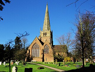
Solihull is a market town and the administrative centre of the Metropolitan Borough of Solihull, in the West Midlands, England. Solihull is situated on the River Blythe in the Forest of Arden area. The town had a population of 126,577 at the 2021 Census, and its wider borough had a population of 216,240. The town is located 8 miles (12 km) southeast of Birmingham and 14 miles (21 km) west of Coventry.

Queen's Wood is a 52-acre area of ancient woodland in the London Borough of Haringey, abutting Highgate Wood and lying between East Finchley, Highgate, Muswell Hill and Crouch End. It was originally part of the ancient Forest of Middlesex which covered much of London, Hertfordshire and Essex and was mentioned in the Domesday Book. It is now one of three Local Nature Reserves in the London Borough of Haringey. It is situated a few minutes' walk from Highgate tube station.

Borsdane Wood is an Ancient Semi Natural Woodland in the Mersey Rivers catchment area, in the Metropolitan Borough of Wigan and Metropolitan Borough of Bolton, Greater Manchester, England. It is believed to have been continuous woodland cover since before 1600 AD and is composed of native tree species that have not obviously been planted. Borsdane Wood was designated a Local Nature Reserve in 1986.

Ruislip Woods is a Site of Special Scientific Interest and national nature reserve covering 726 acres (294 ha) in Ruislip in the London Borough of Hillingdon. The woods became London's first national nature reserve in May 1997. Ruislip Local Nature Reserve at TQ 090 899 is part of the national nature reserve.
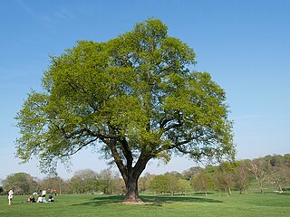
Beckenham Place Park is a large park located near Beckenham in the London Borough of Lewisham. It lies close to the border with the London Borough of Bromley, and was formerly divided between the two boroughs. The Palladian-style mansion that gave the park its name now serves as a community centre and café.

Scratchwood is an extensive, mainly wooded, country park in Mill Hill in the London Borough of Barnet. The 57-hectare site is a Site of Metropolitan Importance for Nature Conservation and together with the neighbouring Moat Mount Open Space. It is a Local Nature Reserve.

Malvern and Brueton Park is a town park and local nature reserve in Solihull in the West Midlands, England. The park is formed from a comparatively narrow strip of land, with the length being approximately ten times the average width, but it is looped forming a roughly U-shaped layout. The parks cover an area of approximately 130 acres (53 ha). Historically the park was formed by the joining of two separate parcels of different land. There is a large water feature, Brueton Park Lake, which runs through the southern end of the park, and is formed by the damming of a local watercourse, the River Blythe.

Palmers Rough is a local nature reserve and park located in Shirley, Solihull. It covers an area of approximately 7.3 hectares and consists of two separate woodland blocks; Palmers Coppice to the east, and Squires Coppice to the west. They are separated by open grassland and include for two football pitches and a small children's playground. A wide range of plants and animals makes Palmers Rough an important urban space and was therefore granted local nature reserve status in 2000. The presence of Palmers Rough is noted within the Domesday Book, and suggests that the woodland dates back over 900 years.
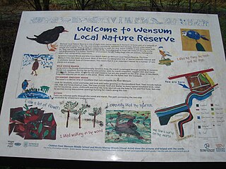
Wensum Local Nature Reserve or Wensum Valley is a Local Nature Reserve in Norwich in the English county of Norfolk. The reserve consists of two sites; Mile Cross Marsh52.6419°N 1.2657°E and Sycamore Crescent Wood which are linked by the Riverside Path a public footpath via the Sycamore Crescent footbridge

Bills Wood is a local nature reserve and park located in Shirley, Solihull. It covers an area of approximately 6.6 hectares and consists of a square parcel of woodland surrounded by residential suburbs. To the east the wood is bounded by the school playing fields of Light Hall School. A wide range of plants and animals makes the wood an important urban space, and was therefore granted local nature reserve status in 1991.

Dulwich Upper Wood is a 2.4 hectare local nature reserve and Site of Borough Importance for Nature Conservation, Grade 1, in Crystal Palace in the London Borough of Southwark. It is owned by Southwark Council and managed by the Trust for Urban Ecology.
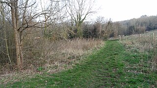
Foxley Wood is an 11.36 hectare Local Nature Reserve and Site of Borough Importance for Nature Conservation, Grade 1, in Purley in the London Borough of Croydon. It is owned and managed by Croydon Council. The site was purchased by Coulsdon and Purley Urban District Council under the Green Belt Act in the 1930s.

Ruffett Wood and Big Wood are adjoining woods with a total area of 7 hectares on the border of the London Borough of Sutton, close to the village of Woodmansterne. Big Wood is to the south and Ruffett Wood is to the north. They are owned by Sutton Council and managed by the Woodland Trust. They are designated a Local Nature Reserve and a Site of Borough Importance for Nature Conservation, Grade 1. The woods are the largest continuous area of woodland in the borough of Sutton.

Sir Joseph Hood Memorial Wood is a 1.7 hectare Local Nature Reserve and a Site of Borough Importance for Nature Conservation, Grade I, in Motspur Park in the London Borough of Merton. It adjoins Sir Joseph Hood Memorial Playing Fields, and both are owned and managed by Merton Council.
References
- ↑ "Yorks Wood". Local Nature Reserves. Natural England. Retrieved 26 July 2013.
- ↑ "Map of Yorks Wood". Local Nature Reserves. Natural England. Retrieved 26 July 2013.
- 1 2 3 "Native Woodland Plan NWP 015/207" (PDF). Solihull Metropolitan Borough Council. Archived from the original (pdf) on 17 May 2011. Retrieved 22 December 2007.
- ↑ The Town Planning Review, page 30, volume 26 (April 1955-January 1956), University of Liverpool Department of Civic Design
- 1 2 "Kingfisher Country Park". Birmingham City Council. Retrieved 22 December 2007.