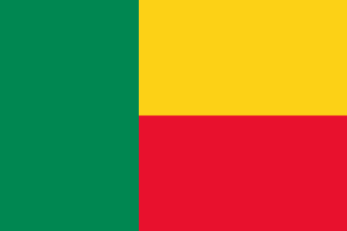
Benin, officially the Republic of Benin, is a country in West Africa. It was formerly known as Dahomey. It is bordered by Togo to the west, Nigeria to the east, Burkina Faso to the north-west, and Niger to the north-east. The majority of its population lives on the southern coastline of the Bight of Benin, part of the Gulf of Guinea in the northernmost tropical portion of the Atlantic Ocean. The capital is Porto-Novo, and the seat of government is in Cotonou, the most populous city and economic capital. Benin covers an area of 112,622 km2 (43,484 sq mi), and its population in 2021 was estimated to be approximately 13 million. It is a tropical country with an economy heavily dependent on agriculture, and is an exporter of palm oil and cotton.
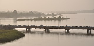
The Niger River is the main river of West Africa, extending about 4,180 kilometres. Its drainage basin is 2,117,700 km2 (817,600 sq mi) in area. Its source is in the Guinea Highlands in south-eastern Guinea near the Sierra Leone border. It runs in a crescent shape through Mali, Niger, on the border with Benin and then through Nigeria, discharging through a massive delta, known as the Niger Delta, into the Gulf of Guinea in the Atlantic Ocean. The Niger is the third-longest river in Africa, exceeded by the Nile and the Congo River. Its main tributary is the Benue River.

Cotonou is the largest city in Benin. Its official population count was 679,012 inhabitants in 2012; however, over two million people live in the larger urban area.
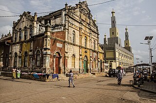
Porto-Novo is the capital and second-largest city of Benin. The commune covers an area of 110 square kilometres (42 sq mi) and as of 2002 had a population of 223,552 people.
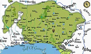
Yorubaland is the homeland and cultural region of the Yoruba people in West Africa. It spans the modern-day countries of Nigeria, Togo and Benin, and covers a total land area of 142,114 km2 (54,871 sq mi). Of this land area, 106,016 km2 (74.6%) lies within Nigeria, 18.9% in Benin, and the remaining 6.5% is in Togo. Prior to European colonization, a portion of this area was known as Yoruba country. The geo-cultural space contains an estimated 55 million people, the majority of this population being ethnic Yoruba.

The Oyo Empire was a Yoruba empire in West Africa. It was located in present-day southern Benin and western Nigeria. The empire grew to become the largest Yoruba-speaking state through the organizational and administrative efforts of the Yoruba people, trade, as well as the military use of cavalry. The Oyo Empire was one of the most politically important states in Western Africa from the mid-17th to the late 18th century and held sway not only over most of the other kingdoms in Yorubaland, but also over nearby African states, notably the Fon Kingdom of Dahomey in the modern Republic of Benin on its west.

The culture of Nigeria is shaped by Nigeria's multiple ethnic groups. The country has 527 languages, seven of which are extinct. Nigeria also has over 1,150 dialects and ethnic groups. The three largest ethnic groups are the Hausas that are predominantly in the north, the Yorubas who predominate in the southwest, and the Igbos in the southeast. There are many other ethnic groups with sizeable populations across the different parts of the country. The Kanuri people are located in the northeast part of Nigeria, the Tiv people are in the north central, and the Efik-Ibibio are in the south South. The Bini people are most frequent in the region between Yorubaland and Igboland.

There are over 525 native languages spoken in Nigeria. The official language and most widely spoken lingua franca is English, which was the language of Colonial Nigeria. Nigerian Pidgin – an English-based creole – is spoken by over 60 million people.

The Legends of Africa reflect a wide-ranging series of kings, queens, chiefs and other leaders from across the African continent including Mali, Benin, Ghana, Nigeria, Congo, Ethiopia, Eritrea and South Africa.

The documented history begins when Oranyan came to rule the Oyo Empire, which became dominant in the early 17th century. The older traditions of the formerly dominant Ile-Ife kingdom are largely oral.

The following outline is provided as an overview of and topical guide to Benin:
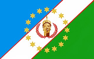
The Yoruba people are a West African ethnic group who mainly inhabit parts of Nigeria, Benin, and Togo. The areas of these countries primarily inhabited by the Yoruba are often collectively referred to as Yorubaland. The Yoruba constitute more than 50 million people in Africa, are over a million outside the continent, and bear further representation among members of the African diaspora. The vast majority of the Yoruba population is today within the country of Nigeria, where they make up 20.7% of the country's population according to Ethnologue estimations, making them one of the largest ethnic groups in Africa. Most Yoruba people speak the Yoruba language, which is the Niger-Congo language with the largest number of native or L1 speakers.
Benin, officially the Republic of Benin, is a country in Western Africa. It borders Togo to the west, Nigeria to the east and Burkina Faso and Niger to the north; its short coastline to the south leads to the Bight of Benin. Its size is just over 110000 km2 with a population of almost 8500000. Its capital is the Yoruba founded city of Porto Novo, but the seat of government is the Fon city of Cotonou. About half the population live below the international poverty line of US$1.25 per day.
The Ohori or Ọ̀họ̀rí-Ìjè are a subgroup of the Yoruba people of West Africa. The local domain of the Ohori is South-eastern Benin north of Pobè town expanding westwards to and west of the Ouémé River. Often, Ohoris, together with groups of Ifonyins, Aworis and Ketus are known collectively as 'Nagos" in Benin.
The South West is the one of the six geopolitical zones of Nigeria representing both a geographic and political region of the country's southwest. It comprises six states — Ekiti, Lagos, Ogun, Ondo, Osun, and Oyo. It makes up part of Yorubaland in Nigeria, with Kwara and parts of Kogi completing it.

The Idaasha also spelt Idaaca, Idaaṣa and Idaaitsa are a group of the Yoruba people, situated in the central portions of the Collines Department of Benin, West Africa. They are based in and around the communities of Glazoué and Dassa both situated west of the Oueme River. Every year, the Idaasha organize a festival of arts and culture known as FACI to celebrate their culture and heritage, themed Àshà Ìbílẹ̀.

The Benin–Burkina Faso border is 386 km in length and runs from the tripoint with Togo in the southwest to the tripoint with Niger in the northeast.
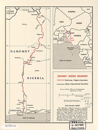
The Benin–Nigeria border is 809 km in length and runs from the tripoint with Niger in the north down to the Bight of Benin in the south.

The Ife Empire was the first empire in Yoruba history. It was founded in what is now southwestern Nigeria and eastern Benin. The Ife Empire lasted from 1200 to 1420. The empire was formed by Odùduwà, and became well-known for its sophisticated art pieces. Although Yoruba was the main language of the empire, there were also various spoken dialects and languages. It rose to power through trade with Sahelian and forest states. Its capital city, Ilé-Ife, was one of the largest urban centers in 14th century West Africa.


