The Chattahoochee River forms the southern half of the Alabama and Georgia border, as well as a portion of the Florida - Georgia border. It is a tributary of the Apalachicola River, a relatively short river formed by the confluence of the Chattahoochee and Flint rivers and emptying from Florida into Apalachicola Bay in the Gulf of Mexico. The Chattahoochee River is about 430 miles (690 km) long. The Chattahoochee, Flint, and Apalachicola rivers together make up the Apalachicola–Chattahoochee–Flint River Basin. The Chattahoochee makes up the largest part of the ACF's drainage basin.

The Etowah River is a 164-mile-long (264 km) waterway that rises northwest of Dahlonega, Georgia, north of Atlanta. On Matthew Carey's 1795 map the river was labeled "High Town River". On later maps, such as the 1839 Cass County map, it was referred to as "Hightower River", a name that was used in most early Cherokee records.

The Sumter National Forest is one of two forests in South Carolina that are managed together by the United States Forest Service, the other being the Francis Marion National Forest. The Sumter National Forest consists of 370,442 acres (1,499.13 km2) which are divided into several non-contiguous sections in western South Carolina. Overall, in descending order of land area the forest is located in parts of Oconee, Union, Newberry, McCormick, Edgefield, Abbeville, Laurens, Chester, Fairfield, Greenwood, and Saluda counties. Forest headquarters of both South Carolina forests are located together in the state's capital city of Columbia.

Liberty Township is one of eight townships in Bollinger County, Missouri, USA. As of the 2000 U.S. Census, its population was 1,224. As of the 2010 U.S. Census, its population had increased to 1,371. Liberty Township covers an area of 91.51 square miles (237.0 km2).
Cane Creek Township is one of ten townships in Butler County, Missouri, USA. As of the 2010 census, its population was 468.
The Big Satilla River is a river in South Georgia. It rises in Ben Hill and Coffee counties and flows southeast for 260 miles (420 km). It is one of Georgia's 14 major watersheds.
Tobesofkee Creek is a 58.9-mile-long (94.8 km) river in Georgia. It originates near Barnesville and flows roughly southeast across Lamar, Monroe, and Bibb counties to join the Ocmulgee River south of the city of Macon. A dam on this stream forms Lake Tobesofkee.
Frogtown Creek is a stream in Lumpkin County, Georgia, in the United States.
Cane Creek is a stream in Georgia, and is a tributary of the Chestatee River. The creek is approximately 14.72 miles (23.69 km) long.
Tenmile Creek is a stream in Butler and Carter counties in the U.S. state of Missouri. It is a tributary of Cane Creek.
Cane Creek is a stream in Butler and Carter counties in southeast Missouri.
Blue John Creek is a stream in Troup County in the U.S. state of Georgia. It is a tributary to Long Cane Creek.

Brasstown Creek is a stream in the U.S. states of Georgia and North Carolina. The 8.5-mile (13.7 km) long stream is a tributary to the Hiwassee River.
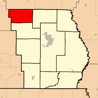
Long Cane is an unincorporated community in Troup County, in the U.S. state of Georgia. The name sometimes is spelled "Longcane".

Uchee Creek is a stream in the east-central part of the U.S. state of Georgia. It derives its name from the Yuchi Indians, who once lived in the area. Variant spellings are Euchee Creek and Yuchi Creek.
Oak Cane Branch is a stream in the U.S. state of Georgia. It is a tributary to the Ogeechee River.
Spoilcane Creek is a stream in the U.S. state of Georgia. It is a tributary to the Chattahoochee River.
Sweetwater Creek is a stream in the U.S. state of Georgia. It is a tributary to the Flint River.

Toccoa Creek is a stream in the U.S. state of Georgia.
Youngcane is an extinct town in Union County, in the U.S. state of Georgia.