Yunguyo

Last updated

Yunguyo
Town
Yunguyo Peru.jpg
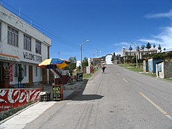
Street in Yunguyo leading to the border crossing to Bolivia
Peru location map.svg
Red pog.svg
Yunguyo
Coordinates: 16°14′39.06″S69°05′33.95″W / 16.2441833°S 69.0927639°W / -16.2441833; -69.0927639
Country Peru
Region Puno
Province Yunguyo
Population
 (2008)
  Total
12,625
Time zone UTC-5:00 (EST)

Yunguyo is a town in the Puno Region in southeastern Peru. It is the capital of Yunguyo Province and Yunguyo District. It has a population of 12,625 (2008 estimate).[ needs update ]

Yunguyo is located on a peninsula on the shores of Lake Titicaca. The border with Bolivia runs next to the town and a road connects it with the town of Copacabana located a few kilometers away on the Bolivian side of the peninsula.

Climate

Climate data for Tahuaco-Yunguyo, elevation 3,888 m (12,756 ft), (1991–2020)
MonthJanFebMarAprMayJunJulAugSepOctNovDecYear
Mean daily maximum °C (°F)14.7
(58.5)
14.9
(58.8)
15.0
(59.0)
15.1
(59.2)
14.5
(58.1)
13.4
(56.1)
13.2
(55.8)
14.1
(57.4)
14.9
(58.8)
15.8
(60.4)
16.5
(61.7)
15.8
(60.4)
14.8
(58.7)
Mean daily minimum °C (°F)4.0
(39.2)
3.9
(39.0)
3.7
(38.7)
2.2
(36.0)
−0.4
(31.3)
−2.0
(28.4)
−2.0
(28.4)
−0.8
(30.6)
1.0
(33.8)
2.2
(36.0)
3.2
(37.8)
3.9
(39.0)
1.6
(34.9)
Average precipitation mm (inches)174.3
(6.86)
145.0
(5.71)
120.3
(4.74)
41.0
(1.61)
11.4
(0.45)
10.4
(0.41)
9.7
(0.38)
18.5
(0.73)
27.0
(1.06)
47.3
(1.86)
54.6
(2.15)
98.7
(3.89)
758.2
(29.85)
Source: National Meteorology and Hydrology Service of Peru [1]

References

  1. "Normales Climáticas Estándares y Medias 1991-2020". National Meteorology and Hydrology Service of Peru. Archived from the original on 21 August 2023. Retrieved 25 October 2023.