The Arctic Archipelago, also known as the Canadian Arctic Archipelago, is a group of islands north of the Canadian mainland.

Beurys Lake is a census-designated place in Schuylkill County, Pennsylvania, United States. The population was 133 at the 2000 census.

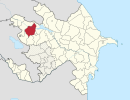
Shusha is a rayon of Azerbaijan. It surrounds the city of Shusha, in Nagorno-Karabakh, and is completely under control of the unrecognised Republic of Artsakh.
Kotyaevka is a small village situated on the right bank of the Kigash River in the Kurmangazy District of Atyrau Region, Kazakhstan. Geographical coordinates are: Latitude (DMS): 46° 32' 40 N, Longitude (DMS): 48° 45' 20 E.

German submarine U-54 was a Type VIIB U-boat of Nazi Germany's Kriegsmarine during World War II.

Dərəkənd is a village in the Lachin Rayon of Azerbaijan.

Ferkhani is a village in the Kalbajar Rayon of Azerbaijan.

Quş yuvası is a village in the Kalbajar Rayon of Azerbaijan.

Otakhlar is a village in the Kalbajar Rayon of Azerbaijan.

Kilsə is a village in the Kalbajar Rayon of Azerbaijan.
Dalqılınclı is a village in the Kalbajar Rayon of Azerbaijan.
Birinci İpək is a village in the Lachin Rayon of Azerbaijan.
Alsószenterzsébet is a village in Zala County, Hungary.
Felsőszenterzsébet is a village in Zala County, Hungary.
Hottó is a village in Zala County, Hungary.
Kálócfa is a village in Zala County, Hungary.
Lickóvadamos is a village in Zala County, Hungary.
Ormándlak is a village in Zala County, Hungary.
Pölöske is a village in Zala County, Hungary. It is famous for the "Pölöskei Szörp" syrup.
Sárhida is a village in Zala County, Hungary.


