
Grójczyk is a village in the administrative district of Gmina Boniewo, within Włocławek County, Kuyavian-Pomeranian Voivodeship, in north-central Poland. It lies approximately 3 kilometres (2 mi) south-west of Boniewo, 25 km (16 mi) south-west of Włocławek, and 65 km (40 mi) south of Toruń.
Kanigówek is a village in the administrative district of Gmina Ciechanów, within Ciechanów County, Masovian Voivodeship, in east-central Poland. It lies approximately 12 kilometres (7 mi) west of Ciechanów and 80 km (50 mi) north-west of Warsaw.
Brzeziny is a village in the administrative district of Gmina Żarnowiec, within Zawiercie County, Silesian Voivodeship, in southern Poland. It lies approximately 30 kilometres (19 mi) east of Zawiercie and 67 km (42 mi) north-east of the regional capital Katowice.
Chlina is a village in the administrative district of Gmina Żarnowiec, within Zawiercie County, Silesian Voivodeship, in southern Poland. It lies approximately 31 kilometres (19 mi) east of Zawiercie and 64 km (40 mi) east of the regional capital Katowice.
Chlina Dolna is a village in the administrative district of Gmina Żarnowiec, within Zawiercie County, Silesian Voivodeship, in southern Poland. It lies approximately 30 kilometres (19 mi) east of Zawiercie and 62 km (39 mi) east of the regional capital Katowice.
Jeziorowice is a village in the administrative district of Gmina Żarnowiec, within Zawiercie County, Silesian Voivodeship, in southern Poland. It lies approximately 27 kilometres (17 mi) east of Zawiercie and 64 km (40 mi) north-east of the regional capital Katowice.
Koryczany is a village in the administrative district of Gmina Żarnowiec, within Zawiercie County, Silesian Voivodeship, in southern Poland. It lies approximately 37 kilometres (23 mi) east of Zawiercie and 72 km (45 mi) east of the regional capital Katowice.
Łany Małe is a village in the administrative district of Gmina Żarnowiec, within Zawiercie County, Silesian Voivodeship, in southern Poland. It lies approximately 31 kilometres (19 mi) east of Zawiercie and 66 km (41 mi) north-east of the regional capital Katowice.
Łany Średnie is a village in the administrative district of Gmina Żarnowiec, within Zawiercie County, Silesian Voivodeship, in southern Poland. It lies approximately 34 kilometres (21 mi) east of Zawiercie and 70 km (43 mi) north-east of the regional capital Katowice.
Łany Wielkie is a village in the administrative district of Gmina Żarnowiec, within Zawiercie County, Silesian Voivodeship, in southern Poland. It lies approximately 31 kilometres (19 mi) east of Zawiercie and 67 km (42 mi) north-east of the regional capital Katowice.
Małoszyce is a village in the administrative district of Gmina Żarnowiec, within Zawiercie County, Silesian Voivodeship, in southern Poland. It lies approximately 31 kilometres (19 mi) east of Zawiercie and 68 km (42 mi) north-east of the regional capital Katowice.
Otola is a village in the administrative district of Gmina Żarnowiec, within Zawiercie County, Silesian Voivodeship, in southern Poland. It lies approximately 28 kilometres (17 mi) east of Zawiercie and 65 km (40 mi) north-east of the regional capital Katowice.
Otola Mała is a village in the administrative district of Gmina Żarnowiec, within Zawiercie County, Silesian Voivodeship, in southern Poland. It lies approximately 30 kilometres (19 mi) east of Zawiercie and 66 km (41 mi) north-east of the regional capital Katowice.
Udórz is a village in the administrative district of Gmina Żarnowiec, within Zawiercie County, Silesian Voivodeship, in southern Poland. It lies approximately 27 kilometres (17 mi) east of Zawiercie and 61 km (38 mi) north-east of the regional capital Katowice.
Wola Libertowska is a village in the administrative district of Gmina Żarnowiec, within Zawiercie County, Silesian Voivodeship, in southern Poland. It lies approximately 29 kilometres (18 mi) east of Zawiercie and 64 km (40 mi) north-east of the regional capital Katowice.
Zabrodzie is a village in the administrative district of Gmina Żarnowiec, within Zawiercie County, Silesian Voivodeship, in southern Poland. It lies approximately 33 kilometres (21 mi) east of Zawiercie and 68 km (42 mi) north-east of the regional capital Katowice.

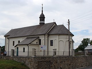
Żarnowiec is a village in Zawiercie County, Silesian Voivodeship, in southern Poland. It is the seat of the gmina called Gmina Żarnowiec. It lies in historic Lesser Poland, approximately 32 kilometres (20 mi) east of Zawiercie and 67 km (42 mi) north-east of the regional capital Katowice. Even though the village now belongs to Silesian Voivodeship, it has never been part of Silesia. Until 1975, it was administratively tied with Lesser Poland’s cities of Kraków and Kielce. The village has a population of 830.
Solca is a village in the administrative district of Gmina Pilica, within Zawiercie County, Silesian Voivodeship, in southern Poland. It lies approximately 9 kilometres (6 mi) north-east of Pilica, 22 km (14 mi) east of Zawiercie, and 60 km (37 mi) north-east of the regional capital Katowice.
Łążyn is a village in the administrative district of Gmina Lubawa, within Iława County, Warmian-Masurian Voivodeship, in northern Poland. It lies approximately 7 kilometres (4 mi) south-east of Fijewo, 24 km (15 mi) south-east of Iława, and 56 km (35 mi) south-west of the regional capital Olsztyn.


