
Mlynky is a village and municipality in the Spišská Nová Ves District in the Košice Region of central-eastern Slovakia. It is one of the most important touristic localities around Slovak Karst. Locals make their living mostly from tourism.

Jadwisin is a village in the administrative district of Gmina Zagrodno, within Złotoryja County, Lower Silesian Voivodeship, in south-western Poland. Prior to 1945 it was in Germany.
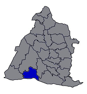
Rogalin is a village in the administrative district of Gmina Horodło, within Hrubieszów County, in eastern Poland, close to the border with Ukraine.

Ręczno is a village in Piotrków County, Łódź Voivodeship, in central Poland. It is the seat of the gmina called Gmina Ręczno. It lies approximately 27 kilometres (17 mi) south-east of Piotrków Trybunalski and 72 km (45 mi) south of the regional capital Łódź.
Kolonia Rzeczyca is a settlement in the administrative district of Gmina Zadzim, within Poddębice County, Łódź Voivodeship, in central Poland. It lies approximately 6 kilometres (4 mi) south of Zadzim, 20 km (12 mi) south-west of Poddębice, and 43 km (27 mi) west of the regional capital Łódź.
Borek Lipiński is a village in the administrative district of Gmina Warta, within Sieradz County, Łódź Voivodeship, in central Poland. It lies approximately 13 kilometres (8 mi) east of Warta, 13 km (8 mi) north of Sieradz, and 47 km (29 mi) west of the regional capital Łódź.
Młynki is a village in the administrative district of Gmina Piekoszów, within Kielce County, Świętokrzyskie Voivodeship, in south-central Poland. It lies approximately 12 kilometres (7 mi) west of Piekoszów and 22 km (14 mi) west of the regional capital Kielce.
Adamów is a village in the administrative district of Gmina Opatów, within Opatów County, Świętokrzyskie Voivodeship, in south-central Poland. It lies approximately 3 kilometres (2 mi) east of Opatów and 60 km (37 mi) east of the regional capital Kielce.
Dębie is a village in the administrative district of Gmina Grójec, within Grójec County, Masovian Voivodeship, in east-central Poland.
Trzylatków Mały is a village in the administrative district of Gmina Błędów, within Grójec County, Masovian Voivodeship, in east-central Poland. It lies approximately 14 kilometres (9 mi) south-west of Grójec and 50 km (31 mi) south-west of Warsaw.
Jelonki is a village in the administrative district of Gmina Ostrów Mazowiecka, within Ostrów Mazowiecka County, Masovian Voivodeship, in east-central Poland. It lies approximately 12 kilometres (7 mi) north-west of Ostrów Mazowiecka and 93 km (58 mi) north-east of Warsaw.
Kalaty is a village in the administrative district of Gmina Stoczek, within Węgrów County, Masovian Voivodeship, in east-central Poland.
Franciszkowo is a village in the administrative district of Gmina Poniec, within Gostyń County, Greater Poland Voivodeship, in west-central Poland.
Russówek is a village in the administrative district of Gmina Żelazków, within Kalisz County, Greater Poland Voivodeship, in west-central Poland. It lies approximately 11 kilometres (7 mi) north of Kalisz and 100 km (62 mi) south-east of the regional capital Poznań.
Zawada is a village in the administrative district of Gmina Gubin, within Krosno Odrzańskie County, Lubusz Voivodeship, in western Poland, close to the German border. It lies approximately 7 kilometres (4 mi) east of Gubin, 24 km (15 mi) south-west of Krosno Odrzańskie, and 48 km (30 mi) west of Zielona Góra.
Rudziny is a village in the administrative district of Gmina Brusy, within Chojnice County, Pomeranian Voivodeship, in northern Poland. It lies approximately 10 kilometres (6 mi) east of Brusy, 27 km (17 mi) north-east of Chojnice, and 76 km (47 mi) south-west of the regional capital Gdańsk.
Czerwona Górka is a village in the administrative district of Gmina Bartoszyce, within Bartoszyce County, Warmian-Masurian Voivodeship, in northern Poland, close to the border with the Kaliningrad Oblast of Russia.
Kleszczewo-Osada is a settlement in the administrative district of Gmina Miłki, within Giżycko County, Warmian-Masurian Voivodeship, in northern Poland.

Hóa Sơn is a commune (xã) and village in Minh Hóa District, Quảng Bình Province, in Vietnam.
Zhutang Township is a rural township in Changhua County, Taiwan. It has a population total of 15,863 and an area of 42.1662 square kilometres.


