
The xylophone is a musical instrument in the percussion family that consists of wooden bars struck by mallets. Each bar is an idiophone tuned to a pitch of a musical scale, whether pentatonic or heptatonic in the case of many African and Asian instruments, diatonic in many western children's instruments, or chromatic for orchestral use.

Inhambane is a province of Mozambique located on the coast in the southern part of the country. It has an area of 68,615 km2 and a population of 1,488,676. The provincial capital is also called Inhambane.
The native folk music of Mozambique has been highly influenced by Portuguese colonisation and local language forms. The most popular style of modern dance music is marrabenta. Mozambican music also influenced another Lusophone music in Brazil, like maxixe, and mozambique style in Cuba and New York City.
The Chopi are a Bantu ethnic group of Mozambique. They have lived primarily in the Zavala region of southern Mozambique, in the Inhambane Province. They traditionally lived a life of subsistence agriculture, traditionally living a rural existence, although many were displaced or killed in the civil war that followed Mozambique's liberation from Portuguese colonial rule in 1975. In addition, drought forced many away from their homeland and into the nation's cities.
The culture of Mozambique is in large part derived from its history of Bantu, Swahili, and Portuguese rule, and has expanded since independence in 1975. The majority of its inhabitants are black Africans. Its main language is Portuguese. Its median religion is Roman Catholicism, but only about 40% of the inhabitants are Christian. It has a rich history in the areas of arts, cuisine, and entertainment.
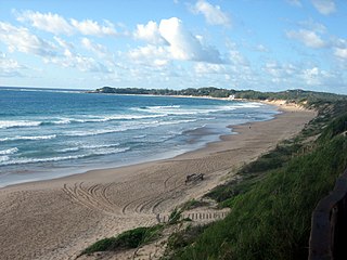
Zavora is a beach, north east of Maputo in Mozambique, in the district of Inharrime, province of Inhambane. It is located 420 km north east of Maputo, the capital of Mozambique, and 27 km east from the town of Inharrime. The capital of the province, the city of Inhambane, is approximately 2 hours drive away towards the North East.

The xibelani dance is an indigenous dance of the Tsonga women from Mpumalanga and Limpopo located in South Africa. The name of the dance comes from the native Xitsonga language and it can translate to "hitting to the rhythm", for example, the concept "xi Bela ni vunanga". The name "xibelani" typically refers to the dance style while the skirt itself is referred to as "tinguvu", however, the term "xibelani" is sometimes used to refer to both the dance and the skirt.

Gorongosa District is a district of Sofala Province in Mozambique. The principal town is Gorongosa. The district is located in the northwest of the province, and borders with Maringué District in the north, Cheringoma District in the east, Muanza District in the southeast, Nhamatanda District in the south, and with Macossa and Gondola Districts of Manica Province in the west. The area of the district is 6,722 square kilometres (2,595 sq mi). It has a population of 116,912 as of 2007.

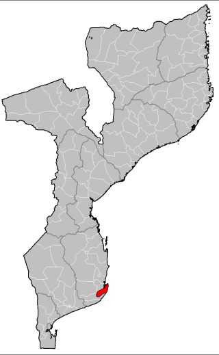
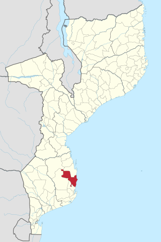
Zavala District is a district of Inhambane Province in south-east Mozambique. Its principal town is Zavala. The district is located at the east of the province, and borders with Inharrime District in the north and with Manjacaze District of Gaza Province in the west. In the east and in the south, the district is bounded by the Indian Ocean. The area of the district is 1,997 square kilometres (771 sq mi). It has a population of 139.616 as of 2007.

Govuro District is a district of Inhambane Province in south-east Mozambique. Its principal town is Nova Mambone. The district is located at the northeast of the province, and borders with Machanga District of Sofala Province in the north, Inhassoro District in the south, and Mabote District in the west. In the east, the district is bounded by the Indian Ocean. The area of the district is 3,961 square kilometres (1,529 sq mi). It has a population of 34,809 as of 2007.
Jangamo District is a district of Inhambane Province in south-east Mozambique. Its principal town is Jangamo. The district is located in the south of the province, and borders with Homoine District in the north and with Inharrime District in the south and in the west. In the east, the district is bounded by the Indian Ocean. The area of the district is 1,294 square kilometres (500 sq mi). It has a population of 93,681 as of 2007.

Inharrime District is a district of Inhambane Province in southeastern Mozambique. Its principal town is Inharrime. The district is located at the south of the province, and borders Panda and Homoine Districts in the north, Jangamo District in the northwest, Zavala District in the south, and Manjacaze District of Gaza Province in west. In the east, the district is bounded by the Indian Ocean. The area of the district is 2,744 square kilometres (1,059 sq mi). It has a population of 97.471 as of 2007.
Massinga District is a district of Inhambane Province in south-east Mozambique. Its principal town is Massinga. The district is located at the east of the province and borders with Inhassoro District in the north, Vilanculos District in the northeast, Morrumbene District in the south, and with Funhalouro District in the west. In the east, the district is bounded by the Indian Ocean. The area of the district is 7,458 square kilometres (2,880 sq mi). In terms of the area, this is the biggest district of Inhambane Province. It has a population of 184,531 as of 2007.

Morrumbene District is a district of Inhambane Province in south-east Mozambique. Its principal town is Morrumbene. The district is located at the east of the province and borders with Massinga District in the north, Homoine District in the south, and with Funhalouro District in the west. In the east, the district is bounded by the Indian Ocean. The area of the district is 2,608 square kilometres (1,007 sq mi). In terms of the area, this is the biggest district of Inhambane Province. It has a population of 124,471 as of 2007.

Panda District is a district of Inhambane Province in south-east Mozambique. Its principal town is Panda. The district is located in the northwestern part of the province and borders Funhalouro District in the north, Homoine District in the east, Inharrime District in the south, and Chibuto and Manjacaze Districts of Gaza Province in the west. The area of the district is 6,852 square kilometres (2,646 sq mi). It has a population of 47.946 as of 2007.

Araripina is a Brazilian municipality in the state of Pernambuco. Has an estimated population in 2020 of 84,864 inhabitants according with IBGE. Total area of 1.847,5 km2 and is located in the state mesoregion of Sertão, at 622 meters above the sea level and 683 km West from the state capital, Recife. The exploration of gypsum and calcarium is the base of the local economy and at the homonymous microregion.
The Southern Bantu languages are a large group of Bantu languages, largely validated in Janson (1991/92). They are nearly synonymous with Guthrie's Bantu zone S, apart from the debated exclusion of Shona and inclusion of Makhuwa. They include all of the major Bantu languages of South Africa, Botswana, Lesotho, Eswatini, and Mozambique, with outliers such as Lozi in Zambia and Namibia, and Ngoni in Zambia, Tanzania and Malawi.
Tofo Beach or simply Tofo is a small town in southeastern Mozambique. The town lies on the Indian Ocean coast, on Barra Beach peninsula in Inhambane Province, Jangamo District, 22 km drive from Inhambane city.

Zanthoxylum piperitum, also known as Japanese pepper, Sichuan pepper or Japanese prickly-ash, is a deciduous aromatic spiny shrub or small tree of the citrus and rue family Rutaceae, native to Japan and Korea.
