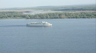
Biysk is a city in Altai Krai, Russia, located on the Biya River not far from its confluence with the Katun River. It is the second largest city of the krai. Population: 210,115 (2010 Census); 218,562 (2002 Census); 233,238 (1989 Census).

Altaysky District is the name of several administrative and municipal districts in Russia. The districts are named after the Altai Mountains.
Krasnogorsky District is the name of several administrative and municipal districts in Russia. The name is generally derived from or related to the collocation "krasnaya gora", meaning roughly "(a) red/beautiful mountain(s)/hill(s)".

Romanovsky District is the name of several administrative and municipal districts in Russia:

Troitsky District is the name of several administrative and municipal districts in Russia:

Tselinny District is the name of several administrative and municipal districts in Russia. The name is generally derived from, or is related to, the root "tselina".

Glazovsky District is an administrative and municipal district (raion), one of the twenty-five in the Udmurt Republic, Russia. It is located in the north of the republic. The area of the district is 2,159.7 square kilometers (833.9 sq mi). Its administrative center is the city of Glazov. Population: 17,132 (2010 Census); 18,792 ; 19,161 (1989 Census).

Karakulinsky District is an administrative and municipal district (raion), one of the twenty-five in the Udmurt Republic, Russia. It is located in the southeast of the republic. The area of the district is 1,192.6 square kilometers (460.5 sq mi). Its administrative center is the rural locality of Karakulino. Population: 12,230 (2010 Census); 13,835 ; 14,620 (1989 Census). The population of Karakulino accounts for 39.4% of the district's total population.

Krasnogorsky District is an administrative and municipal district (raion), one of the twenty-five in the Udmurt Republic, Russia. It is located in the northwest of the republic. The area of the district is 1,860.1 square kilometers (718.2 sq mi). Its administrative center is the rural locality of Krasnogorskoye. Population: 10,347 (2010 Census); 12,219 ; 14,202 (1989 Census). The population of Krasnogorskoye accounts for 42.8% of the district's total population.

Sharkansky District is an administrative and municipal district (raion), one of the twenty-five in the Udmurt Republic, Russia. It is located in the east of the republic. The area of the district is 1,404.5 square kilometers (542.3 sq mi). Its administrative center is the rural locality of Sharkan. Population: 19,100 (2010 Census); 21,384 ; 21,487 (1989 Census). The population of Sharkan accounts for 34.6% of the district's total population.

Uvinsky District is an administrative and municipal district (raion), one of the twenty-five in the Udmurt Republic, Russia. It is located in the southwestern central part of the republic. The area of the district is 2,445.4 square kilometers (944.2 sq mi). Its administrative center is the rural locality of Uva. Population: 39,671 (2010 Census); 40,738 ; 40,876 (1989 Census). The population of Uva accounts for 50.4% of the district's total population.

Zavyalovsky District is an administrative and municipal district (raion), one of the twenty-five in the Udmurt Republic, Russia. It is located in the southern central part of the republic. The area of the district is 2,203.3 square kilometers (850.7 sq mi). Its administrative center is the rural locality of Zavyalovo. Population: 66,000 (2010 Census); 59,145 (2002 Census); 53,388 (1989 Census). The population of Zavyalovo accounts for 13.6% of the district's total population.

Charyshsky District is an administrative and municipal district (raion), one of the fifty-nine in Altai Krai, Russia. It is located in the south of the krai. The area of the district is 6,881 square kilometers (2,657 sq mi). Its administrative center is the rural locality of Charyshskoye. Population: 12,337 (2010 Census); 14,898 (2002 Census); 15,774 (1989 Census). The population of Charyshskoye accounts for 26.1% of the district's total population.
Troitsky District is an administrative and municipal district (raion), one of the fifty-nine in Altai Krai, Russia. It is located in the eastern central part of the krai. The area of the district is 4,200 square kilometers (1,600 sq mi). Its administrative center is the rural locality of Troitskoye. Population: 24,868 (2010 Census); 30,538 (2002 Census); 34,383 (1989 Census). The population of Troitskoye accounts for 40.4% of the district's total population.

Zavyalovsky District is an administrative and municipal district (raion), one of the fifty-nine in Altai Krai, Russia. It is located in the northwestern central part of the krai. The area of the district is 2,224 square kilometers (859 sq mi). Its administrative center is the rural locality of Zavyalovo. Population: 19,305 (2010 Census); 22,389 (2002 Census); 21,695 (1989 Census). The population of Zavyalovo accounts for 35.9% of the district's total population.
Mamontovsky is a rural locality in Aleysky District of Altai Krai, Russia.

Novoyegoryevskoye is a rural locality and the administrative center of Yegoryevsky District of Altai Krai, Russia. Population: 5,794 (2010 Census); 6,217 (2002 Census); 5,985 (1989 Census).
Vavozh is a rural locality and the administrative center of Vavozhsky District, Udmurtia, Russia. Population: 5,816 (2010 Census); 5,631 (2002 Census); 5,085 (1989 Census).
Zavyalovo is a rural locality and the administrative center of Zavyalovsky District, Udmurtia, Russia. Population: 8,986 (2010 Census); 7,457 (2002 Census); 6,830 (1989 Census).
Yar is a rural locality and the administrative center of Yarsky District, Udmurtia, Russia. Population: 6,596 (2010 Census); 7,202 (2002 Census); 6,917 (1989 Census).


