Related Research Articles
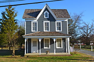
Ocean View is a town in Sussex County, Delaware, United States. The population was 1,882 at the 2010 census, an increase of 87.1% over the previous decade. It is part of the Salisbury, Maryland-Delaware Metropolitan Statistical Area and lies in Baltimore Hundred.

Strandquist is a city in Lincoln Township of Marshall County, Minnesota, United States. The population was 70 at the 2020 census.
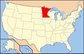
The United States District Court for the District of Minnesota is the federal district court whose jurisdiction is the state of Minnesota. Its two primary courthouses are in Minneapolis and Saint Paul. Cases are also heard in the federal courthouses of Duluth and Fergus Falls.
Baird Inlet is a 35-mile-long (56 km) bay in the Yukon-Kuskokwim Delta in the U.S. state of Alaska. It borders Nelson Island and is drained primarily by the Ninglick and Kolavinarak Rivers.

Audubon Swamp Garden is a 60-acre (24 ha) cypress and tupelo swamp on the grounds of Magnolia Plantation near Charleston, South Carolina, United States. At one time, the swamp served as a reservoir for the plantation's rice cultivation. The swamp garden includes native flora and non-native, exotic plantings and is home to herons, ibis, turtles, otters, alligators, and other wildlife.
Pocomoke State Forest is a state forest of Maryland that lies on both banks of the Pocomoke River in Worcester County. The portion north of the Pocomoke lies between Dividing and Nassawango Creeks. The Pocomoke River Wildlife Management Area borders the southern portion of the forest.

The Dudhwa Tiger Reserve is a protected area in Uttar Pradesh that stretches mainly across the Lakhimpur Kheri and Bahraich districts and comprises the Dudhwa National Park, Kishanpur Wildlife Sanctuary and Katarniaghat Wildlife Sanctuary. It covers an area of 1,284.3 km2 (495.9 sq mi). Three large forested areas are extant within the reserve, although most of the surrounding landscape is agricultural. It shares the north-eastern boundary with Nepal, which is defined to a large extent by the Mohana River. It ranges in altitude from 110 to 185 m, and several streams flow through the reserve from the northwest across the alluvial plain that encompasses the reserve.
Hawassa Airport is Sub Ethiopian Airlines which serves in Hawassa, Sidama Region, Ethiopia. The construction of the airport started at the beginning of 2015. The old dirt runway is within the city, at 7°04′00″N38°29′25″E.
Stamford is an unincorporated community in Jackson County, in the U.S. state of South Dakota.
Empire City is an unincorporated community in Cherokee County, Kansas, United States, and located at 37°05′21″N94°38′31″W.
Katesville is an unincorporated community in west central Franklin County, North Carolina, United States.

Old Halfway is an unincorporated community in Shelby Township, Tippecanoe County, in the U.S. state of Indiana.
Rena is an unincorporated community in Clallam County, in the U.S. state of Washington.
Fulkerson is an unincorporated community in Johnson County, in the U.S. state of Missouri.
Flat Creek is a stream in Benton, Morgan and Pettis counties in the U.S. state of Missouri. It is a tributary of the Lamine River.
McFarland is an extinct town in Taney County, in the U.S. state of Missouri. The community was on Swan Creek approximately two miles north of Forsyth.

Grand Canyon is a valley in Warren County in the U.S. state of Missouri. The valley is an approximately four mile section of Charrette Creek which has a relatively wide floodplain between high canyon walls. The north end of the "canyon" is at 38°43′18″N91°05′21″W and the south or downstream end is at 38°39′32″N91°06′14″W.
Castle Rock, originally known as La Centinela, is a pillar in Corral Hollow, in San Joaquin County, California. It rises to an elevation of 653 feet (199 m).
Trumbull is an unincorporated community in Ellis County, Texas, United States.
Chapman is an unincorporated community in Coal Township, Jackson County, Ohio, United States. It is located south of Coalton at 39°05′21″N82°37′06″W, at the intersection of Ohio State Route 93 and Jackson Hill Road.
References
38°29′25″N75°5′21″W / 38.49028°N 75.08917°W
| | This Delaware state location article is a stub. You can help Wikipedia by expanding it. |