
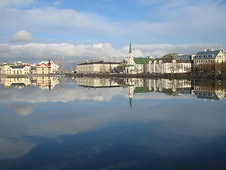
Reykjavík is the capital of, and largest city in, Iceland. It is located in southwestern Iceland, on the southern shore of Faxaflói Bay. With a latitude of 64°08′ N, the city is the world's northernmost capital of a sovereign state. Reykjavík has a population of around 140,000 as of 2023. The Capital Region has a population of around 248,000.

Grafarvogur is among the largest residential districts of Reykjavík, Iceland. It is a relatively new neighbourhood and is located in eastern most side of Reykjavík, major construction began in the late 1980s and continued well into the 1990s.

Reykjavík Airport is the main domestic airport serving Reykjavík, the capital of Iceland, located about two kilometres from the city centre. It is the domestic hub of Icelandair flights and has two runways. Reykjavík Airport is owned and operated by the state enterprise Isavia.

The rivers Elliðaár are situated in the Reykjavík area in the south-west of Iceland. Two small rivers have their source in the volcanic mountain range of Bláfjöll and stream down to Elliðavatn lake at the eastern suburban border of the city, its outlet forming the river. On their way, they pass through the nature reserve area of Heiðmörk.

Árbæjarsafn is the historical museum of the city of Reykjavík as well as an open-air museum and a regional museum. Its purpose is to give the public an insight into the living conditions, work and recreational activities of the people of Reykjavík in earlier times.
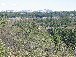
Heiðmörk was proclaimed a municipal conservation area of Reykjavík in 1950. It is located southeast of Elliðavatn, Iceland, and is about 6 miles (9.7 km) from the city of Reykjavík. Its name is derived from its namesake in Norway, Hedmark, an area with deep forests.
As of 2025, Iceland has no public railway system, although there have been three small short-lived railways in the past. The main reasons for the lack of railways are the small population outside the capital region, the availability of automobile, bus, and air transportation for inter-city travel, and the sometimes harsh environment.

Hlemmur is a town square in Reykjavík, Iceland. It is located in the eastern part of the central Reykjavík. As of 2024, it is currently being reconstructed as a bus rapid transit interchange for the Borgarlina project.

Vesturbær is a district in Reykjavík in Iceland, comprising eight neighbourhoods west of the city center: Gamli Vesturbær, Bráðræðisholt, Grandahverfi, Hagahverfi, Melar, Skjól, Grímsstaðaholt, Skildinganes and Litli Skerjafjörður.
Reykjavík City Center is a sub-municipal administrational district that covers much of the central part Reykjavík, the capital of Iceland. The district includes six neighbourhoods: Kvos, Grjótaþorp, Skólavörðuholt, Þingholt, Skuggahverfi and Vatnsmýri.

Breiðholt is a southeastern district of Reykjavík, Iceland. It includes three neighbourhoods: Neðra-Breiðholt, Efra-Breiðholt and Seljahverfi. It is one of the largest districts in Reykjavík, with a population of around 20,000.

Orkuveita Reykjavíkur is an Icelandic energy and utility company that provides electricity, geothermal hot water through district heating and cold water for consumption and fire fighting. It also operates a wholesale access fiber network and waste-treatment facilities. The company's service area extends to 20 communities in the south-west part of Iceland. Orkuveita Reykjavíkur is owned by the City of Reykjavík (93.5%) and the Municipalities of Akranes (5.5%) and Borgarbyggð (1%).

Area codes 818 and 747 are telephone area codes in the North American Numbering Plan (NANP) for the San Fernando Valley region of Los Angeles County in the U.S. state of California.

Silfra is a rift formed in the Mid-Atlantic Ridge – the divergent tectonic boundary between the North American and Eurasian plates – and is located in the Þingvallavatn Lake in the Þingvellir National Park in Iceland.

Reykjavik Art Museum is the largest visual art institution in Iceland. It occupies three locations in Reykjavík; Hafnarhús by the old harbour (64.1490°N 21.9406°W), Kjarvalsstaðir by Klambratún (64.1378°N 21.9135°W) and Ásmundarsafn in Laugardalur (64.1416°N 21.8853°W).

Laugardalur is a district of Reykjavík, the capital of Iceland. It is just east of the city centre and contains various recreational facilities including the main stadium. The name means "hot spring valley", as washing laundry was once done in geothermal hot springs there until the 1930s.
ON Power, is an Icelandic power company, headquartered in Reykjavík, that produces and sells electricity to industry and households by harnessing renewable, mainly geothermal, resources. ON Power also provides water for space heating in Reykjavík and surrounding areas. Traditionally, ON Power's main service area is Reykjavík and surrounding areas in the south-west part of Iceland, although households and businesses can buy electricity from any supplier in Iceland, regardless of location.
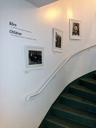
Reykjavík Museum of Photography, in Reykjavík, Iceland, preserves about five million photographs by professional and amateur photographers, from around 1870 to the present century. The collection includes studio portraits, and industrial, advertising, press, landscape and family photographs.

The Rauðhólar are remnants of a cluster of rootless cones in Elliðaárhraun lava fields on the south-eastern outskirts of Reykjavík, Iceland next to the South Iceland part of Hringvegur, the Suðurlandsvegur.
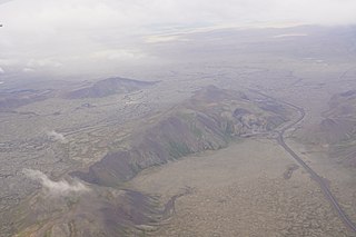
Leitin is a small shield volcano in the southwest of Iceland.
