Hemne is a municipality in Trøndelag county, Norway. It is part of the Fosen region. The administrative centre of the municipality is the village of Kyrksæterøra. Other villages include Heim, Hellandsjøen, Holla, and Vinjeøra. The European route E39 highway runs through the southern part of Hemne.

Rissa is a former municipality in the old Sør-Trøndelag county in Norway in the Fosen region. The municipality existed from 1860 until its dissolution on 1 January 2018 when it became part of the municipality of Indre Fosen in Trøndelag county. The administrative centre of the municipality was the village of Årnset. Other villages in the municipality included Askjem, Hasselvika, Husbysjøen, Rørvika, Råkvåg, and Stadsbygd.

Meldal is a municipality in Trøndelag county, Norway. It is part of the Orkdalen region. The administrative centre of the municipality is the village of Meldal. Other villages include Løkken Verk, Bjørnli, Å, and Storås.

Midtre Gauldal is a municipality in Trøndelag county, Norway. It is part of the Gauldalen region. The administrative centre of the municipality is the village of Støren. Other villages in the municipality include Singsås, Soknedal, Enodden, and Rognes.
Meråker is a municipality in Trøndelag county, Norway. It is part of the Stjørdalen region. The administrative centre of the municipality is the village of Midtbygda which is about 20 kilometres (12 mi) west of Storlien in Sweden and 46 kilometres (29 mi) east of the town of Stjørdalshalsen in neighboring Stjørdal municipality. Other villages in Meråker include Gudåa, Kopperå, and Stordalen.

Namdalseid is a municipality in Trøndelag county, Norway. It is part of the Namdalen region. The administrative centre of the municipality is the village of Namdalseid. Other villages and farm areas in the municipality include Sjøåsen, Statland, Tøttdalen, and Sverkmoen.

Vikna is a municipality in Trøndelag county, Norway. It is part of the Namdalen region. The administrative centre of the municipality is the village of Rørvik. Other villages in Vikna include Austafjord, Garstad, and Valøya.
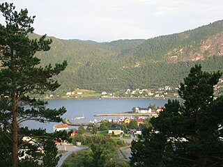
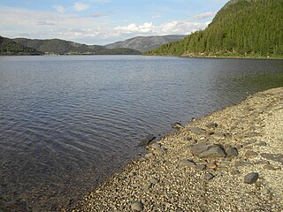
Kyrksæterøra is the administrative center of the municipality of Hemne in Trøndelag county, Norway. The village was known as the "white town of the Hemnfjorden" at one time because there were only white houses. It is located at the end of the Hemnfjorden, about 5 kilometres (3.1 mi) southwest of the village of Holla. The villages of Hellandsjøen and Heim both lie to the north and the village of Vinjeøra lies to the south. Hemne Church is located in the village. Norwegian County Road 680 passes through the village. The newspaper Søvesten has been published in Kyrksæterøra since 1994.

Roan is a municipality in Trøndelag county, Norway. It is part of the Fosen region in the northern part of the county. The administrative centre of the municipality is the village of Roan. Other villages include Bessaker, Brandsfjord, and Hofstad.

Fannrem is a village in the municipality of Orkdal in Trøndelag county, Norway. The village is located along the Orkla River about 5 kilometres (3.1 mi) south of the urban area of Orkanger, Thamshavn, and Råbygda, and about 9 kilometres (5.6 mi) north of the village of Vormstad.

Bjørnør is a former municipality in the old Sør-Trøndelag county in Norway. The 865-square-kilometre (334 sq mi) municipality existed from 1838 until 1892. It encompassed the area of what is now the municipalities of Roan and Osen, plus the Stoksund area in the present day municipality of Åfjord, all in the western part of the Fosen peninsula in Trøndelag county. Bjørnør bordered the municipality of Aafjord to the south and Nordre Trondhjem county to the north and west. The administrative centre of the municipality was the village of Roan where the Roan Church is located.
Horg is a former municipality in the old Sør-Trøndelag county, Norway. The 291-square-kilometre (112 sq mi) municipality existed from 1841 until its dissolution in 1964. The municipality of Horg encompassed the southern part of what is now the municipality of Melhus in Trøndelag county. The municipality included areas on both sides of the river Gaula. The administrative centre was the village of Lundamo. The main church for the municipality was Horg Church.
Straumsetervatnet or Selavatnet is a lake on the border of the municipalities of Åfjord and Verran in Trøndelag county, Norway. The majority of the 4.72-square-kilometre (1.82 sq mi) lake lies in Verran, with the northwestern end of the lake partially lying in Åfjord. The village of Sela lies on the northern side of the lake and the village of Sandsetra at the southeastern end of the lake. The lake is one of the sources for the Folla river system which flows into the Trondheimsfjord at the village of Follafoss.

Ogndal is a former municipality in what was the old Nord-Trøndelag county, Norway. The 418-square-kilometre (161 sq mi) municipality existed from 1885 until its dissolution in 1964. The municipality included the whole Ogndalen valley and areas to the west, up to, but not including the town of Steinkjer in what is now the central and western part of the municipality of Steinkjer in Trøndelag county. Starting in 1917, the administrative center of Ogndal was actually located in the town of Steinkjer.
Å or Å Sentrum is a village in the municipality of Meldal in Trøndelag county, Norway. It is the southernmost of the four urban areas in the municipality: Meldal, Løkken Verk, Storås, and Å. It lies along the Orkla River, about 2 kilometres (1.2 mi) north of the border with the municipality of Rennebu.
Skogn is a village in Levanger municipality in Trøndelag county, Norway. The village is located on the eastern shore of the Trondheimsfjorden, about 8 kilometres (5.0 mi) southwest of the town of Levanger. The European route E06 highway runs through the village, just past the Fiborgtangen industrial area located along the shore. There is a Norske Skog Skogn paper mill at Fiborgtangen. The Nordlandsbanen railway line stops in the village at Skogn Station.
Stoksund is a former municipality in the old Sør-Trøndelag county, Norway. The municipality existed from 1892 until its dissolution in 1964. The 114-square-kilometre (44 sq mi) municipality was located in what is now the northwestern part of the municipality of Åfjord in Trøndelag county. The municipality included the island of Stokkøya and the surrounding islets, plus the surrounding area of the mainland. The administrative centre was the village of Revsnes, where the Stoksund Church is located.
Stordalsvatnet is a lake in the municipality of Åfjord in Trøndelag county, Norway. The lake is located on the Stordalselva river which flows into the Åfjorden. The lake lies between the villages of By and Årnes.

Steinkjer is the administrative centre of the municipality of Steinkjer in Trøndelag county, Norway. The town is located at the northeastern end of the inner-most part of the Trondheimsfjorden, at the mouth of the river Steinkjerelva. In the eastern part of the town, the river of Figgja also flows into the fjord. The town is split in two by Steinkjerelva, creating the two traditional neighborhoods of Nordsia and Sørsia. Both the European route E6 highway and the Nordlandsbanen railway line run through the town, the latter serving the city at Steinkjer Station. Steinkjer Church and Egge Church are both located in the town.