
The Great Seto Bridge is a series of double deck bridges connecting Okayama and Kagawa prefectures in Japan across a series of five small islands in the Seto Inland Sea. Built over the period 1978–88, it is one of the three routes of the Honshū–Shikoku Bridge Project connecting Honshū and Shikoku islands, and the only one with railroad connections included. At 13.1 kilometers (8.1 mi), it ranks as the world's longest two-tiered bridge system.

Greater Caucasus is the major mountain range of the Caucasus Mountains.

Grigoriopol District is an administrative district of Transnistria, Moldova. It is located along the river Dniester, in the center of Transnsitria. Its seat is the city of Grigoriopol, located at 47°8′N29°18′E, on the Dniester river. The district contains two cities/towns and 14 communes :
The Ely Shoshone Indian Reservation is an Indian reservation for the Ely Shoshone Tribe of Nevada, Shoshone people, in and near the south side of the city of Ely in south-central White Pine County, Nevada. In 2005 it had a population of around 500, a textile business, and its own court system. The reservation is quite small, with a land area of only 104.99 acres (0.4249 km²) and a 2000 census official resident population of 133 persons. Part of the city of Ely lies within its territory.
Heydar Aliyev Stadium is a multi-use stadium in Imishli, Azerbaijan. It is currently used mostly for football matches and is the home stadium of Mil-Muğan. The stadium holds 8,500 people and was opened in 2006.
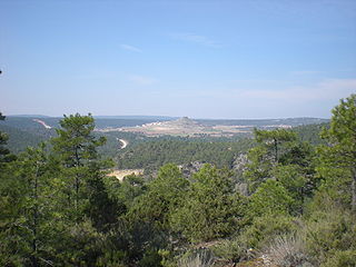
Monteagudo de las Salinas is a municipality in Cuenca Province, Castile-La Mancha, Spain.

Rudná is a village and municipality in the Rožňava District in the Košice Region of middle-eastern Slovakia.

Nižný Žipov is a village and municipality in the Trebišov District in the Košice Region of south-eastern Slovakia.

Hronovce is a village and municipality in the Levice District in the Nitra Region of Slovakia.

Qıraqlı is a village in the Khachmaz Rayon of Azerbaijan. The village forms part of the municipality of Ağaşirinoba.
Bağbanlı is a village and municipality in the Quba Rayon of Azerbaijan. It has a population of 1,562.

Fangzi is a district of the city of Weifang, Shandong province, China. It has an area of 345.55 km2 (133.42 sq mi) and around 239,500 inhabitants (2003).

Hernádbűd is a village in Borsod-Abaúj-Zemplén County in northeastern Hungary.
Kissikátor is a village in Borsod-Abaúj-Zemplén County in northeastern Hungary.
Pusztaradvány is a village in Borsod-Abaúj-Zemplén County in northeastern Hungary.
Taktaharkány is a village in Borsod-Abaúj-Zemplén County in northeastern Hungary.
The Adachi Museum of Art opened in Yasugi, Shimane Prefecture, Japan in 1970. It houses a collection of modern Japanese art, including paintings by Taikan Yokoyama, and has a celebrated garden.


