
The geography of France consists of a terrain that is mostly flat plains or gently rolling hills in the north and west and mountainous in the south and the east.

Taymyr Dolgano-Nenets Autonomous Okrug, or Taymyria, was a federal subject of Russia, the northernmost in mainland Russia. It was named after the Taymyr Peninsula. It was also called Dolgan-Nenets Autonomous Okrug, by the name of the indigenous people, Dolgans and Nenetses.
Oleksandrivsk or Aleksandrovsk is a small city in Luhansk Municipality, Luhansk Oblast (region) of Ukraine. Population: 6,635 (2013 est.).

This is a list of the extreme points of Azerbaijan, the points that are farther north, south, east or west than any other location.

Bohdanovce is a village and municipality in Košice-okolie District in the Kosice Region of eastern Slovakia.

Tašuľa is a small village in Sobrance District, Košice Region in eastern Slovakia. As of 2011, it had 201 inhabitants. It is 5 km distant from the seat of district, Sobrance
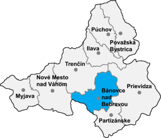
Šišov is a village and municipality in Bánovce nad Bebravou District in the Trenčín Region of north-western Slovakia.

Maintsokely is a town and commune in Madagascar. It belongs to the district of Andilamena, which is a part of Alaotra-Mangoro Region. The population of the commune was estimated to be approximately 4,000 in 2001 commune census.

Tazakend is a village in the Bilasuvar Rayon of Azerbaijan.
Tatoni is a village in the Lerik Rayon of Azerbaijan. The village forms part of the municipality of Qosmalyan.
Cəfərli is a village in the Jalilabad Rayon of Azerbaijan.
Daşdalıqcar is a village and municipality in the Lankaran Rayon of Azerbaijan. It has a population of 1,400.
Hasıllı is a village and municipality in the Jalilabad Rayon of Azerbaijan. It has a population of 392.
Fərəcullalı is a village and municipality in the Jalilabad Rayon of Azerbaijan. It has a population of 155.

Warpuny is a village in the administrative district of Gmina Sorkwity, within Mrągowo County, Warmian-Masurian Voivodeship, in northern Poland. It lies approximately 11 kilometres (7 mi) north of Sorkwity, 11 km (7 mi) north-west of Mrągowo, and 48 km (30 mi) east of the regional capital Olsztyn.
Księży Lasek is a village in the administrative district of Gmina Rozogi, within Szczytno County, Warmian-Masurian Voivodeship, in northern Poland. It lies approximately 15 kilometres (9 mi) south-west of Rozogi, 23 km (14 mi) south-east of Szczytno, and 63 km (39 mi) south-east of the regional capital Olsztyn.
Megyaszó is a village in Borsod-Abaúj-Zemplén County in northeastern Hungary.
Sajólászlófalva is a village in Borsod-Abaúj-Zemplén County in northeastern Hungary.

Sáta is a village in Borsod-Abaúj-Zemplén County in northeastern Hungary. Sáta lies in the western part of the county, about 15 km from Ózd.


