The French Southern and Antarctic Lands is an overseas territory of France. It consists of:
The Kerguelen Islands, also known as the Desolation Islands, are a group of islands in the sub-Antarctic constituting one of the two exposed parts of the Kerguelen Plateau, a large igneous province mostly submerged in the southern Indian Ocean. They are among the most isolated places on Earth, located more than 3,300 kilometres from Madagascar. The islands, along with Adélie Land, the Crozet Islands, Amsterdam and Saint Paul islands, and France's Scattered Islands in the Indian Ocean, are part of the French Southern and Antarctic Lands and are administered as a separate district.
The Crozet Islands are a sub-Antarctic archipelago of small islands in the southern Indian Ocean. They form one of the five administrative districts of the French Southern and Antarctic Lands.
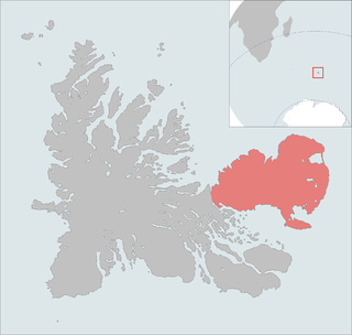
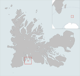
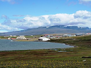
The Courbet Peninsula is a peninsula in northeastern Grande Terre Island, the main island of the subantarctic Kerguelen Archipelago, Southern Indian Ocean. In the south of the peninsula is Port-aux-Français, the principal station of the archipelago.
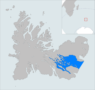
The Golfe du Morbihan is a bay on the eastern coast of Grande Terre, the largest of the Kerguelen islands. It forms a deep and broad notch in the central section of the island.
The Commission de toponymie du Québec is the Government of Québec's public body responsible for cataloging, preserving, making official and publicize Québec's place names and their origins according to the province's toponymy rules. It also provides recommendations to the government with regard to toponymic changes.
Les Îles Leygues or the Leygues Islands, occasionally called « les Îles Swain », are a group of small islands and islets that are part of the subantarctic Kerguelen archipelago, a French territory in the southern Indian Ocean.
The Îles Nuageuses comprise a group of small islands that are part of the Kerguelen archipelago, a French territory in the southern Indian Ocean. They are an important breeding spot for seabirds, especially penguins and albatrosses, and for fur seals.

Edgar Aubert de la Rüe (1901–1991) was a French geographer, geologist, traveller and photographer who was primarily devoted to the islands of Saint Pierre and Miquelon, Kerguelen, and Vanuatu. Mount Aubert de la Rue on Heard Island is named after him.

Lac Marville is a lagoon in the Kerguelen islands, part of the French Southern and Antarctic Lands. Extending over approximately 27 km2 (10 sq mi), it is the largest lake in the archipelago and one of the largest in France.

Île du Port is one of the Kerguelen Islands in the southern Indian Ocean, situated in the Golfe des Baleiniers off the north coast of Grande Terre, the main island.

The Île de l'Ouest is a French island in the Kerguelen archipelago located west of Grande Terre in the extension of the Lakes peninsula, by the foothills of the Cook glacier. It has two bays:Noroît Bay to the north and Bretonne Bay to the south.

Île Haute is one of the Kerguelen Islands situated in the Golfe du Morbihan near the coast of Grande Terre, the principal island.

Lake Armor is a fjord lake located on the central plateau of the main island of the Kerguelen archipelago, in the French Southern and Antarctic Lands.

The Volcan du Diable, the Devil's Volcano in English, is a small mountain of the Kerguelen Islands, located in the central region of the main island of Grande Terre. It reaches the height of 315 metres.
The Second voyage of Kerguelen was an expedition of the French Navy to the southern Indian Ocean conducted by the 64-gun ship of the line Roland, the 32-gun frigate Oiseau, and the corvette Dauphine, under Captain Kerguelen. The aims of the expedition were to confirm the findings of the First voyage of Kerguelen, returning the Kerguelen Islands and exploring what was thought to be a peninsula of a southern continent.
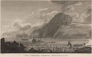
Port-Christmas is a natural and historical site on the Kerguelen Islands, located at the northern tip of the main island, on the east coast of the Loranchet Peninsula. It covers the bottom of Baie de l'Oiseau, the first shelter for sailors approaching the archipelago from the north, and is easily identifiable by the presence at the entrance of a natural arch, now collapsed, known as the Kerguelen Arch.
Mont Crozier is a summit of the Kerguelen Archipelago, a group of volcanic islands in the southern Indian Ocean, southeast of Africa. Mont Crozier is located on the Courbet Peninsula of Grande Terre and rises to 979 metres (3,212 ft) above sea level.
The Kerguelen Islands, an archipelago in the southern Indian Ocean, were discovered uninhabited on February 12, 1772 by Breton navigator Yves Joseph de Kerguelen de Trémarec, and have remained without a permanent population ever since. The only residents were during an attempt to set up a farm, a few occasional occupations for whaling activities, and since the 1950s, a French scientific presence. Its toponymy was thus given ex nihilo, by the various explorers, whalers and sealers who frequented its waters and anchorages, and then in the 20th century, once French possession of the archipelago had been reaffirmed, by a few French institutions.