Bosut is a village located in the Sremska Mitrovica municipality, in the Syrmia District of Serbia. It is situated near the Bosut River, in the autonomous province of Vojvodina. The village has a Serb ethnic majority and its population numbers 1,139 people.
Klisura is the oldest village in Demir Kapija Municipality in the Republic of Macedonia. It was along the Vardar River but moved into the mountains to be away from the main road in the mid 19th century. Many current Demir Kapija residents came to develop the town and municipality during socialism, one of Tito's plans for the modernization and industrialization of his Yugoslavia. Klisura was at its highest population of over 600 residents just after World War I. A large church and monastery were built there before then. Today, the village is nearly abandoned, but it has a unique tradition around Easter. Former inhabitants return to the village on Good Friday for a village reunion. On May 23, many people come to celebrate the patron Saint Nicholas. Several residents still herd goats, sheep, and other livestock.

Dąb Mały is a village in the administrative district of Gmina Włocławek, within Włocławek County, Kuyavian-Pomeranian Voivodeship, in north-central Poland. It lies approximately 23 kilometres (14 mi) east of Włocławek and 70 km (43 mi) south-east of Toruń.

Predești is a commune in Dolj County, Romania with a population of 3,405. It is composed of three villages: Bucicani, Predești and Predeștii Mici. It included four other villages until 2004, when they were split off to form Pleșoi Commune.

Loznitsa is a small town in northeastern Bulgaria, part of Razgrad Province, located in the geographic region of Ludogorie. It is the administrative centre of the homonymous Loznitsa Municipality, which lies in the southernmost part of the Province. As of December 2009, the town has a population of 2,409 inhabitants.
Vădastra is a commune in Olt County, Romania. It is composed of a single village, Vădastra. It also included Vișina Nouă village until 2004, when it was split off to form a separate commune.
Počepice is a village and municipality in Příbram District in the Central Bohemian Region of the Czech Republic.

Bjeluša is a village in the municipality of Arilje, Serbia. According to the 2011 census, the village has a population of 452 people.
Biniće is a village in the municipality of Raška, Serbia. According to the 2002 census, the village has a population of 179 people.
Crna Glava is a village in the municipality of Raška, Serbia. According to the 2002 census, the village has a population of 246 people.
Gostiradiće is a village in the municipality of Raška, Serbia. According to the 2002 census, the village has a population of 53 people.

Gradac is a village in the municipality of Raška, Serbia. According to the 2002 census, the village has a population of 368 people.
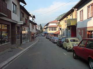
Varevo is a village in the municipality of Raška, Serbia. According to the 2002 census, the village has a population of 1497 people.
Zarevo, Serbia is a village in the municipality of Raška, Serbia. According to the 2002 census, the village has a population of 71 people.
Zabrnjica is a village in the municipality of Priboj, Serbia. According to the 2002 census, the village has a population of 205 people.
Živinice is a village in the municipality of Priboj, Serbia. According to the 2002 census, the village has a population of 118 people.
Čauševići is a village in the municipality of Prijepolje, Serbia. According to the 2002 census, the village has a population of 132 people.
Pravoševo is a village in the municipality of Prijepolje, Serbia. According to the 2002 census, the village has a population of 85 people.
Seljane is a village in the municipality of Prijepolje, Serbia. According to the 2002 census, the village has a population of 168 people.
Seljašnica is a village in the municipality of Prijepolje, Serbia. According to the 2002 census, the village has a population of 774 people.