
A województwo is the highest-level administrative subdivision of Poland, corresponding to a "province" in many other countries. The term "województwo" has been in use since the 14th century, and is commonly translated in English as "province". Województwo is also rendered in English by "voivodeship" or a variant spelling.

The Warta is a river in western-central Poland and a tributary of the Oder. With a length of approximately 795 kilometres (494 mi), it is the country's second-longest river located within its borders and third-longest in terms of total length. The Warta has a basin area of 54,520 square kilometers (21,050 sq mi) and it is navigable from Kostrzyn nad Odrą to Konin, approximately half of its length. It is connected to the Vistula by the Noteć River and the Bydgoszcz Canal near the city of Bydgoszcz.

Świętokrzyskie Voivodeship, Świętokrzyskie Province, or Holy Cross Province is one of the 16 voivodeships (provinces) into which Poland is divided. It is situated in southeastern Poland, in the historical province of Lesser Poland, and takes its name from the Świętokrzyskie mountain range. Its capital and largest city is Kielce.

Lower Silesian Voivodeship, or Lower Silesia Province, in southwestern Poland, is one of the 16 voivodeships (provinces) into which Poland is divided.

Lublin Voivodeship, or Lublin Province, is a voivodeship, or province, located in southeastern Poland. It was created on January 1, 1999, out of the former Lublin, Chełm, Zamość, Biała Podlaska and (partially) Tarnobrzeg and Siedlce Voivodeships, pursuant to Polish local government reforms adopted in 1998. The province is named after its largest city and regional capital, Lublin, and its territory is made of four historical lands: the western part of the voivodeship, with Lublin itself, belongs to Lesser Poland, the eastern part of Lublin Area belongs to Red Ruthenia, and the northeast belongs to Polesie and Podlasie.

Łódź Voivodeship is a province (voivodeship) in central Poland. It was created on 1 January 1999 out of the former Łódź Voivodeship (1975–1999) and the Sieradz, Piotrków Trybunalski and Skierniewice Voivodeships and part of Płock Voivodeship, pursuant to the Polish local government reforms adopted in 1998. The province is named after its capital and largest city, Łódź, pronounced.
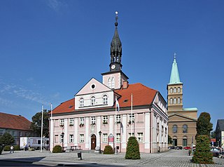
Międzyrzecz is a town in western Poland, on the Obra and Paklica river, with 18,310 inhabitants. The capital of Gmina Międzyrzecz and Międzyrzecz County. Since the Local Government Reorganization Act of 1998, it has been situated in Lubusz Voivodeship. From 1975–1998 Międzyrzecz was part of Gorzów Voivodeship. The town limits cover 10.26 square kilometres (3.96 sq mi).
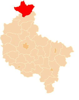
Złotów County is a unit of territorial administration and local government (powiat) in Greater Poland Voivodeship, west-central Poland. Its administrative seat and largest town is Złotów, which lies 107 kilometres (66 mi) north of the regional capital Poznań. The county contains three other towns: Jastrowie, 17 km (11 mi) northwest of Złotów, Okonek, 23 km (14 mi) northwest of Złotów, and Krajenka, 7 km (4 mi) southwest of Złotów.

Parsęta is a river in the West Pomeranian Voivodeship (Zachodniopomorskie) of north-western Poland, a tributary of the Baltic Sea, with a length of 143 km (89 mi) and a basin area of 3,084 km2 (1,191 sq mi).

Radom County is a unit of territorial administration and local government (powiat) in Masovian Voivodeship, east-central Poland. It came into being on January 1, 1999, as a result of the Polish local government reforms passed in 1998. Its administrative seat is the city of Radom, although the city is not part of the county. The county contains three towns: Pionki, 22 km (14 mi) north-east of Radom, Iłża, 27 km (17 mi) south of Radom, and Skaryszew, 12 km (7 mi) south-east of Radom.
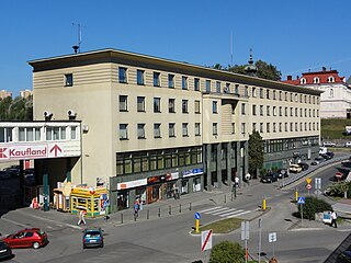
Cieszyn County is a unit of territorial administration and local government (powiat) in Silesian Voivodeship, southern Poland, on the Czech and Slovak border. It came into being on January 1, 1999, as a result of the Polish local government reforms passed in 1998.
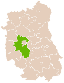
Lublin County is a unit of territorial administration and local government (powiat) in Lublin Voivodeship, eastern Poland. It was established on January 1, 1999, as a result of the Polish local government reforms passed in 1998. Its administrative seat is the city of Lublin, although the city is not part of the county. The only towns in Lublin County are Bełżyce, which lies 23 km (14 mi) west of Lublin, and Bychawa, 26 km (16 mi) south of Lublin.
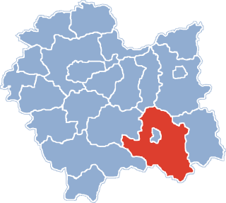
Nowy Sącz County is a unit of territorial administration and local government (powiat) in Lesser Poland Voivodeship, southern Poland, on the Slovak border. It came into being on January 1, 1999, as a result of the Polish local government reforms passed in 1998. Its administrative seat is the city of Nowy Sącz, although the city is not part of the county. The county contains five towns: Krynica-Zdrój, 31 km (19 mi) south-east of Nowy Sącz, Stary Sącz, 9 km (6 mi) south-west of Nowy Sącz, Grybów, 19 km (12 mi) east of Nowy Sącz, Piwniczna-Zdrój, 21 km (13 mi) south of Nowy Sącz, and Muszyna, 33 km (21 mi) south-east of Nowy Sącz.
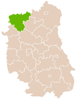
Łuków County is a unit of territorial administration and local government (powiat) in Lublin Voivodeship, eastern Poland. It was established on January 1, 1999, as a result of the Polish local government reforms passed in 1998. Its administrative seat and largest town is Łuków, which lies 76 kilometres (47 mi) north of the regional capital Lublin. The only other town in the county is Stoczek Łukowski, lying 30 km (19 mi) west of Łuków.
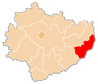
Sandomierz County is a unit of territorial administration and local government (powiat) in Świętokrzyskie Voivodeship, south-central Poland. It came into being on January 1, 1999, as a result of the Polish local government reforms passed in 1998. Its administrative seat and largest town is Sandomierz, which lies 83 kilometres (52 mi) east of the regional capital Kielce. The county also contains the towns of Koprzywnica, lying 16 km (10 mi) south-west of Sandomierz, and Zawichost, 16 km (10 mi) north-east of Sandomierz.
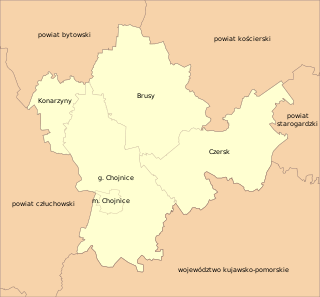
Chojnice County is a unit of territorial administration and local government (powiat) in Pomeranian Voivodeship, northern Poland. It came into being on January 1, 1999, as a result of the Polish local government reforms passed in 1998. Its administrative seat and largest town is Chojnice, which lies 103 kilometres (64 mi) south-west of the regional capital Gdańsk. The county also contains the towns of Czersk, lying 30 km (19 mi) east of Chojnice, and Brusy, 24 km (15 mi) north-east of Chojnice.

Opoczno County is a unit of territorial administration and local government (powiat) in Łódź Voivodeship, south-east Poland. It came into being on January 1, 1999, as a result of the Polish local government reforms passed in 1998. Its administrative seat and largest town is Opoczno, which lies 72 kilometres (45 mi) south-east of the regional capital Łódź. The only other town in the county is Drzewica, lying 15 km (9 mi) north-east of Opoczno.

Kusowo is a village in the administrative district of Gmina Szczecinek, within Szczecinek County, West Pomeranian Voivodeship, in north-western Poland. It lies approximately 13 kilometres (8 mi) north-west of Szczecinek and 137 km (85 mi) east of the regional capital Szczecin.

Greater Poland, often known by its Polish name Wielkopolska, is a historical region of west-central Poland. Its chief city is Poznań.


