Łososiowice

Last updated
Łososiowice
Village
Poland adm location map.svg
Red pog.svg
Łososiowice
Coordinates: 51°18′N16°39′E / 51.300°N 16.650°E / 51.300; 16.650
Country Flag of Poland.svg  Poland
Voivodeship Lower Silesian
County Wołów
Gmina Wołów
Population 219

Łososiowice [wɔsɔɕɔˈvit͡sɛ] (German : Losswitz) is a village in the administrative district of Gmina Wołów, within Wołów County, Lower Silesian Voivodeship, in south-western Poland. [1] The earliest mention concerning Łososiowice dates from 1208. [2] It was destroyed in 1431 by the Hussite forces. In 1939 it had a population of 395. Prior to 1945 it was in Germany.

German language West Germanic language

German is a West Germanic language that is mainly spoken in Central Europe. It is the most widely spoken and official or co-official language in Germany, Austria, Switzerland, South Tyrol (Italy), the German-speaking Community of Belgium, and Liechtenstein. It is also one of the three official languages of Luxembourg and a co-official language in the Opole Voivodeship in Poland. The languages which are most similar to German are the other members of the West Germanic language branch: Afrikaans, Dutch, English, the Frisian languages, Low German/Low Saxon, Luxembourgish, and Yiddish. There are also strong similarities in vocabulary with Danish, Norwegian and Swedish, although those belong to the North Germanic group. German is the second most widely spoken Germanic language, after English.

Gmina Wołów is an urban-rural gmina in Wołów County, Lower Silesian Voivodeship, in south-western Poland. Its seat is the town of Wołów, which lies approximately 38 kilometres (24 mi) north-west of the regional capital Wrocław.

Wołów County County in Lower Silesian, Poland

Wołów County is a unit of territorial administration and local government (powiat) in Lower Silesian Voivodeship, south-western Poland. It came into being on January 1, 1999, as a result of the Polish local government reforms passed in 1998. The county covers an area of 675 square kilometres (261 sq mi). Its administrative seat is the town of Wołów, although the county also contains the slightly larger town of Brzeg Dolny.

There is a baroque church from 1701 built there, with an inside matroneum. It has three tombstones of Stober family. It had a functioning Roman Catholic parish until 1945. The last pastor of the village, Alois Pohl, died probably during the Soviet offensive of 1945.

Matroneum gallery on the interior of a building

A matroneum in architecture is a gallery on the interior of a building, originally intended to accommodate women.

It lies approximately 5 kilometres (3 mi) south of Wołów, and 34 kilometres (21 mi) north-west of the regional capital Wrocław.

Wrocław Place in Lower Silesian Voivodeship, Poland

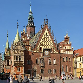
Wrocław is a city in western Poland and the largest city in the historical region of Silesia. It lies on the banks of the River Oder in the Silesian Lowlands of Central Europe, roughly 350 kilometres (220 mi) from the Baltic Sea to the north and 40 kilometres (25 mi) from the Sudeten Mountains to the south. The population of Wrocław in 2018 was 639,258, making it the fourth-largest city in Poland and the main city of Wrocław agglomeration.

The village has a population of 219.

Related Research Articles

Radecz Village in Lower Silesian, Poland

Radecz is a village in the administrative district of Gmina Brzeg Dolny, within Wołów County, Lower Silesian Voivodeship, in south-western Poland. Prior to 1945 it was in Germany.

Wały, Lower Silesian Voivodeship Village in Lower Silesian, Poland

Wały is a village in the administrative district of Gmina Brzeg Dolny, within Wołów County, Lower Silesian Voivodeship, in south-western Poland. Prior to 1945 it was in Germany.

Baszyn Village in Lower Silesian, Poland

Baszyn is a village in the administrative district of Gmina Wińsko, within Wołów County, Lower Silesian Voivodeship, in south-western Poland. Prior to 1945 it was in Germany.

Budków, Lower Silesian Voivodeship Village in Lower Silesian, Poland

Budków is a village in the administrative district of Gmina Wińsko, within Wołów County, Lower Silesian Voivodeship, in south-western Poland. Prior to 1945 it was in Germany.

Chwałkowice, Lower Silesian Voivodeship Village in Lower Silesian, Poland

Chwałkowice is a village in the administrative district of Gmina Wińsko, within Wołów County, Lower Silesian Voivodeship, in south-western Poland. Prior to 1945 it was in Germany.

Głębowice, Lower Silesian Voivodeship Village in Lower Silesian, Poland

Głębowice is a village in the administrative district of Gmina Wińsko, within Wołów County, Lower Silesian Voivodeship, in south-western Poland. Prior to 1945 it was in Germany.

Iwno, Lower Silesian Voivodeship Village in Lower Silesian, Poland

Iwno is a village in the administrative district of Gmina Wińsko, within Wołów County, Lower Silesian Voivodeship, in south-western Poland. Prior to 1945 it was in Germany.

Wińsko Village in Lower Silesian, Poland

Wińsko is a village in Wołów County, Lower Silesian Voivodeship, in south-western Poland. It is the seat of the administrative district (gmina) called Gmina Wińsko.

Boraszyn Village in Lower Silesian, Poland

Boraszyn is a village in the administrative district of Gmina Wołów, within Wołów County, Lower Silesian Voivodeship, in south-western Poland. Prior to 1945 it was in Germany.

Dębno, Wołów County Village in Lower Silesian, Poland

Dębno is a village in the administrative district of Gmina Wołów, within Wołów County, Lower Silesian Voivodeship, in south-western Poland.

Garwół Village in Lower Silesian, Poland

Garwół is a village in the administrative district of Gmina Wołów, within Wołów County, Lower Silesian Voivodeship, in south-western Poland. Prior to 1945 it was in Germany.

Gliniany, Lower Silesian Voivodeship Village in Lower Silesian, Poland

Gliniany is a village in the administrative district of Gmina Wołów, within Wołów County, Lower Silesian Voivodeship, in south-western Poland. Prior to 1945 it was in Germany. Following World War II the native German populace was expelled and replaced by Poles.

Golina, Lower Silesian Voivodeship Village in Lower Silesian, Poland

Golina is a village in the administrative district of Gmina Wołów, within Wołów County, Lower Silesian Voivodeship, in south-western Poland. Prior to 1945 it was in Germany. Following World War II the native German populace was expelled and replaced by Poles.

Gródek, Lower Silesian Voivodeship Village in Lower Silesian, Poland

Gródek is a village in the administrative district of Gmina Wołów, within Wołów County, Lower Silesian Voivodeship, in south-western Poland. Prior to 1945 it was in Germany.

Krzydlina Mała Village in Lower Silesian, Poland

Krzydlina Mała is a village in the administrative district of Gmina Wołów, within Wołów County, Lower Silesian Voivodeship, in south-western Poland.

Krzydlina Wielka Village in Lower Silesian, Poland

Krzydlina Wielka is a village in the administrative district of Gmina Wołów, within Wołów County, Lower Silesian Voivodeship, in south-western Poland. Prior to 1945 it was in Germany. It lies approximately 11 kilometres (7 mi) south-west of Wołów and 43 km (27 mi) north-west of the regional capital Wrocław.

Mojęcice Village in Lower Silesian, Poland

Mojęcice is a village in the administrative district of Gmina Wołów, within Wołów County, Lower Silesian Voivodeship, in south-western Poland. Prior to 1945 it was in Germany. It lies approximately 6 kilometres (4 mi) south-west of Wołów and 38 km (24 mi) north-west of the regional capital Wrocław.

Piotroniowice Village in Lower Silesian, Poland

Piotroniowice is a village in the administrative district of Gmina Wołów, within Wołów County, Lower Silesian Voivodeship, in south-western Poland. The earliest mention concerning Piotroniowice dates from 13th century. It was burned by the Hussites in 1431. It was also damaged during the Thirty Years' War several times. Piotroniowice in 1939 had a population of 250. by Prior to 1945 it was in Germany.

Stary Wołów Village in Lower Silesian, Poland

Stary Wołów is a village in the administrative district of Gmina Wołów, within Wołów County, Lower Silesian Voivodeship, in south-western Poland. The earliest mention concerning the village dates from 13th century. Prior to 1945 it was in Germany.

Wodnica, Lower Silesian Voivodeship Village in Lower Silesian, Poland

Wodnica is a village in the administrative district of Gmina Wołów, within Wołów County, Lower Silesian Voivodeship, in south-western Poland. Prior to 1945 it was in Germany.

References

  1. "Central Statistical Office (GUS) TERYT (National Register of Territorial Land Apportionment Journal)" (in Polish). 2008-06-01.
  2. Kodeks dyplomatyczny Śląska (volume II, K.Maleczyński and A.Skowrońska, Wydawnictwo PAN, Wrocław 1959).

Coordinates: 51°18′N16°39′E / 51.300°N 16.650°E / 51.300; 16.650

Geographic coordinate system Coordinate system

A geographic coordinate system is a coordinate system that enables every location on Earth to be specified by a set of numbers, letters or symbols. The coordinates are often chosen such that one of the numbers represents a vertical position and two or three of the numbers represent a horizontal position; alternatively, a geographic position may be expressed in a combined three-dimensional Cartesian vector. A common choice of coordinates is latitude, longitude and elevation. To specify a location on a plane requires a map projection.