Bęćkowo is a village in the administrative district of Gmina Szczuczyn, within Grajewo County, Podlaskie Voivodeship, in north-eastern Poland. It lies approximately 5 kilometres (3 mi) north-east of Szczuczyn, 11 km (7 mi) south-west of Grajewo, and 79 km (49 mi) north-west of the regional capital Białystok.
Ceromin is a settlement in the administrative district of Gmina Czarna Dąbrówka, within Bytów County, Pomeranian Voivodeship, in northern Poland. It lies approximately 7 kilometres (4 mi) south-east of Czarna Dąbrówka, 20 km (12 mi) north of Bytów, and 68 km (42 mi) west of the regional capital Gdańsk.

Qarabulaq is a village in the Gobustan Rayon of Azerbaijan.
Łaszczyn is a village in the administrative district of Gmina Cielądz, within Rawa County, Łódź Voivodeship, in central Poland. It lies approximately 2 kilometres (1 mi) east of Cielądz, 11 km (7 mi) south-east of Rawa Mazowiecka, and 64 km (40 mi) east of the regional capital Łódź.
Lutobory is a village in the administrative district of Gmina Sadkowice, within Rawa County, Łódź Voivodeship, in central Poland. It lies approximately 2 kilometres (1 mi) south-west of Sadkowice, 18 km (11 mi) east of Rawa Mazowiecka, and 72 km (45 mi) east of the regional capital Łódź.
Pierzchnia Góra is a village in the administrative district of Gmina Warta, within Sieradz County, Łódź Voivodeship, in central Poland. It lies approximately 7 kilometres (4 mi) east of Warta, 13 km (8 mi) north of Sieradz, and 53 km (33 mi) west of the regional capital Łódź.
Henryków is a village in the administrative district of Gmina Zduńska Wola, within Zduńska Wola County, Łódź Voivodeship, in central Poland. It lies approximately 40 kilometres (25 mi) south-west of the regional capital Łódź.
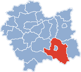
Zawadka is a village in the administrative district of Gmina Łososina Dolna, within Nowy Sącz County, Lesser Poland Voivodeship, in southern Poland.
Borów is a village in the administrative district of Gmina Jędrzejów, within Jędrzejów County, Świętokrzyskie Voivodeship, in south-central Poland. It lies approximately 7 kilometres (4 mi) south-west of Jędrzejów and 42 km (26 mi) south-west of the regional capital Kielce.
Długojów is a village in the administrative district of Gmina Zagnańsk, within Kielce County, Świętokrzyskie Voivodeship, in south-central Poland. It lies approximately 8 kilometres (5 mi) north-west of Zagnańsk and 17 km (11 mi) north of the regional capital Kielce.
Ostrów is a village in the administrative district of Gmina Przemyśl, within Przemyśl County, Subcarpathian Voivodeship, in south-eastern Poland, close to the border with Ukraine. It lies approximately 4 kilometres (2 mi) west of Przemyśl and 58 km (36 mi) south-east of the regional capital Rzeszów.
Nowe Sarnowo is a village in the administrative district of Gmina Dzierzążnia, within Płońsk County, Masovian Voivodeship, in east-central Poland. Despite being founded for a significant period of time, its population has remained low.
Łady-Krajęczyno is a village in the administrative district of Gmina Gzy, within Pułtusk County, Masovian Voivodeship, in east-central Poland.
Jelitowo is a village in the administrative district of Gmina Niechanowo, within Gniezno County, Greater Poland Voivodeship, in west-central Poland.
Przecław is a village in the administrative district of Gmina Niegosławice, within Żagań County, Lubusz Voivodeship, in western Poland. It lies approximately 31 kilometres (19 mi) east of Żagań and 41 km (25 mi) south-east of Zielona Góra.
Wola is a village in the administrative district of Gmina Bartoszyce, within Bartoszyce County, Warmian-Masurian Voivodeship, in northern Poland, close to the border with the Kaliningrad Oblast of Russia.
Krajewo-Kawęczyno is a settlement in the administrative district of Gmina Janowiec Kościelny, within Nidzica County, Warmian-Masurian Voivodeship, in northern Poland.
Tylkówek is a settlement in the administrative district of Gmina Pasym, within Szczytno County, Warmian-Masurian Voivodeship, in northern Poland.
Koprzywno is a settlement in the administrative district of Gmina Barwice, within Szczecinek County, West Pomeranian Voivodeship, in north-western Poland. It lies approximately 6 kilometres (4 mi) west of Barwice, 27 km (17 mi) west of Szczecinek, and 117 km (73 mi) east of the regional capital Szczecin.
Tarnina is a settlement in the administrative district of Gmina Szczecinek, within Szczecinek County, West Pomeranian Voivodeship, in north-western Poland.