
The geography of France consists of a terrain that is mostly flat plains or gently rolling hills in the north and west and mountainous in the south and the east.

The Jubilee line is a London Underground line that runs between Stratford in east London and Stanmore in the suburban north-west, via the Docklands, South Bank and West End. Opened in 1979, it is the newest line on the network, although some sections of track date back to 1932 and some stations to 1879.

The European route E 22 is one of the longest European routes. It has a length of about 5,320 km (3,310 mi). Many of the E-roads have been extended into Asia since the year 2000; the E 22 was extended on 24 June 2002.

Jalalpur is a town and a municipal board in Ambedkar Nagar district in the Indian state of Uttar Pradesh.

Advanced Landing Grounds (ALGs) were temporary advance airfields constructed by the Allies during World War II during the liberation of Europe. They were built in the UK prior to the invasion and thereafter in northwest Europe from 6 June 1944 to V-E Day, 7 May 1945.
Giáo Liêm is a commune (xã) and village in Sơn Động District, Bắc Giang Province, in northeastern Vietnam.
Alsónemesapáti is a village in Zala County, Hungary.
Hottó is a village in Zala County, Hungary.
Orbányosfa is a village in Zala County, Hungary.
Pusztaszentlászló is a village in Zala County, Hungary.
Salomvár is a village in Zala County, Hungary.
Sárhida is a village in Zala County, Hungary.
Semjénháza is a village in Zala County, Hungary.
A Tjasker is a type of small drainage windmill used in the Netherlands and Germany. There are 28 tjaskers remaining the Netherlands.
Dagnam Park is a public park located in Harold Hill in the London Borough of Havering.
Melk Melk is a village in Jolgah Rural District, in the Central District of Jahrom County, Fars Province, Iran. At the 2006 census, its existence was noted, but its population was not reported.

The Black Horse was formerly a pub at 168 Mile End Road, Stepney, London E1.
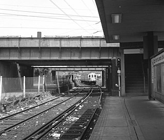
The West Ham station attack was a bomb and shooting incident at West Ham station in east London on 15 March 1976. A 5 lb bomb on a Metropolitan line train exploded prematurely in the front carriage of the train, injuring seven passengers. The bomb detonated prior to reaching the City of London, where it was thought the intended target was Liverpool Street station at rush hour. The suspect, Adrian Vincent Donnelly, a Provisional Irish Republican Army (IRA) terrorist, then shot Peter Chalk, a Post Office engineer, in the chest. He then shot and killed the train's driver Julius Stephen, who had attempted to catch him. Donelly exited the station to the street and threatened people with his revolver before PC Raymond Kiff caught up with him. Shouting "You English bastards!", Donelly shot himself in the chest, but he survived and was apprehended by Kiff.


