A sidewalk, pavement, footpath, or footway, is a path along the side of a road. Usually constructed of concrete or asphalt, it is designed for pedestrians. A sidewalk may accommodate moderate changes in grade (height) and is normally separated from the vehicular section by a curb. There may also be a median strip or road verge either between the sidewalk and the roadway or between the sidewalk and the boundary.

Indian River County is a county located in the Treasure Coast region of the U.S. state of Florida. As of the 2010 census, the population was 138,028. Its seat is Vero Beach. It is Florida's 7th richest county and in 2000 was the 87th richest county in the U.S. by per capita income.

Vero Beach is a city in and the seat of Indian River County, Florida, United States. It is thirty-four miles south of Melbourne. According to the U.S. Census Bureau's 2010 data, the city had a population of 15,220.
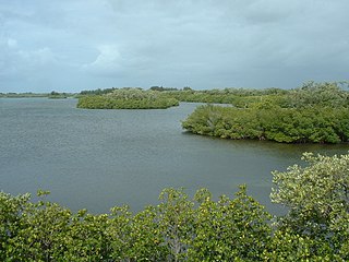
Sebastian Inlet State Park is a Florida state park located 10 miles south of Melbourne Beach and 6 miles north of Vero Beach in Florida. The park lies on both sides of the Sebastian Inlet, which forms the boundary between Brevard and Indian River counties. The land for the park was acquired by the state of Florida in 1971. In 2010, it was the second most visited state park in Florida.

The Fuller Warren Bridge is the prestressed-concrete girder bridge that carries Interstate 95 (I-95) across the St. Johns River in Jacksonville, Florida. The current structure was finished in October 2002, replacing the original bascule-bridge span, finished in 1954.

The Treasure Coast is a region of the U.S. state of Florida. It is located on the state's Atlantic coast, comprising Indian River, St. Lucie, and Martin counties. The region, whose name refers to the Spanish Treasure Fleet lost in a 1715 hurricane, evidently emerged from residents' desire to distinguish themselves from Miami and the Gold Coast region to the south.
State Road 60 is an east–west route transversing Florida from the Gulf of Mexico to the Atlantic Ocean. The western terminus of SR 60 is at the Sunsets at Pier 60 site in Clearwater Beach. The eastern terminus is in Vero Beach near the Atlantic Coast just past State Road A1A.

The John Seigenthaler Pedestrian Bridge is a truss bridge that spans the Cumberland River in Nashville, Tennessee, United States. The bridge spans 960 m (3,150 ft) and is one of the longest pedestrian bridges in the world.
State Road 80 is a 123.5 miles (198.8 km) route linking US 41 Business in Fort Myers and State Road A1A in Palm Beach. The road is the northernmost of three linking Southwest Florida to South Florida via the Everglades. Due to increasing traffic, State Road 80 has experienced upgrades and widening in various sections since 2000.
Interstate 95 (I-95) is the main Interstate Highway of Florida's Atlantic Coast. It begins at a partial interchange with U.S. Highway 1 (US 1) just south of downtown Miami, and heads north past Daytona Beach, through Jacksonville, and to the Georgia state line at the St. Marys River near Becker. The route also passes through the cities of Fort Lauderdale, West Palm Beach, and Titusville.
State Road 607 is a state highway that extends 2.5 miles (4.0 km) from its southern terminus to the Indian River County line. A north–south road in northern St. Lucie County and southern Indian River County, it is locally known as Emerson Avenue throughout its route.
State Road 732 (SR 732) comprises two segments of a state highway in the Jensen Beach, Florida vicinity. The western 2.2-mile-long (3.5 km) segment is a part of Jensen Beach Boulevard between U.S. Route 1 (US 1) and County Road 723 (CR 723) and CR 707A. The eastern 1.9-mile-long (3.1 km) segment consists of Causeway Boulevard and the Jensen Beach Causeway over the Indian River Lagoon and runs between CR 707 and SR A1A.
TCPalm is the digital news site for Treasure Coast Newspapers, the largest daily news operation on the Treasure Coast of southeastern Florida. The region encompasses three coastal counties: Martin County, St. Lucie County and Indian River County. Treasure Coast Newspapers publishes three daily print newspapers: The Stuart News, St. Lucie News Tribune and the Indian River Press Journal, as well as the weekly Jupiter Courier. The site was launched by Scripps Howard newspapers in 1996 and has been owned by Gannett since 2016.
U.S. Highway 1 (US 1) in Florida runs 545 miles (877 km) along the state's east coast– from Key West to its crossing of the St. Marys River into Georgia north of Boulogne –and south of Folkston. US 1 was designated through Florida when the United States Numbered Highway System was established in 1926. The road is maintained by the Florida Department of Transportation (FDOT).
Vero Beach High School (VBHS) is a 9–12 public high school in Vero Beach, Florida, United States that was established in 1925. The school is operated by the Indian River County School District.
State Road 656 (SR 656), also known as 17th Street, is a two-mile-long (3.2 km) state road in Indian River County, extending from U.S. Route 1 (US 1) to SR A1A mostly inside the city limits of Vero Beach. It is the southernmost of two crossings in Vero Beach between the mainland and the barrier island, with the other being at State Road 60 1.4 miles (2.3 km) to the north.
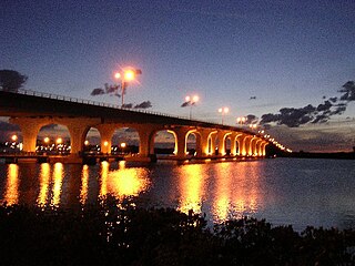
The Merrill P. Barber Bridge is a concrete arch bridge that spans the Indian River Intracoastal Waterway in Indian River County, Florida. The bridge was built by Odebrecht Contractors of Florida, Inc. and was completed in 1995. A fishing pier is constructed below the bridge on the east side.

The Granada Bridge is a high-clearance bridge that spans the Halifax River and Intracoastal Waterway, linking the mainland and beach peninsula parts of Ormond Beach, Volusia County, Florida. Granada Bridge carries four lanes of State Road 40 and Granada Blvd. The Casements, along with City Hall Plaza, Fortunato Park, and Riverbridge Park reside at the four corners of Ormond Beach's Granada Bridge, which give their collective name to the annual "Four Corners Festival" in Ormond Beach.

Brightline is a privately run inter-city rail route between Miami and West Palm Beach, Florida. Brightline began operating over its current route in January 2018 and the company is currently building an extension to the Orlando International Airport which is expected to enter service in 2022.
Elite Airways is an airline based in the United States operating charter and scheduled passenger flights. The airline adjusts destinations as demand increases or decreases. The airline is headquartered in Portland, Maine.

