
The demographics of New Zealand encompass the gender, ethnic, religious, geographic, and economic backgrounds of the 5.1 million people living in New Zealand. New Zealanders predominantly live in urban areas on the North Island. The five largest cities are Auckland, Wellington, Christchurch, Hamilton, and Tauranga. Few New Zealanders live on New Zealand's smaller islands. Waiheke Island is easily the most populated smaller island with 9,420 residents, while Great Barrier Island, the Chatham and Pitt Islands, and Stewart Island each have populations below 1,000. New Zealand is part of a realm and most people born in the realm's external territories of Tokelau, the Ross Dependency, the Cook Islands and Niue are entitled to New Zealand passports.

Otago is a region of New Zealand located in the southern half of the South Island administered by the Otago Regional Council. It has an area of approximately 32,000 square kilometres (12,000 sq mi), making it the country's second largest local government region. Its population was 254,600 in June 2023.
Balclutha is a town in South Otago, lying towards the end of the Clutha River, on the east coast of the South Island of New Zealand. It is about halfway between Dunedin and Gore on the Main South Line railway, State Highway 1 and the Southern Scenic Route. Balclutha has a population of 4,340, and is the largest town in South Otago.

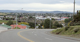
Alexandra is a town in the Central Otago district of the South Island of New Zealand. It is on the banks of the Clutha River, on State Highway 8, 188 kilometres (117 mi) by road from Dunedin and 33 kilometres (21 mi) south of Cromwell. The nearest towns to Alexandra via state highway 8 are Clyde seven kilometres to the northwest and Roxburgh forty kilometres to the south. State highway 85 also connects Alexandra to Omakau, Lauder, Oturehua, Ranfurly and on to Palmerston on the East Otago coast.

Arrowtown is a historic gold mining town in the Otago region of the South Island of New Zealand. Arrowtown is located on the banks of the Arrow River approximately 7.5 km from State Highway 6. Arrowtown is located 19.5 kilometres to the east of Queenstown. As well as the route via State Highway 6 at Arrow Junction, there is also road access directly to Queenstown via Arthurs Point and a third route via the picturesque Lake Hayes.

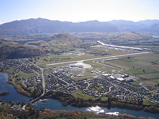
Cromwell is a town in Central Otago region of the South Island of New Zealand. Cromwell is located on the shores of Lake Dunstan where the Kawarau river joins Lake Dunstan. Cromwell was established during the Otago gold rush and is now more known as one of the sub regions of the Central Otago wine region. In 2018, the town of Cromwell was home to a population of 5610 people.

Lawrence is a small town in Otago, in New Zealand's South Island. It is located on State Highway 8, the main route from Dunedin to the inland towns of Queenstown and Alexandra. It lies 35 kilometres to the northwest of Milton, 11 kilometres northwest of Waitahuna, and close to the Tuapeka River, a tributary of the Clutha.

The Otago Gold Rush was a gold rush that occurred during the 1860s in Central Otago, New Zealand. This was the country's biggest gold strike, and led to a rapid influx of foreign miners to the area – many of them veterans of other hunts for the precious metal in California and Victoria, Australia.

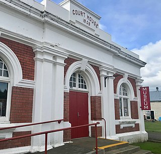
Ranfurly is a town in the Central Otago District of Otago, New Zealand. Located 110 kilometres north of Dunedin, it lies in the dry rough plain of Maniototo at a moderately high altitude close to a small tributary of the Taieri River. It operates as a service town for the local farming community. The town was formerly known as Eweburn, one of the "farmyard" names bestowed by former Otago Chief Surveyor John Turnbull Thomson on many small streams and locations in the district. The modern name honours the Fifth Earl of Ranfurly, who served as Governor of New Zealand (1897–1904) at the time of the extension of the Otago Central Railway to the area. Ranfurly is well known for its Art Deco buildings, such as its hotel and the milk bar.
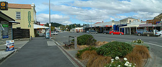
Roxburgh is a small New Zealand town of about 600 people in Central Otago. It is in Teviot Valley on the banks of the Clutha River, 40 kilometres (25 mi) south of Alexandra in the South Island. State Highway 8, which links Central Otago with Dunedin city, passes through the town. Roxburgh is well known for its Summer fruit and "Jimmy's Pies."
Frankton is a suburb of the town of Queenstown in the South Island of New Zealand, it was formerly a separate settlement.

The villages and then city that lay at the head of Otago Harbor never existed in isolation, but have always been a staging ground between inland Otago and the wider world. While Dunedin's current official city limits extend north to Waikouaiti, inland to Middlemarch and south to the Taieri River mouth, this articles focus is the history of the Dunedin urban area, only mentioning Mosgiel, the Otago Peninsula, Port Chalmers and inland Otago for context.

Voting in New Zealand was introduced after colonisation by British settlers. The first New Zealand Constitution Act was passed in 1852, and the first parliamentary elections were held the following year.
The Gold Fields District electorate was a 19th-century parliamentary electorate in the Otago region, New Zealand. It was created in 1862, with the first elections in the following year, and it returned two members. It was one of eventually three special interest constituencies created to meet the needs of gold miners. All three of these electorates were abolished in 1870. A unique feature of the Gold Fields District was that it was superimposed over other electorates, and voting was open to those who had held a mining license for some time. As such, suffrage was more relaxed than elsewhere in New Zealand, as voting was otherwise tied to property ownership. Another feature unique to the gold mining electorates was that no electoral rolls were prepared, but voting could be done upon showing a complying miner's license.
Otautau is a small farming, forestry and milling town located inland on the western edge of the Southland Plains of New Zealand on the banks of the Aparima River. Otautau is located approximately 40 kilometres (25 mi) north west of Invercargill. The average elevation of Otautau is 60 metres.

Blair Athol (1861–1882) was a British Thoroughbred racehorse and sire. In a career that lasted little more than three months in the summer and autumn of 1864, he ran seven times and won five races including one walk-over. His wins included The Derby and the St Leger. Despite the brevity of his racing career, he was regarded by contemporary experts as one of the best British racehorses of his era and arguably the greatest horse ever trained in the North of England. He went on to become a highly successful stallion, siring the winners of many races.

Southland is New Zealand's southernmost region. It consists mainly of the southwestern portion of the South Island and Stewart Island/Rakiura. It includes Southland District, Gore District and the city of Invercargill. Murihiku Southland is bordered by the culturally similar Otago to the north and east, and the West Coast in the extreme northwest. The region covers over 3.1 million hectares and spans 3,613 km of coast. As of June 2023, Southland has a population of 103,900, making it the eleventh-most-populous New Zealand region, and the second-most sparsely populated.
The Bruce by-election 1862 was a by-election held in the multi-member Bruce electorate during the 3rd New Zealand Parliament, on 31 July 1862. The by-election was caused by the death of incumbent MP Charles Kettle on 5 June, and was won by Edward Cargill.
The 1861 New Zealand census was a national census of Europeans and "half-castes", taken on 16 December 1861.
The 1858 New Zealandcensus was held on 24 December 1858. This was the first national census held since 1851, and the first census after the passing of the 1858 Census Act, which stated that a census of Europeans was to be held every three years. Enumerators delivered forms to households during December, then collected them on 26 December or as soon as possible after that date. The European population of New Zealand more than doubled during the seven years between the 1851 and 1858 censuses. The census asked questions about the "social and domestic condition" of the population: place of birth, years in the colony, marital status, religion, occupation, and so on. There were also questions about education and literacy, and questions about how much land was cultivated or fenced, crops and livestock. Information was also gathered about public amenities such as churches, hospitals, banks and businesses.