A1206 road (Great Britain)

Last updated

Blue Bridge at the West India Docks entrance Blue Bridge (geograph 1839274).jpg
Blue Bridge at the West India Docks entrance

The A1206, also known as the Isle of Dogs Distributor Road, [1] is a crescent-shaped ring road around the Isle of Dogs, in the East End of London. [2] It is made up of Westferry Road, Manchester Road and Prestons Road and is the main road through the area, connecting parts of the London Docklands. [3]

Contents

Route

View north of Westferry Circus A1206 north of Westferry Circus (upper).jpg
View north of Westferry Circus

From west to east, the road starts in Limehouse, then changes from Westferry Road to Manchester Road at Island Gardens. [3] At Cubitt Town it crosses the entrance to the West India Docks via the Blue Bridge, a bascule bridge that allows ships to reach the docks. [1] It then becomes Prestons Road, ending in Poplar. Several side roads and buildings along Westferry Road, such as Cuba Street and Spinnaker House, have names related to the historic connection the Isle of Dogs has with the shipping industry. [3]

History

At the start of the 19th century, Westferry Road was called the Deptford and Greenwich Ferry Road. [3] It began to be built up as the London Docklands developed. [4] The first bridge over the West India Dock entrance opened concurrently with the docks in 1805. The current bridge is the sixth iteration and opened in 1969. [5]

St Paul's Presbyterian Church was on Westferry Road, opening in 1859. [3] [6] It escaped demolition in the 1980s and was converted into an arts centre. [3] Millwall Fire Station was at No. 461 Westferry Road and opened in 1877. It was replaced by a later building in 1905. [7]

The road was originally classified as the A1206 only as far as the bridge over the entrance to Millwall Docks. [8] The local area was transformed after the deterioration and closure of the London Docklands and the redevelopment of areas such as Canary Wharf in the 1980s. To the west, Westferry Circus opened in 1991 as the main traffic entrance for Canary Wharf. The Westferry Printing Works opened off Westferry Road to the north of Millwall Dock in 1984, and subsequently became one of the largest print works in Europe. [3]

Traffic

London Marathon runners on the A1206 in 1982 1982 London Marathon - Blackwall entrance, West India Docks (geograph 2238635).jpg
London Marathon runners on the A1206 in 1982

Because the A1206 is the main road through the Isle of Dogs, incidents on it can cause serious congestion in the surrounding area. The proposed Silvertown Tunnel should help alleviate this. The occasional closures of Blue Bridge to vehicular traffic (to allow ships to reach the docks) create queues in both directions. [1]

Related Research Articles

Isle of Dogs Area in the East End of London, England

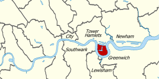
The Isle of Dogs is a large peninsula bounded on three sides by a large meander in the River Thames in East London, England, which includes the Cubitt Town, Millwall and Canary Wharf districts. The area was historically part of the Manor, Hamlet, Parish and, for a time, the wider borough of Poplar. The name had no official status until the 1987 creation of the Isle of Dogs Neighbourhood by Tower Hamlets London Borough Council. It has been known locally as simply "the Island" since the 19th century.

Poplar, London Area of East London, England

Poplar is a district in East London, England, the administrative centre of the borough of Tower Hamlets. Five miles (8 km) east of Charing Cross, it is part of the East End.

Canary Wharf Major business and financial district in London, England

Canary Wharf is the secondary central business district of London on the Isle of Dogs in the London Borough of Tower Hamlets. After the City of London, it is one of the main financial centres in the United Kingdom and the world, containing many high-rise buildings including the third-tallest in the UK, One Canada Square.

Westferry DLR station Docklands Light Railway station

Westferry is a station on the Docklands Light Railway (DLR), at the junction of Limehouse Causeway and Westferry Road in Limehouse in London Docklands, England. The station is located in Travelcard Zone 2. To the west is Limehouse station, whilst to the east the DLR splits, with one branch going to Poplar station and the other to West India Quay station.

West India Docks Historic dock site, now part of Canary Wharf area.

The West India Docks are a series of three docks, quaysides and warehouses built to import goods from and export goods and occasionally passengers to the British West Indies on the Isle of Dogs in London the first of which opened in 1802. Following their commercial closure in 1980, the Canary Wharf development was built around the wet docks by narrowing some of their broadest tracts.

Blackwall, London Area of the East End of London, England

Blackwall is a locale in East London, located in the London Borough of Tower Hamlets, it includes Leamouth and the conservation area of Coldharbour.

Millwall Human settlement in London, England

Millwall is a district on the western and southern side of the Isle of Dogs, in east London, England, in the London Borough of Tower Hamlets. It lies to the immediate south of Canary Wharf and Limehouse, north of Greenwich and Deptford, east of Rotherhithe, west of Cubitt Town, and has a long shoreline along London's Tideway, part of the River Thames. It was part of the County of Middlesex and from 1889 the County of London following the passing of the Local Government Act 1888, it later became part of Greater London in 1965.

Cubitt Town Area on the Isle of Dogs in London, England

Cubitt Town is a district on the eastern side of the Isle of Dogs in London, England. This part of Poplar was redeveloped as part of the Port of London in the 1840s and 1850s by William Cubitt, Lord Mayor of London (1860–1862), after whom it is named. It is on the east of the Isle, facing Royal Borough of Greenwich across the River Thames. To the west is Millwall, to the east and south is Greenwich, to the northwest Canary Wharf and to the north, across the Blue Bridge, is the rest of Poplar. It is in Blackwall & Cubitt Town Ward of Tower Hamlets London Borough Council.

Leamouth Human settlement in England

Leamouth is a mixed-use development and historically a wharf in the Port of London in Blackwall. It lies on the west side of the confluence of the Bow Creek stretch of the Lea, and the River Thames.

Millwall Dock

Millwall Dock is a dock at Millwall, London, England, located south of Canary Wharf on the Isle of Dogs.

East India Docks

The East India Docks were a group of docks in Blackwall, east London, north-east of the Isle of Dogs. Today only the entrance basin and listed perimeter wall remain visible.

City Canal Former canal excavated across the Isle of Dogs in east London

The City Canal was a short, and short-lived, canal excavated across the Isle of Dogs in east London, linking two reaches of the River Thames. Today, it has been almost completely reconstructed to form the South Dock of the West India Docks.

Frederick Walter Simms

Frederick Walter Simms was a British civil engineer.

John Aird & Co. was once a leading British civil engineering business based in London.

London Yard was a shipyard in London, in use between around 1856 and 1908 by various shipbuilding companies, including Westwood, Baillie and Yarrow Shipbuilders.

J & W Dudgeon

J & W Dudgeon was a Victorian shipbuilding and engineering company based in Cubitt Town, London, founded by John and William Dudgeon.

Charlie Browns Roundabout Road junction on the North Circular Road in London, England

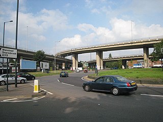
Charlie Brown's Roundabout is an outer northeast London roundabout for lesser arterial roads and is a local landmark name for the motorway access flyovers above.

East India Dock Road

East India Dock Road is a major arterial route from Limehouse to Canning Town in London. The road takes its name from the former East India Docks in the Port of London, and partly serves as the high street of Poplar. To the west it becomes Commercial Road and to the east Newham Way. It forms part of the A13, a major road connecting the historic City of London to Tilbury and Southend.

Tower Hamlets Town Hall

Tower Hamlets Town Hall is a municipal facility in a building known as Mulberry Place, in Nutmeg Lane, Poplar, London. It is the headquarters of Tower Hamlets London Borough Council.

William Wallen Junior (1817–1891) was an architect and surveyor in London. He is the son of William Wallen Sr. (1790–1873) also an architect and surveyor. The Wallen family was linked to British architecture during the 19th century.

References

Citations

  1. 1 2 3 "Application by Transport for London for an Order Granting Development Consent for the Silvertown Tunnel" (PDF). Transport for London. November 2016. p. 13. Retrieved 17 January 2020.
  2. "A1206". Sabre. The Society for All British and Irish Road Enthusiasts. Retrieved 21 December 2015.
  3. 1 2 3 4 5 6 7 Weinreb et al. 2008, p. 1003.
  4. 'Southern Millwall: Drunken Dock and the Land of Promise', in Survey of London: Volumes 43 and 44, Poplar, Blackwall and Isle of Dogs, ed. Hermione Hobhouse (London, 1994), pp. 466-480. British History Online http://www.british-history.ac.uk/survey-london/vols43-4/pp466-480 [accessed 17 January 2020].
  5. Mitchell, Bob (2003). Jubilee Line Extension: From Concept to Completion. Thomas Telford. p. 83. ISBN   978-0-727-73028-2.
  6. 'Plate 82: Churches in Southern Millwall', in Survey of London: Volumes 43 and 44, Poplar, Blackwall and Isle of Dogs, ed. Hermione Hobhouse (London, 1994), p. 82. British History Online http://www.british-history.ac.uk/survey-london/vols43-4/plate-82 [accessed 17 January 2020]
  7. 'Southern Millwall: The Mellish Estate in Southern Millwall', in Survey of London: Volumes 43 and 44, Poplar, Blackwall and Isle of Dogs, ed. Hermione Hobhouse (London, 1994), pp. 480-489. British History Online http://www.british-history.ac.uk/survey-london/vols43-4/pp480-489 [accessed 17 January 2020].
  8. Seventh Series Sheet 171 - London SE (Map). Ordnance Survey. June 1959. Retrieved 18 January 2020.

Sources

Coordinates: 51°29′14″N00°00′48″W / 51.48722°N 0.01333°W / 51.48722; -0.01333