The A14 is a major trunk road in England, running 127 miles (204 km) from Catthorpe Interchange, a major intersection at the southern end of the M6 and junction 19 of the M1 in Leicestershire to the Port of Felixstowe, Suffolk. The road forms part of the unsigned Euroroutes E24 and E30. It is the busiest shipping lane in East Anglia carrying anything from cars to large amounts of cargo between the UK and Mainland Europe.

The A12 is a major road in Eastern England. It runs north-east/south-west between London and the coastal town of Lowestoft in the north-eastern corner of Suffolk, following a similar route to the Great Eastern Main Line until Ipswich. A section of the road between Lowestoft and Great Yarmouth became part of the A47 in 2017. Between the junctions with the M25 and the A14, the A12 forms part of the unsigned Euroroute E30. Unlike most A roads, this section of the A12, together with the A14 and the A55, has junction numbers as if it were a motorway.
The A11 is a major trunk road in England. It originally ran roughly north east from London to Norwich, Norfolk. It now consists of a short section in Inner London and a much longer section in Cambridgeshire, Suffolk and Norfolk. The lengthy section between these was renumbered as a result of the opening of the M11 in the 1970s and then the A12 extension in 1999.
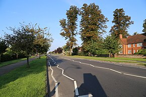
The A45 is a major road in England. It runs east from Birmingham past the National Exhibition Centre and the M42, then bypasses Coventry and Rugby, where it briefly merges with the M45 until it continues to Daventry. It then heads to Northampton and Wellingborough before running north of Rushden and Higham Ferrers and terminating at its junction with the A14 in Thrapston.
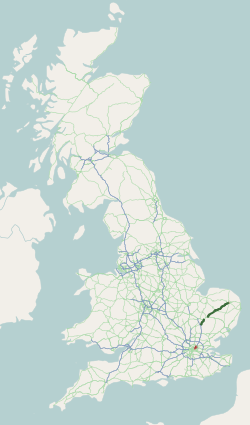
European route E30 is an A-Class European route from the port of Cork in Ireland in the west to the Russian city of Omsk, near the border with Kazakhstan in the east. For much of the Russian stretch, it follows the Trans-Siberian Highway and, east of the Ural Mountains, with AH6 of the Asian Highway Network, which continues to Busan, South Korea. The total length is 6,530 km (4,060 mi)—3,300 km (2,100 mi) from Cork to Moscow, and 3,230 km (2,010 mi) from Moscow to Omsk. The naming is by the United Nations Economic Commission for Europe (UNECE).

The European route E24 is part of the United Nations international E-road network. It runs for 254 km (158 mi) from Birmingham to Ipswich.

The A120 is an A-road in England, which runs between Puckeridge in Hertfordshire and Harwich in Essex.

The A1156 road runs through the centre of Ipswich, Suffolk, England. Formerly part of the A45, the road connects the A14, to the north-west of Ipswich to the A14 (again), and the A12 to the south-east of Ipswich, at the Seven Hills junction.
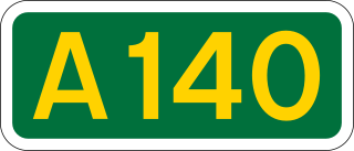
The A140 is an 'A-class' road in Norfolk and Suffolk, East Anglia, England partly following the route of the Roman Pye Road. It runs from the A14 near Needham Market to the A149 south of Cromer. It is of primary status for the entirety of its route. It is approximately 56 miles (90 km) in length.

The A143 is a road that runs from the Gorleston-on-Sea area of Great Yarmouth, in Norfolk to Haverhill in Suffolk.

The A146 is an A road that connects Norwich in Norfolk and Lowestoft in Suffolk, two of East Anglia's largest population centres. It is around 27 miles (43 km) in length and has primary classification along its entire route. It is mainly single carriageway throughout its route, with the exception of a section of dual carriageway on the southern edge of Norwich.

The A145 is an A road in the English county of Suffolk. It runs from east of the town of Beccles, close to the border with Norfolk, to the village of Blythburgh where it joins the A12 road. It is around 11 miles (18 km) in length and single carriageway throughout.
Copdock and Washbrook is a civil parish in the Babergh district in the county of Suffolk, England. It covers the villages of Copdock and Washbrook, as well as the hamlets of Coles Green, Mace Green and Washbrook Street.

Copdock is a village and former civil parish, now in the parish of Copdock and Washbrook, in the Babergh district, in the county of Suffolk, England. In 1961 the civil parish had a population of 399.

Ipswich is the county town of Suffolk, England. It is a medieval port and industrial town with a strong transport history; the urban area has a population of 122,000 and currently offers urban transport services for cars, cycles and buses. In addition there are 3 railway stations and regional coach services. London Stansted Airport is accessible by the airlink coach.

Falkenham is a village and a civil parish in the East Suffolk district, in the English county of Suffolk, near the village of Kirton and the towns of Ipswich and Felixstowe. The population of the civil parish as of the 2011 census was 170.

Transport in East Anglia consists of extensive road and rail networks as well as one of England's key regional airports and the country's busiest container port. Despite having very little motorway within their borders, the counties of Suffolk, Norfolk and Cambridgeshire have modern transport links with the rest of the country.

The A144 is an A road in the English county of Suffolk. It runs from the town of Bungay, close to the border with Norfolk, to the A12 trunk road near the village of Darsham, passing through the market town of Halesworth. It is around 14 miles (23 km) in length and is single carriageway throughout.

The A1094 is an A road in the English county of Suffolk. It is around 7 miles (11 km) in length. The road runs from a junction off the A12 trunk road at Friday Street in Benhall to Aldeburgh on the North Sea coast. The road is single carriageway throughout.
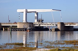
The Breydon Bridge is a single-span drawbridge carrying the A47 in Great Yarmouth across the River Yare close to Breydon Water. It replaces the former railway Breydon Viaduct which was closed in 1953 and demolished by 1963. Completed in 1985, an average of 31,000 vehicles cross the bridge each day.