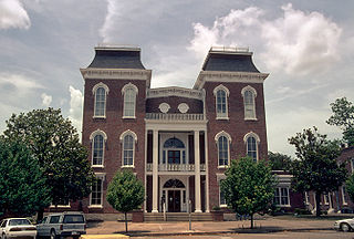
Montgomery County is located in the State of Alabama. As of the 2020 census, its population was 228,954, making it the seventh-most populous county in Alabama. Its county seat is Montgomery, the state capital. Montgomery County is included in the Montgomery, AL Metropolitan Statistical Area.

Barbour County is a county in the southeastern part of the U.S. state of Alabama. As of the 2020 census, the population was 25,223. Its county seat is Clayton. Its largest city is Eufaula. Its name is in honor of James Barbour, who served as Governor of Virginia.

Bullock County is a county of the U.S. state of Alabama. As of the 2020 census, the population was 10,357. Union Springs was chosen as the county seat in 1867, and presently is the county's only incorporated city. The county was named for Confederate Army Colonel Edward C. Bullock who was a state senator and outspoken secessionist who died during the American Civil War.

Pike County is located in the U.S. state of Alabama. As of the 2020 census the population was 33,009. Its county seat is Troy. Its name is in honor of General Zebulon Pike, of New Jersey, who led an expedition to southern Colorado and encountered Pikes Peak in 1806.

Wilcox County is a county of the U.S. state of Alabama. As of the 2020 census, the population was 10,600. Its county seat is Camden.

Will County is a county in the northeastern part of the state of Illinois. According to the 2020 census, it had a population of 696,355, an increase of 2.8% from 677,560 in 2010, making it Illinois's fourth-most populous county. The county seat is Joliet. Will County is one of the five collar counties of the Chicago–Naperville–Elgin, IL–IN–WI Metropolitan Statistical Area. The portion of Will County around Joliet uses area codes 815 and 779, while 630 and 331 are for far northern Will County and 708 is for central and eastern Will County.

Haralson County is a county located in the northwestern part of the U.S. state of Georgia. As of the 2020 census, the population was 29,919, up from 28,780 in 2010. The county seat is Buchanan. The county was created on January 26, 1856, and was named for Hugh A. Haralson, a former Georgia congressman.

Midway is a town located in eastern Bullock County, Alabama, United States. At the 2020 census, the population was 421.

Union Springs is a city in and county seat of Bullock County, Alabama, United States. The population was 3,980 at the 2010 census.

Alexandria is a census-designated place and unincorporated community in Calhoun County, Alabama, United States. At the 2020 census, the population was 4,032. It is included in the Anniston–Oxford, Alabama Metropolitan Statistical Area.

Magnolia Springs is a town in south Baldwin County, Alabama, United States, in the Daphne-Fairhope-Foley metropolitan area. The town voted to incorporate in 2006. As of the 2010 census it had a population of 723.

Fitzpatrick is an unincorporated community and census-designated place in Bullock County, Alabama, United States. It first appeared as a CDP in the 2010 census with a population of 83. The community is served by Alabama State Route 110.

Arlington, originally known as Dumas Store, is an unincorporated community in Wilcox County, Alabama, United States.

Calvert is an unincorporated community and census-designated place (CDP) in Mobile and Washington counties, Alabama, United States. It is located in the extreme northeast corner of Mobile County and southeast corner of Washington County near the Tombigbee River, along U.S. Route 43. As of the 2020 census, the population of Calvert was 255.

Dunnavant, also spelled Dunavant, is a census-designated place and unincorporated community in Shelby County, Alabama, United States. Its population was 981 as of the 2010 census. The community's name is probably derived from a local family. A post office was established in 1897 and was in operation until it was closed in 1958.
Arkwright was an unincorporated community in Shelby County, Alabama, United States. The community lies near the banks of the Coosa River and is now within the city limits of Vincent. Arkwright was founded in 1907 and was named for Preston Stanley Arkwright, who served as founder and president of Georgia Railway and Power Company and as an official with the Atlanta, Birmingham and Atlantic Railway. At one point, the community was home to a railroad station, post office, bank, cotton gin, gristmill, general store, furniture store, and school. The post office was in operation from 1909 to 1926. In 1924, the railroad company raised the railroad bed, eliminating the need for a depot. The population soon began to decline and the post office was closed shortly afterwards. The Arkwright Baptist Church and Arkwright Heritage Area, which includes multiple structures and cemeteries, were added to the Alabama Register of Landmarks and Heritage in 2011.
Ada is an unincorporated community in Montgomery County, Alabama, United States. Ada is located at the intersection of U.S. Route 331 and Alabama State Route 94, 20 miles (32 km) south of Montgomery.
Abel is an unincorporated community in Cleburne County, in the U.S. state of Alabama.
Cromwell is an unincorporated community in Choctaw County, Alabama, United States.
Acton is an unincorporated community in Jefferson County, in the U.S. state of Alabama. It is a suburban area bordering the city of Birmingham, centered around the intersection of Caldwell Mill Road and Old Looney Mill Road just west of the Cahaba River. It is not to be confused with the former mining village of Acton, Alabama in Shelby County (now within the city of Hoover, approximately 6+1⁄2 miles to the southwest as the crow flies. Initially, this Acton was also in Shelby County before a border adjustment shifted it into Jefferson County.


