
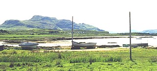
Fort William formerly and, , formerly is a town in Lochaber in the Scottish Highlands, located on the eastern shore of Loch Linnhe. At the 2011 census, Fort William had a population of 10,459, making it the second largest settlement in both the Highland council area, and the whole of the Scottish Highlands; only the city of Inverness has a larger population.

Glencoe or Glencoe Village is the main settlement in Glen Coe in the Lochaber area of the Scottish Highlands. It lies at the north-west end of the glen, on the southern bank of the River Coe where it enters Loch Leven.

Rannoch Moor is an expanse of around 50 square miles (130 km2) of boggy moorland to the west of Loch Rannoch in Scotland, where it extends from and into westerly Perth and Kinross, northerly Lochaber, and the area of Highland Scotland toward its south-west, northern Argyll and Bute. Rannoch Moor is designated a Site of Special Scientific Interest (SSSI) and a Special Area of Conservation. Much of the western part of the moor lies within the Ben Nevis and Glen Coe National Scenic Area, one of 40 such areas in Scotland.

Argyll, sometimes called Argyllshire, is a historic county and registration county of western Scotland.
Kilchoan is a village on the Scottish peninsula of Ardnamurchan, beside the Sound of Mull in Lochaber, Highland. It is the most westerly village in Great Britain, although several tiny hamlets lie further west on the peninsula. The western linear, coastal parts of the village are Ormsaigmore and Ormsaigbeg.

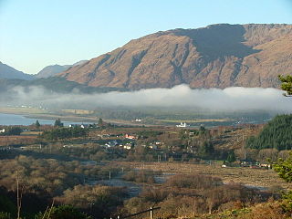
The Great Glen, also known as Glen Albyn or Glen More, is a glen in Scotland running for 62 miles (100 km) from Inverness on the edge of Moray Firth, in an approximately straight line to Fort William at the head of Loch Linnhe. It follows a geological fault known as the Great Glen Fault, and bisects the Scottish Highlands into the Grampian Mountains to the southeast and the Northwest Highlands to the northwest.

Loch Leven is a sea loch located on the west coast of Scotland. It is spelled Loch Lyon in Timothy Pont's map of the area and is pronounced Li' un. The local Gaelic pronunciation is Lee' oon

Castle Stalker is a four-storey tower house or keep. It is set on a tidal islet on Loch Laich, an inlet off Loch Linnhe. It is about 1+1⁄2 miles north-east of Port Appin, Argyll, Scotland, and is visible from the A828 road about midway between Oban and Glen Coe. The islet is accessible with difficulty from the shore at low tide. The name "Stalker" comes from the Gaelic Stalcaire, meaning "hunter" or "falconer". The island castle is one of the best preserved medieval tower houses to survive in western Scotland and is a Category A listed building. It stands in the Lynn of Lorn National Scenic Area, one of forty such areas in Scotland.
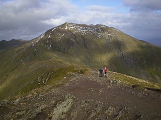
Ben Lawers is the highest mountain in the Breadalbane region of the Scottish Highlands. It lies north of Loch Tay and is the highest peak of the 'Ben Lawers group', a ridge that includes six other Munros: Beinn Ghlas, Meall Garbh, Meall Corranaich, An Stùc, Meall Greigh and Meall a' Choire Leith. It is also the highest peak in Perthshire, and the tenth highest Munro in Scotland. Ben Lawers was long thought to be over 4000 feet in height; accurate measurement in the 1870s showed it to be 3,983 feet (1,214 m).
The Golden Treasury of Scottish Poetry was edited by Hugh MacDiarmid, and published in 1940. From the introduction:

Loch Eil is a sea loch in Lochaber, Scotland that opens into Loch Linnhe near the town of Fort William.
Achaphubuil is a small settlement to the north of Ardgour in Lochaber, in the Highlands of Scotland. Achaphubuil lies to the south of The Narrows, which link Loch Linnhe to Loch Eil. The village of Corpach is on the opposite shore, with Fort William across Loch Linnhe to the north-east.

Achadh nan Darach is a hamlet in Highland, Scotland. It lies near the banks of Loch Linnhe on the A828 road, just south of Kentallen, several miles southwest of Fort William. Its name means "field of oaks". It lies at the edge of the Glen Duror Forest, which stretches further to the east and southeast.

Breacleit is the central village on Great Bernera in the Outer Hebrides, Scotland. Breaclete is within the parish of Uig. Although the village name comes from a geographical feature rather than a steading it is generally believed to be an ancient settlement. The oldest building in the village is the thatched water mill by the shore of Loch Risay which was restored in the 1990s. It was formerly a tiny crofting and fishing settlement of just 12 crofts surrounding the natural harbour of Loch Beag but crofting has now ceased and holiday homes have taken over. The earliest clearly mapped reference is on Murdoch MacKenzie's first Admiralty chart surveyed in 1748. In 1851 J.M. MacKenzie, the Chamberlain to the estate owner Sir James Matheson, proposed that all the tenants of the village were to be evicted and sent to North America on the emigrant ship the SS Marquis of Stafford. This plan was not fully carried through however but it still had a great effect on the village leaving it with a population of just three families. This population was later supplemented through evictions elsewhere notably the clearances of Hacklete and Barragloum villages in the south of Great Bernera.

Loch Creran is a sea loch in Argyll, on the west coast of Scotland. It is about 10 kilometres (6.2 mi) long from its head at Invercreran to its mouth on the Lynn of Lorne, part of Loch Linnhe. The loch separates the areas of Benderloch to the south and Appin to the north. The island of Eriska lies at the mouth of the loch. The loch is bridged at its narrowest point at Creagan, by the A828 road. The village of Barcaldine lies on the south shore of the loch.

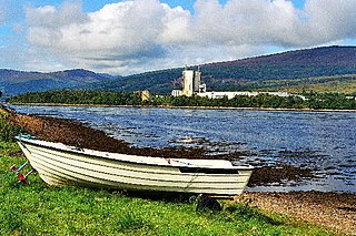
Corpach is a large village north of Fort William, in the Scottish Highlands. The canal lock at Corpach Basin on Loch Linnhe, east of the narrows leading to Loch Eil, is the western sea entrance of the Caledonian Canal. It is a natural harbour, unlike Fort William.
Inchree is a small hamlet, situated at the northern end of the village of Onich. It is 7 miles south of the town of Fort William, in Inverness-shire, Scottish Highlands and is in the Scottish council area of Highland. Inchree is located 200 metres off the A82 main road, and is also 500 metres south of the Corran Ferry terminal.

Cuil Bay, meaning recess, corner, niche or nook, is a 237° facing, large sand and shingle coastal embayment with a semi-circular outline, on a chord of 2 km, situated on the south‐west part of the Ardsheal peninsula, on the southern coast of the sea loch of Loch Linnhe, in the parish of Lismore and Appin, within the council area of Lochaber in Scotland. It was formerly part of Argyll and Bute before boundary changes occurred. The bay is situated adjacent to the village of Duror. The bay is reached by a small road that leads from the Duror Primary School, leaving the main A828 road, following the line of the River Duror, as it races to meet the sea, before opening out into a vista of a long shore of meadows and sea-grasses as the land meets the bay proper.

Duror,, occasionally Duror of Appin is a small, remote coastal village that sits at the base of Glen Duror, in district of Appin, in the Scottish West Highlands, within the council area of Argyll and Bute in Scotland. Duror is known for the first building of the Telford Parliamentary churches by the Scottish civil engineer, architect and stonemason, Thomas Telford, from 1826, the first in a series of 32, built in Scotland. William Thomson was the architect. Duror is the location of the famous Appin Murder. Although no direct evidence for this connection exists, the murder event and the kidnap of James Annesley, supposedly provided the inspiration for Robert Louis Stevenson writing the novel Kidnapped.

