Cartmel Priory church serves as the parish church of Cartmel, Cumbria, England.

Winchelsea is a small town in the non-metropolitan county of East Sussex, within the historic county of Sussex, England, located between the High Weald and the Romney Marsh, approximately 2 miles (3.2 km) south west of Rye and 7 miles (11 km) north east of Hastings. The current town, which was founded in 1288, replaced an earlier town of the same name, known as Old Winchelsea, that was lost to coastal erosion in the late medieval period. Winchelsea is part of the civil parish of Icklesham.

Dunton is a village and civil parish in the Aylesbury Vale district of Buckinghamshire, England. The village is situated approximately 8 miles (13 km) north from Aylesbury and 4 miles (6.4 km) south-east from Winslow.
Ickford is a village and civil parish in the unitary authority area of Buckinghamshire, England. It is on the boundary with Oxfordshire, about 4 miles (6.4 km) west of the market town of Thame.

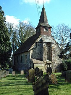
Postling village and civil parish is situated near the Roman road of Stone Street, about 17 miles (27 km) south of Canterbury, Kent, in South East England. Postlinges is the spelling used in the Domesday Book where it was part of the lands of Hugo de Montfort; Postlinge is also seen in old records. There is much archaeological evidence of continued occupation of the area. Postling Court is, in effect, the old manor-house, although is, more correctly as the name suggests, the one-time meeting place of the local court and magistrate. The population of the civil parish includes the hamlet of Newbarn.

Hawkinge is a town and civil parish in the Folkestone and Hythe district of Kent, England. The original village of Hawkinge is actually just less than a mile due east of the present village centre; the village of Hawkinge was formed by the merging of Hawkinge and Uphill.
Cheriton is a northern suburb of Folkestone in Kent. It is the location of the English terminal of the Channel Tunnel as well as of the major army barracks of Shorncliffe Camp.

North Leverton with Habblesthorpe is a village and civil parish in the English county of Nottinghamshire. The population as at the 2011 Census was 1,047.

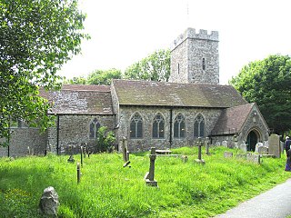
Elham is a village and civil parish in East Kent situated approximately 9 miles (14 km) south of Canterbury and 5 miles (8 km) north west of Folkestone in the Elham Valley. At the 2011 Census the population included the hamlet of Ottinge and village of Wingmore.
Folkestone Priory was a pre-Reformation Benedictine monastery at Folkestone in the English county of Kent. The priory church survives as the present parish church. It was the successor to Folkestone Abbey, an Anglo-Saxon nunnery on a different site.
Treyford is a hamlet and Anglican parish in the Chichester district of West Sussex, England. It lies within the civil parish of Elsted and Treyford. The hamlet sits on the Elsted to Bepton Road 4 miles (6.4 km) southwest of Midhurst.
Trimley St. Martin is a parish and village that lies between the rivers Orwell and the Deben, on the long narrow tongue of land from Ipswich to Felixstowe referred to as the Colneis Hundred.

Stelling Minnis is a village and civil parish in the Folkestone and Hythe district in Kent, England. The village lies 13 kilometres (8 mi) to the south of Canterbury, and to the east of the B2068, Stone Street, the Roman road, which takes traffic between Lympne and Canterbury.
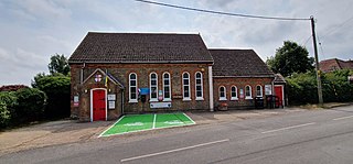
Painters Forstal is a village in the Swale district of the English county of Kent. It is 2 miles (3.2 km) south-west of the town of Faversham and is part of the civil parish of Ospringe. It lies just south of the M2 motorway, and has developed almost completely since the 1950s.
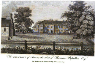
Acrise Place is a mainly 18th-century house located about 6 miles (9.6 km) north of Folkestone in the village of Acrise, Kent, England. It is a Grade II* listed building.

Shocklach Oviatt is a former civil parish, now in the parish of Shocklach Oviatt and District, in the unitary authority of Cheshire West and Chester and the ceremonial county of Cheshire, England. The parish of Shocklach comprised the townships Shocklach Oviatt, Church Shocklach and Caldecott. The civil parish was abolished in 2015 to form Shocklach Oviatt and District.

Houghton is a small village and a civil parish in the English county of Norfolk. It covers an area of 7.64 km2 (2.95 sq mi) and had a population of 69 in 36 households at the 2001 census. At the 2011 census the population of the parish was again below 100, and was therefore included in the civil parish of West Rudham.

Ramsden is a village and civil parish about 3+1⁄2 miles (5.6 km) north of Witney in West Oxfordshire. The 2011 Census recorded the parish's population as 342.
Hawkedon is a village and civil parish in the West Suffolk district of Suffolk in eastern England. Located around 7 miles (11 km) south-south-west of Bury St Edmunds, the parish also contains the hamlet of Thurston End, and in 2005 had a population of 120. The majority of the village is classed as a conservation area.

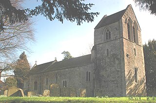
Denton with Wootton is a civil parish in the Dover District of Kent, England. The parish contains the settlements of Denton and Wootton, 1 mile (1.6 km) apart.