Related Research Articles
Casco Township is a civil township of Allegan County in the U.S. state of Michigan. The population was 2,823 at the 2010 census.
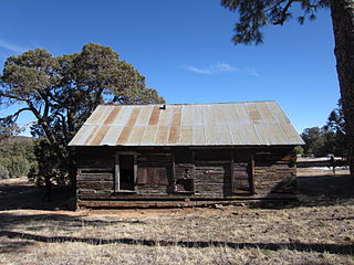
Tres Alamos is a ghost town in Cochise County in the U.S. state of Arizona. The town was settled in 1874 in what was then the Arizona Territory.
Caprock is an unincorporated community in Lea County, New Mexico, United States. Caprock is located on a geological formation in the high plains, approximately 47 miles east of Roswell. U.S. Route 380 passes through the community. It was founded by Edward Crossland, who planted the cottonwoods in the area, in 1913. A post office was established in 1916 but is closed. Caprock's school closed in 1927. Caprock today consists solely of a country store, two ranches, and a TV transmission tower. The ZIP Code for Caprock is 88213.
Hermosa is recognized as a populated place in Sierra County, New Mexico, United States. It is located in the Palomas Creek valley, west of Truth or Consequences.
Rancho Los Cerritos was a 27,054-acre (109.48 km2) 1834 land grant in present-day southern Los Angeles County and Orange County, California The grant was the result of a partition of the Rancho Los Nietos grant. "Cerritos" means "little hills" in Spanish. The rancho lands include the present-day cities of Cerritos and Long Beach.
La Bajada is a census-designated place in Santa Fe County, New Mexico, United States. It is named after a geographical feature of the nearby Caja del Rio.
Chattanooga Creek is a stream in Walker County, Georgia and Hamilton County, Tennessee.
Jicarilla is a ghost town in Lincoln County, in the U.S. state of New Mexico. It became a boomtown in 1892 following the discovery of gold and coal in the nearby Jicarilla Mountains.
New Palestine is an unincorporated community in Clermont County, in the U.S. state of Ohio.
Bixby is a ghost town in Perkins County, in the U.S. state of South Dakota. The GNIS classifies it as a populated place.
La Vereda del Monte was a backcountry route through remote regions of the Diablo Range, one of the California Coast Ranges. La Vereda del Monte was the upper part of La Vereda Caballo,, used by mesteñeros from the early 1840s to drive Alta California horses to Sonora for sale.
Kissenger is an unincorporated community in Pike County, in the U.S. state of Missouri.
Frisco is an unincorporated community in Stoddard County, in the U.S. state of Missouri.
Elephant Butte is a populated place on the southeast end of the Elephant Butte Reservoir in Sierra County, New Mexico, United States. It should not be confused with the modern city of Elephant Butte, New Mexico that is on the west side of the reservoir to the northwest of this place. This site lies at an elevation of 4,465 feet and overlooks Elephant Butte to the north, the geographic feature that gives its name to all these locations.

Rail is an extinct town in east central Wright County, in the Ozarks of southern Missouri, United States. The GNIS classifies it as a populated place. The village was located on the west bank of Beaver Creek, just southeast of the intersection of Missouri routes 38 and 95.

Oscura Mountains, originally known to the Spanish as the Sierra Oscura, are a ridge of mountains, trending north and south, east of the Jornada del Muerto and west of the Tularosa Valley. It is located in Socorro County and Lincoln County, New Mexico. Their highest elevation is Oscura Peak at 8,625 feet. Its southern end is at 33°30′30″N106°18′45″W and its north end is at 33°49′15″N106°22′20″W near North Oscura Peak.
Aleman is a locale, a formerly populated place in Sierra County, New Mexico, United States. It lies at an elevation of 4,669 feet.
Bingham, is a populated place in Socorro County, New Mexico, United States. It lies at an elevation of 5,485 feet along Highway 380, halfway between San Antonio and Carrizozo. It has had a post office since 1934, now located at 33°54′39″N106°20′58″W.
References
- ↑ U.S. Geological Survey Geographic Names Information System: Adobe Ranch
- ↑ U.S. Geological Survey Geographic Names Information System: Adobe Post Office (historical)
- ↑ Helbock, Richard W., Post Offices of New Mexico, Las Cruces, NM, 1981.
Coordinates: 33°51′44″N106°18′18″W / 33.86222°N 106.30500°W
Municipalities and communities of Socorro County, New Mexico, United States | ||
|---|---|---|
| City |  | |
| Village | ||
| CDPs | ||
| Other communities | ||
| Populated places | ||
| Indian reservations | ||
| Ghost towns | ||
| Footnotes | ‡This populated place also has portions in an adjacent county or counties | |
| | This New Mexico state location article is a stub. You can help Wikipedia by expanding it. |