Aguinaldo, officially the Municipality of Aguinaldo, is a municipality in the province of Ifugao, Philippines. According to the 2024 census, it has a population of 20,924 people.[5]
The Municipality of Aguinaldo was officially created through Batas Pambansa Bilang 86, which was approved on September 20, 1980. The law separated several barangays—Bunhian, Damag, Galonogon, Itab, Jacmal, Ta-ang, Talete, and Ubao—from the Municipality of Mayoyao in the province of Ifugao.
Prior to its creation, the area that now comprises Aguinaldo was known collectively as Bunhian, a part of Mayoyao. During the 1970s, local leaders from the aforementioned barangays began advocating for separation and the establishment of their own municipality. This movement was supported by Romulo Lumauig and Gualberto Lumauig, who represented Ifugao in the House of Representatives and the Interim Batasang Pambansa, respectively.
Their efforts culminated in the enactment of Batas Pambansa Blg. 86, signed into law by then-President Ferdinand Marcos, formally establishing the Municipality of Aguinaldo. The municipality was named after Emilio Aguinaldo, the first President of the Philippines, who is believed to have passed through the area while fleeing from American forces during the Philippine-American War.[6]
Geography
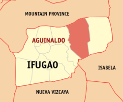
Aguinaldo is situated 82.10 kilometres (51.01mi) from the provincial capital Lagawe, and 409.59 kilometres (254.51mi) from the country's capital city of Manila.
Barangays
Aguinaldo is politically subdivided into 16 barangays.[7] Each barangay consists of puroks and some have sitios.
In the 2024 census, the population of Aguinaldo was 20,924 people,[14] with a density of 39 inhabitants per square kilometre or 100 inhabitants per square mile.
Economy
The economy is mostly agricultural with palay as the main crop.
Aguinaldo, belonging to the lone congressional district of the province of Ifugao, is governed by a mayor designated as its local chief executive and by a municipal council as its legislative body in accordance with the Local Government Code. The mayor, vice mayor, and the councilors are elected directly by the people through an election which is being held every three years.
The Aguinaldo Schools District Office governs all educational institutions within the municipality. It oversees the management and operations of all private and public, from primary to secondary schools.[24]
This page is based on this Wikipedia article Text is available under the CC BY-SA 4.0 license; additional terms may apply. Images, videos and audio are available under their respective licenses.