RTA Rapid Transit is a rapid transit and semi-metro system owned and operated by the Greater Cleveland Regional Transit Authority (GCRTA).

The Greater Cleveland Regional Transit Authority is the public transit agency for Cleveland, Ohio, United States and the surrounding suburbs of Cuyahoga County. RTA is the largest transit agency in Ohio, with a ridership of 22,431,500, or about 75,300 per weekday as of the fourth quarter of 2023.

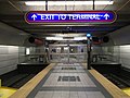
Tower City Center is a large mixed-use facility in Downtown Cleveland, Ohio, on its Public Square. The facility is composed of a number of interconnected office buildings, including Terminal Tower, the Skylight Park mixed-use shopping center, Jack Cleveland Casino, Hotel Cleveland, Chase Financial Plaza, and Tower City station, the main hub of Cleveland's four RTA Rapid Transit lines.

The Blue Line is a light rail line of the RTA Rapid Transit system in Cleveland and Shaker Heights, Ohio, running from Tower City Center downtown, then east and southeast to Warrensville Center Blvd near Chagrin Blvd. 2.6 miles (4.2 km) of track, including two stations, are shared with the rapid transit Red Line, the stations have low platforms for the Blue Line and high platforms for the Red Line. The Blue Line shares the right-of-way with the Green Line in Cleveland, and splits off after passing through Shaker Square. All RTA light rail lines use overhead lines and pantographs to draw power.
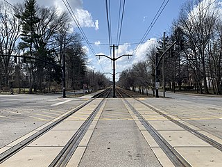
The Green Line is a light rail line of the RTA Rapid Transit system in Cleveland and Shaker Heights, Ohio, running from Tower City Center downtown, then east to Green Road near Beachwood. 2.6 miles (4.2 km) of track, including two stations, are shared with the rapid transit Red Line; the stations have low platforms for the Green Line and high platforms for the Red Line. The Green Line shares the right-of-way with the Blue Line in Cleveland, and splits off after passing through Shaker Square. All RTA light rail lines use overhead lines and pantographs to draw power.
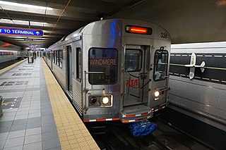
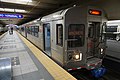
The Red Line is a rapid transit line of the RTA Rapid Transit system in Cleveland, Ohio, running from Cleveland Hopkins International Airport northeast to Tower City in downtown Cleveland, then east and northeast to Windermere. 2.6 miles (4.2 km) of track, including two stations, are shared with the light rail Blue and Green Lines; the stations have high platforms for the Red Line and low platforms for the Blue and Green Lines. The whole Red Line is built next to former freight railroads. It follows former intercity passenger rail as well, using the pre-1930 right-of-way of the New York Central from Brookpark to West 117th, the Nickel Plate from West 98th to West 65th, and the post-1930 NYC right-of-way from West 25th to Windermere. The Red Line uses overhead lines and pantographs to draw power and trains operate using one-person operation. In 2023, the line had a ridership of 3,469,100, or about 10,800 per weekday as of the fourth quarter of 2023.

Cleveland Lakefront Station is an Amtrak train station at North Coast Harbor in Cleveland, Ohio. The current station was built in 1977 to provide service to the Lake Shore Limited route, which was reinstated by Amtrak via Cleveland and Toledo in 1975. It replaced service to Cleveland Union Terminal. Lakefront Station is located in downtown Cleveland near the Lake Erie waterfront, adjacent to the Cleveland Memorial Shoreway and in the immediate vicinity of the Rock and Roll Hall of Fame, the Great Lakes Science Center, the Steamship William G. Mather Museum and Cleveland Browns Stadium. The station has had little to no renovation since its opening.

West Park station is a station on the RTA Red Line in Cleveland, Ohio. It is located off Lorain Avenue just west of West 143rd Street in the West Park neighborhood.

West 25th–Ohio City station is a station on the RTA Red Line in the Ohio City neighborhood of Cleveland, Ohio. It is located at the intersection of West 24th Street, Abbey Avenue and Lorain Avenue, diagonally across Lorain Avenue from the West Side Market.

Tri-C–Campus District station is a station on the RTA Rapid Transit system in Cleveland, Ohio, serving the Red, Blue, and Green Lines. It is located just east of East 34th Street near the intersection of East 34th and Broadway, on the north side of the CSX railway tracks, and below the bridge that carries East 34th Street over the railway tracks. Tri-C refers to Cuyahoga Community College.
Green Road station is a station on the Green Line of the RTA Rapid Transit in Shaker Heights, Ohio, located in the median of Shaker Boulevard at its intersection with Green Road, after which the station is named. It is the eastern terminus of the Green Line.
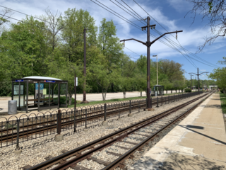
West Green station is a station on the Green Line of the RTA Rapid Transit in Shaker Heights, Ohio. It is located at the western end of the parking lot shared with Green Road station, only 150 yards (140 m) west of Green Road platforms. The station is designed to provide convenient boarding for riders who park in the western end of the parking area.

Superior station is a station on the RTA Red Line in East Cleveland, Ohio. It is located on Superior Avenue at the intersection of Emily Street, approximately 1½ blocks west of Euclid Avenue. A small parking lot is located northeast of the station entrance along Emily Street.
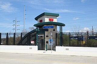
East 105th–Quincy station is a station on the RTA Red Line in Cleveland, Ohio. It is located in the Fairfax neighborhood on the city's east side. The station has a small entrance on the north side of Quincy Avenue.

East 79th station is a station on the RTA Red Line in Cleveland, Ohio. It is located on the west side of East 79th Street between Woodland Avenue and Grand Avenue. The entrance is on the east side of East 79th Street.

West 65th–Lorain station is a station on the RTA Red Line in Cleveland, Ohio. It is located between Lorain Avenue and Madison Avenue at West 61st Street.

Puritas–West 150th station is a station on the RTA Red Line in Cleveland, Ohio. It is located at off West 150th Street just north of Interstate 71. The entrance to the station parking lot is off exit/entrance ramp to Interstate 71. There is also an entrance from West 154th Street, connecting the station directly to Puritas Avenue.

Brookpark station is a station on the RTA Red Line located on the borders of Brook Park and Cleveland, Ohio, USA. It is located along Brookpark Road, west of the intersection of Henry Ford Boulevard and east of the intersection of the Berea Freeway.
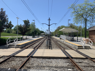
Warrensville–Van Aken station is a station on the RTA light rail Blue Line in Shaker Heights, Ohio. It is the eastern terminus of the Blue Line. Unlike most of the stations in Shaker Heights, Warrensville–Van Aken is located off street, not in the median of Van Aken Boulevard. It is located in a block surrounded by Chagrin Boulevard, Van Aken Boulevard, and Northfield Road and Tuttle Road in the midst of a dense retail/commercial area. The station is located one block west of Warrensville Center Road, after which it named.

The transportation system of Cleveland is a network that includes several modes of transportation including sidewalks, roads, public transit, bicycle paths and regional and international airports.