
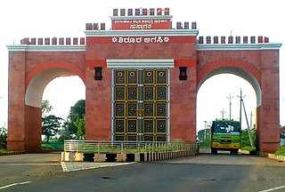
Bagalakote district, is an administrative district in the Indian state of Karnataka. The district headquarters is located in the town of Bagalakote. The district is located in northern Karnataka and borders Belgaum, Gadag, Koppal, Raichur and Bijapur. The new Bagalakote district was carved out of Vijayapura in 1997 via Government of Karnataka directive Notification RD 42 LRD 87 Part III. The bifurcated Bagalakote district consists of ten taluks — Badami, Bagalakote, Bilagi, Guledgudda, Rabkavi Banhatti, Hunagund, Ilkal, Jamakhandi and Mudhol, Teradal.

Bijapur district, officially known as Vijayapura district, is a district in the state of Karnataka in India. The city of Bijapur is the headquarters of the district, and is located 530 km northwest of Bangalore. Bijapur is well known for the great monuments of historical importance built during the Adil Shahi dynasty.

Kalaburagi district, formerly known as Gulbarga district, is one of the 31 districts of Karnataka state in southern India. Kalaburagi city is the administrative headquarters of the district. The district is the headquarters of Kalaburagi division.
Bagalakote, is a city in the state of Karnataka, India, which is also the headquarters of Bagalakote district. It is situated on branch of River Ghataprabha about 481 km (299 mi) northwest of state capital Bengaluru, 410 km (255 mi) southwest of Hyderabad, and about 570 km (354 mi) southeast of Mumbai. The population of the urban agglomeration was 111,933 according to the provisional results of 2011 national census of India, and the city is spread over an area of 49.06 square kilometres (18.94 sq mi) with an average elevation of 532 m (1,745 ft) above MSL. bagracotta 1832 baugeracotta
Mandya District is an administrative district of Karnataka, India. The district is bordered on the south by Mysore and Chamarajangar districts, on the west by Hassan District, on the north by Tumkur District and on the east by Ramanagara district. The district Mandya was carved out of larger Mysore district in the year 1939.

Davanagere district is an administrative district of Karnataka state in India. It is the centre of Karnataka. The city of Davanagere is the district headquarters. It had a population of 1,643,494 of which 32.31% was urban as of 2011. This district was separated from Chitradurga district in 1997 by the then Chief minister of Karnataka J. H. Patel including Chennagiri and Honali Taluks Shimoga district.

Bilagi is a panchayat town and taluka in the Bagalkot district of Karnataka, India. It is located at a distance of 30 km from the district headquarters of Bagalkote. The main occupation of people in this taluka is agriculture. Most of the farmers grow sugarcane.
Muddebihal is both a City and a Taluk in the Vijayapura district in the Indian state of Karnataka.
Sindagi is a City and Taluk in Vijayapura district in the Indian state of Karnataka, about 60 km to the east of Bijapur.
Basavana Bagewadi is a Municipality and Taluka in Vijayapura district in the state of Karnataka, India.
Bijjaragi is a village in the State of Karnataka, India. It is located in Vijayapur taluk of Vijayapur district, Karnataka.
Chadchan is a taluq in the southern state of Karnataka, India. It is located in Vijayapura district in northern part of Karnataka.
Chandkavathe is a village in the southern state of Karnataka, India. It is located in the Sindgi taluk of Bijapur district in Karnataka.

Bijapur District, formerly known as Birjapur, is one of the 27 districts of the state of Chhattisgarh in central India. It is one of the two new districts created on May 11, 2007. As of 2011 it is the second least populous district of Chhattisgarh, after Narayanpur. It is the second-least literate district in India, with a literacy rate of at 41.58%, according to the 2011 census.
Diggewadi is a village in Raybag taluk in Belgaum Panchayat in the southern state of Karnataka, India. The official language of Diggewadi is Kannada.
Devara Hipparagi is a New Taluk of Vijayapura district, Karnataka, India.
Talikoti also Talikot is a taluq in Vijaypur district in the northern part of the Indian state of Karnataka, about 85 kilometres to the southeast of Vijayapura city. It lies on the river called Doni. It is famous for the Battle of Talikota in 1565.
Bijapur Taluk, officially Vijayapura Taluka, is a taluka in the Indian state of Karnataka. It is located in the Bijapur district. The administrative centre for Bijapur Taluka is in the city of Bijapur. The taluka is located in the southwest quadrant of the district. In the 2011 census there were forty-six panchayat villages in Bijapur Taluka. The main river in the taluka is the Don River.
Korhalli is a large village located in Almel Taluk in Bijapur District of Karnataka State, India.
Wandal is a village in the southern state of Karnataka, India.

