Tripura is a state in Northeast India. The third-smallest state in the country, it covers 10,491 km2 (4,051 sq mi); and the seventh-least populous state with a population of 36.71 lakh. It is bordered by Assam and Mizoram to the east and by Bangladesh to the north, south and west. Tripura is divided into 8 districts and 23 sub-divisions, where Agartala is the capital and the largest city in the state. Tripura has 19 different tribal communities with a majority of the Bengali population. Bengali, English and Kokborok are the state's official languages.
Agartala is the capital and the largest city of the Indian state of Tripura, situated on the banks of Hoara River, about 2 kilometres (1.2 mi) east of the border with Bangladesh and about 2,499 km from the National Capital New Delhi. According to 2022 census, Agartala is the second-most populous city in Northeast India with a population of about 5.7 lakh. It is India's third international internet gateway and being developed under the Smart Cities Mission.

Narmadapuram is a city and municipality in the Indian state of Madhya Pradesh. It serves as the headquarters of both Narmadapuram district and Narmadapuram division. It is located in central India, on the south bank of the Narmada River. Narmadapuram is 76.7 km (47.7 mi) from the state capital and the nearest airport Bhopal.

Dhalai is an administrative district in the state of Tripura in India. The district headquarter is in Ambassa. As of 2011 it was the least populous district of Tripura, although it is the largest district in the state.

Udaipur, formerly known as Rangamati, is the third biggest urban area in the Indian state of Tripura. The town was a capital of the state during the reign of the Manikya Dynasty. It is famous for the Tripura Sundari temple also known as Tripureswari temple, one of the 51 Shakti Peethas.It is a Municipal Council in Gomati district & also the headquarters of Gomati district. Udaipur is about 51 km from Agartala, the capital of Tripura.
Belonia is a town and municipal council in South Tripura district, Tripura, India. It is also the headquarters of South Tripura District. It is linked with Agartala by National Highway 108A from Belonia to Jolaibari and via National Highway 8 from Jolaibari to Agartala. Belonia lies on the border with Bangladesh.

Dharmanagar or (Dhôrmônôgôr) is a town with a municipal council in the northeast of India. It is the administrative center for North Tripura district, located in the northernmost region of the state near the Assam border on the west and the India-Bangladesh border on the east. It is the second largest urban area in the state, which make it one of the important commercial centre. The juri river pass through the town.
Kamalpur is a town and a Nagar Panchayat in Dhalai District in the Indian state of Tripura around 93 km from the state capital Agartala. It is the largest Sub-divisional town in Dhalai District.
Kotdwar is a city, municipal corporation in Pauri Garhwal district of Uttarakhand, India. It's just 101 km from Pauri town, the district headquarter. It is the eighth-largest city in Uttarakhand. Its old name was "Khohdwar", which means the gateway of the river Khoh since it is located on the bank of river Khoh. It is situated in the southwestern part of the state and is one of the main entrance points in the state of Uttarakhand.
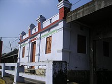
Ranirbazar is a town and a Municipal Council in West Tripura district in the Indian state of Tripura.
Shilghati is a panchayat village located in the Gomati district of Tripura state of India. It is situated some 16 kilometers far from Udaipur, the nearest main town and lies on the banks of the river Gomati, which has its origin on the high altitudes of Boromura hill range.

Kailashahar is the fourth largest urban area in the north eastern state of India, Tripura, located near northwest Bangladesh border. It is a Municipal council and the administrative center of the Unakoti district, this city is surrounded by unakoti hills and flows through Tripura's longest river, Manu.
Khowai district is a district of Tripura state of India. This district was created in January, 2012 when four new districts were created in Tripura, taking the number of districts in the state from four to eight. The district headquarters are located in the town Khowai. The district was carved out of West Tripura district along with new Sipahijala district. The district is divided into two subdivisions, namely Khowai and Teliamura.
Devtamura is a hill range in South Tripura district of Tripura, India. It is known for an archaeological site of rock sculptures, a panel of carved images of Hindu deities of Durga, Ganesha and Kartikeya on the bank of Gomati River. The stone images are estimated to have curved during the 15/16th century.

Gomati district is a district of Tripura, India. This district was created in January 2012 when four new districts were created in Tripura, taking the number of districts in the state from four to eight. Udaipur is its headquarters.

Melaghar is a small town located in the Indian state of Tripura and a Municipal Council in Sipahijala district, situated about 50 km from the capital Agartala. It is a neighbour to Sonamura and 10 km away from the Bangladesh International border. Neermahal is a famous tourist attraction in the town, situated in the middle of Rudrasagar Lake.
Udaipur railway station is a railway station in Gomati district, Tripura. Its code is UDPU. It serves Udaipur, Tripura, city. The station lies on the Lumding–Sabroom section, which comes under the Lumding railway division of the Northeast Frontier Railway. The segment from Agartala to Sabroom via Udaipur became operational on 3 October 2019.
Santirbazar is a town and Municipal Council in South Tripura district, Tripura, India. It is linked with Agartala by National Highway 8 via Udaipur and Bishramganj to Sabroom.

Chabimura also known as Chakwrakma or Chakrakma is famous for its panels of rock carving on steep mountain wall on the bank of Gomati river in Indian state Tripura. There are huge carved images of Shiva, Vishnu, Kartika, Mahisasura Mardini Durga and other Gods and Goddesses.

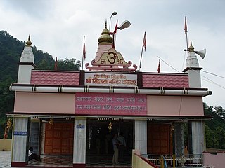
Kasbeswari Kali Mata or Kamalasagar Kali Temple was built on a hill-top by Maharaja Dhanya Manikya in the late 15th century. It is situated just beside the Bangladesh border, The lake, Kamalasagar, in front of this temple rightly enhances its beauty.