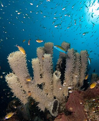
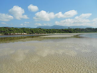
The Global 200 is the list of ecoregions identified by the World Wide Fund for Nature (WWF), the global conservation organization, as priorities for conservation. According to WWF, an ecoregion is defined as a "relatively large unit of land or water containing a characteristic set of natural communities that share a large majority of their species dynamics, and environmental conditions". For example, based on their levels of endemism, Madagascar gets multiple listings, ancient Lake Baikal gets one, and the North American Great Lakes get none.

The Orinoco Delta is a vast river delta of the Orinoco River, located in eastern Venezuela.

The Maranhão mangroves is a mangrove ecoregion of northern Brazil. It supports half of the shorebird population of the country. The combination of flat land, heavy rainfall and high tides causes the mangroves to extend up to 40 kilometres (25 mi) inland, where they are interspersed with other rainforest species.

The following outline is provided as an overview of and introduction to Oceanography.

A marine habitat is a habitat that supports marine life. Marine life depends in some way on the saltwater that is in the sea. A habitat is an ecological or environmental area inhabited by one or more living species. The marine environment supports many kinds of these habitats.

The Amazon biome contains the Amazon rainforest, an area of tropical rainforest, and other ecoregions that cover most of the Amazon basin and some adjacent areas to the north and east. The biome contains blackwater and whitewater flooded forest, lowland and montane terra firma forest, bamboo and palm forest, savanna, sandy heath and alpine tundra. Some areas of the biome are threatened by deforestation for timber and to make way for pasture or soybean plantations.

The Amazon–Orinoco–Southern Caribbean mangroves (NT1401) is an ecoregion along the coasts of Colombia, Venezuela, Guyana, Suriname, French Guiana and Brazil.

The Guianan mangroves (NT1411) is a coastal ecoregion of southeastern Venezuela, Guyana, Suriname, French Guiana and Brazil. The mangroves provide an important habitat for migrating birds that winter in the area. Large areas are intact, although they are threatened by destruction of the trees for timber and to make way for agriculture, and from upstream agricultural and industrial pollution.

The Amapá mangroves (NT1402) is an ecoregion along the Atlantic coast of the state of Amapá in Brazil. The low coastal plain has been formed from recent sedimentation, including sediments deposited by the rivers and sediments carried northward from the mouth of the Amazon River by strong currents and deposited by the tides. The extensive mangroves grow on the newly formed coastal mudflats and along the edges of estuaries. They merge into freshwater várzea flooded forests further inland. The ecoregion is generally well-preserved, although excessive extraction of natural resources including timber and shrimps is a concern.

The Pará mangroves (NT1427) is an ecoregion along the Atlantic coast of the state of Pará in Brazil. They constitute the western extension of the Maranhão mangroves ecoregion. The mangroves are relatively intact, although they are under some pressure from agriculture and logging.

The Paramaribo swamp forests (NT0149) is an ecoregion in the coastal plain of Suriname covering a strip of land that is almost always flooded by fresh waters. It transitions into saline mangrove swamps towards the coast, and into submontane forests towards the interior.
The East African coral coast is a marine ecoregion along the eastern coast of Africa. It extends along the coasts of Kenya, Tanzania, and northern Mozambique, from Lamu in Kenya to Angoche in Mozambique. It adjoins the Northern Monsoon Current Coast ecoregion to the north, and the Bight of Sofala/Swamp Coast ecoregion to the south.
The Bight of Sofala/Swamp Coast is a marine ecoregion along the eastern coast of Africa, characterized by extensive mangrove swamps and coastal wetlands. It extends along the coast of Mozambique, from Angoche to the Bazaruto Archipelago. It adjoins the East African coral coast ecoregion to the north, and the Delagoa ecoregion to the south.

The Ilha Grande mangroves ecoregion covers a series of disconnected salt-water and brackish mangrove forests along the southeastern coast of Brazil on the South Atlantic Ocean. The ecoregion is defined as covering the mangroves found between the Paraíba do Sul River in the north to Florianópolis in the south. This coastal region is the most densely population region of Brazil, and many of the mangroves are in close proximity to ports and industrial cities. A number of ecological reserves have been established to protect the high biodiversity of the mangroves, recognizing their importance to migratory birds, and as nursery habitat for juvenile fish, crabs, shrimp, and mollusks.

The Guianan marine ecoregion stretches along the middle of the northeast coast of South America, touching Venezuela, Guyana, Suriname and French Guiana. It extends about 200 miles offshore, with the warm Guianan Current moving east-to-west through the region. This current brings in fresh, turbid waters from the mouth of the Amazon River to the east. As the current exits the ecoregion to the west it contributes an estimated 70% of the waters of the Caribbean Sea. A very large oil field has been recently discovered in the Guyana-Suriname Basin of the ecoregion. The Guianan is one of two ecoregions in the North Brazil Shelf province, a Large marine ecosystem (LME). The Guianan is thus part of the larger Tropical Atlantic realm.

The Northeastern Brazil marine ecoregion covers the coastal marine environment around the Northeast Region of Brazil. The marine ecoregion extends from the mouth of the Parnaíba River in the west around the eastern point of the Brazilian mainland and south to the Bay of All Saints. The warm South Equatorial Current feeds warm tropical water into the region from the east. The Northeastern Brazil ecoregion is one of two coastal marine ecoregions in the Tropical Southwest Atlantic marine province. It is thus part of the Tropical Atlantic realm.

The Eastern Brazil marine ecoregion covers the coastal marine environment along the middle of the east coast of Brazil. The ecoregion extends south from the Bay of All Saints to Cabo Frio just east of the city of Rio de Janeiro. The Brazil Current enters from the east, feeding warm subtropical water to the south along the coast. The influence of the tropical waters leaves the ecoregion relatively oligotrophic. The Eastern Brazil ecoregion is one of two coastal marine ecoregions in the Tropical Southwest Atlantic marine province. It is thus part of the Tropical Atlantic realm. .

The Southeastern Brazil marine ecoregion covers the warm coastal waters to 250 miles offshore of southeastern Brazil, from the latitude of Rio de Janeiro in the north to Florianópolis in the south. Marine diversity is supported by local upwellings in the north and the inflow of the Brazil Current. The region is one of transition from a tropical to a warm temperate environment. The marine ecoregion is one of four coastal marine ecoregions in the Warm Temperate Southwestern Atlantic marine province. It is thus part of the Temperate South America realm. .

The Rio Grande marine ecoregion covers the waters offshore of the southern Brazilian states of Rio Grande do Sul and Santa Catarina. The ecoregion stretches along 500 miles of sandy beach coast, and 200 miles out to sea. The warm Brazil Current flows south through the region in parallel with the coast. The continental shelf is smooth and flat, with the bottom mostly sand and mud. Overfishing is a problem, but marine life in recent years has benefited from measures such as a 2018 ban on motorized shrimp trawler fishing within 12 miles of the Rio Grande do Sul coast. The Rio Grande ecoregion is one of four coastal marine ecoregions in the Warm Temperate Southwestern Atlantic marine province. It is thus part of the Temperate South America realm. .


