Related Research Articles

Chautauqua , also Chautaugua or Chatauqua, is an unincorporated community in Montgomery and Warren counties in the U.S. state of Ohio. Chautauqua is located at 39°35′28″N84°17′47″W. It lies on the west bank of the Great Miami River at the county boundary. It was established in 1901 with 310 acres (1.3 km2). The members of the Miami Valley Chautauqua Association lived in common in the town, occupying about two hundred homes.

Level is an unincorporated community in southern Harlan Township, Warren County, Ohio, United States, which in the 19th century was a station on the Marietta and Cincinnati Railroad and had its own post office, since closed. According to the U.S. Geographic Names Information System (GNIS), an alternate name for this community is Windsor.
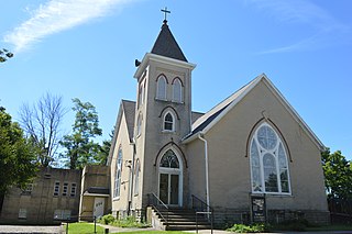
Liberty is an unincorporated community in Montgomery County, in the U.S. state of Ohio.
Amity is an unincorporated community in north-eastern Canaan Township, Madison County, Ohio, United States. It is located at 40°4′7″N83°15′5″W, at the intersection of Plain City-Georgesville Road and Amity Pike Road, between Plain City and West Jefferson.

Wolf Creek is a 19.8-mile-long (31.9 km) tributary of the Great Miami River in southwestern Ohio in the United States. It rises in western Montgomery County, northwest of Brookville, and flows generally southeast, passing through the center of Trotwood and joining the Great Miami in downtown Dayton.
Saint Charles is an unincorporated community in Butler County, in the U.S. state of Ohio.
Gano is an unincorporated community in Butler County, in the U.S. state of Ohio.
Savona is an unincorporated community in Darke County, in the U.S. state of Ohio.
Afton is an unincorporated community in Clermont County, in the U.S. state of Ohio.
Ninemile is an unincorporated community in Clermont County, in the U.S. state of Ohio.
Airhill is an unincorporated community in Montgomery County, in the U.S. state of Ohio.
Bachman is an unincorporated community in Montgomery County, in the U.S. state of Ohio.
Dodson is an unincorporated community in Montgomery County, in the U.S. state of Ohio.
Fishburg is an extinct town in Montgomery County, in the U.S. state of Ohio. The exact location of the town is unknown to the GNIS.
Harries is a historic community in Montgomery County, in the U.S. state of Ohio.
Kinsey is a historic community in Montgomery County, in the U.S. state of Ohio; its location, 39°51′14″N84°17′34″W, makes it a neighborhood of Englewood.
Spanker is an unincorporated community in Montgomery County, in the U.S. state of Ohio.
Tadmor is an extinct town in Montgomery County, in the U.S. state of Ohio. Its location, 39°53′45″N84°9′55″W, is now within the Vandalia city limits.
Arlington is an unincorporated community in Montgomery County, in the U.S. state of Ohio.
Griggs Corners is an unincorporated community in Ashtabula County, in the U.S. state of Ohio.
References
- ↑ U.S. Geological Survey Geographic Names Information System: Amity, Montgomery County, Ohio
- ↑ Drury, Augustus Waldo (1909). History of the City of Dayton and Montgomery County, Ohio, Volume 1. S. J. Clarke Publishing Company. pp. 903–904.
- ↑ U.S. Geological Survey Geographic Names Information System: Amity Post Office (historical)
Municipalities and communities of Montgomery County, Ohio, United States | ||
|---|---|---|
| Cities |  | |
| Villages | ||
| Townships | ||
| CDPs | ||
| Other communities | ||
| Ghost towns | ||
| Footnotes | ‡This populated place also has portions in an adjacent county or counties | |
39°47′21″N84°22′3″W / 39.78917°N 84.36750°W
| | This Montgomery County, Ohio state location article is a stub. You can help Wikipedia by expanding it. |